Where is Manatee County, Florida?
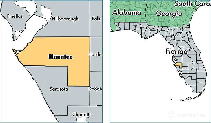
Manatee County is a county equivalent area found in Florida, USA. The county government of Manatee is found in the county seat of Bradenton.
With a total 2,312.23 sq. km of land and water area, Manatee County, Florida is the 992nd largest county equivalent area in the United States. Home to 351,746 people, Manatee County has a total 175101 households earning 47876 on average per year.
Manatee County, Florida offers the following attraction to visitors: De Soto NMEM
Manatee County, Florida - Quick Facts
| FIPS Code | 12081 |
| Area Codes | 941 |
| Time Zone | EST |
| Major Cities | Bradenton (population: 223,933), Palmetto (population: 40,809), Sarasota (population: 26,933), Parrish (population: 17,722), Ellenton (population: 12,361), Myakka City (population: 6,567), Bradenton Beach (population: 5,178), Anna Maria (population: 1,554), Cortez (population: 794), Terra Ceia (population: 457) |
| Land Area | 135,810 sq miles |
| Water Area | 743 sq miles |
| Household Income | $47,876 |
| Housing Units | 175,101 |
| Median Home Value | $165,400 |
| High School Grads | 87% of population |
| Holders of Bachelors Degrees | 27% of population |
| Retail Spending | $12,339 per capita |
| Food & Accomodation Sales | $443,809 per capita |
This page was last updated on June 30, 2016.