Where is Columbia County, Florida?
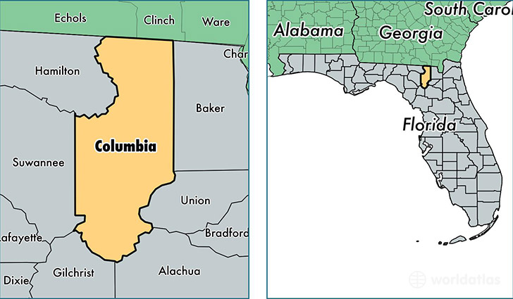
Columbia County is a county equivalent area found in Florida, USA. The county government of Columbia is found in the county seat of Lake City.
With a total 2,075.4 sq. km of land and water area, Columbia County, Florida is the 1173rd largest county equivalent area in the United States. Home to 67,857 people, Columbia County has a total 28124 households earning 38070 on average per year.
Columbia County, Florida - Quick Facts
| FIPS Code | 12023 |
| Area Codes | 386 |
| Time Zone | EST |
| Major Cities | Lake City (population: 58,146), Fort White (population: 9,287), Lulu (population: 284) |
| Land Area | 26,200 sq miles |
| Water Area | 798 sq miles |
| Household Income | $38,070 |
| Housing Units | 28,124 |
| Median Home Value | $108,700 |
| High School Grads | 83% of population |
| Holders of Bachelors Degrees | 13% of population |
| Retail Spending | $12,692 per capita |
| Food & Accomodation Sales | $103,321 per capita |
| Universities and Colleges | Lake City Community College |
This page was last updated on June 30, 2016.