Where is Yuma County, Colorado?
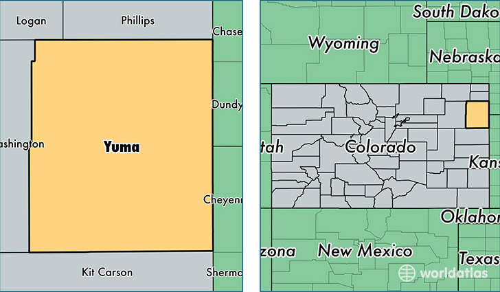
Yuma County is a county equivalent area found in Colorado, USA. The county government of Yuma is found in the county seat of Wray.
With a total 6,134.89 sq. km of land and water area, Yuma County, Colorado is the 255th largest county equivalent area in the United States. Home to 10,202 people, Yuma County has a total 4416 households earning 44308 on average per year.
Yuma County, Colorado - Quick Facts
| FIPS Code | 8125 |
| Area Codes | 970 |
| Time Zone | MST |
| Major Cities | Yuma (population: 4,732), Wray (population: 3,823), Eckley (population: 428), Idalia (population: 408), Joes (population: 261), Kirk (population: 208), Vernon (population: 164) |
| Land Area | 3,939 sq miles |
| Water Area | 2,364 sq miles |
| Household Income | $44,308 |
| Housing Units | 4,416 |
| Median Home Value | $136,600 |
| High School Grads | 88% of population |
| Holders of Bachelors Degrees | 18% of population |
| Retail Spending | $11,074 per capita |
| Food & Accomodation Sales | $8,777 per capita |
This page was last updated on June 30, 2016.