Where is Phillips County, Colorado?
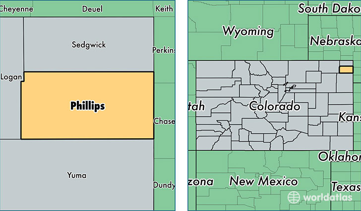
Phillips County is a county equivalent area found in Colorado, USA. The county government of Phillips is found in the county seat of Holyoke.
With a total 1,782.03 sq. km of land and water area, Phillips County, Colorado is the 1470th largest county equivalent area in the United States. Home to 4,363 people, Phillips County has a total 2084 households earning 43011 on average per year.
Phillips County, Colorado - Quick Facts
| FIPS Code | 8095 |
| Area Codes | 970 |
| Time Zone | MST |
| Major Cities | Holyoke (population: 2,996), Haxtun (population: 1,471), Amherst (population: 151), Paoli (population: 28) |
| Land Area | 1,685 sq miles |
| Water Area | 688 sq miles |
| Household Income | $43,011 |
| Housing Units | 2,084 |
| Median Home Value | $132,700 |
| High School Grads | 86% of population |
| Holders of Bachelors Degrees | 17% of population |
| Retail Spending | $10,207 per capita |
| Food & Accomodation Sales | $1,880 per capita |
This page was last updated on June 30, 2016.