Where is Gunnison County, Colorado?
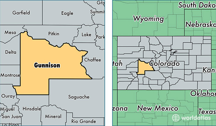
Gunnison County is a county equivalent area found in Colorado, USA. The county government of Gunnison is found in the county seat of Gunnison.
With a total 8,442.67 sq. km of land and water area, Gunnison County, Colorado is the 166th largest county equivalent area in the United States. Home to 15,725 people, Gunnison County has a total 11498 households earning 52332 on average per year.
Gunnison County, Colorado offers the following attraction to visitors: Curecanti NRA
Gunnison County, Colorado - Quick Facts
| FIPS Code | 8051 |
| Area Codes | 970,719 |
| Time Zone | MST |
| Major Cities | Gunnison (population: 9,888), Crested Butte (population: 4,440), Almont (population: 277), Somerset (population: 159), Cimarron (population: 141), Powderhorn (population: 93), Ohio City (population: 82), Parlin (population: 79), Pitkin (population: 78) |
| Land Area | 6,071 sq miles |
| Water Area | 3,239 sq miles |
| Household Income | $52,332 |
| Housing Units | 11,498 |
| Median Home Value | $329,500 |
| High School Grads | 93% of population |
| Holders of Bachelors Degrees | 55% of population |
| Retail Spending | $14,116 per capita |
| Food & Accomodation Sales | $89,685 per capita |
This page was last updated on June 30, 2016.