Where is Elbert County, Colorado?
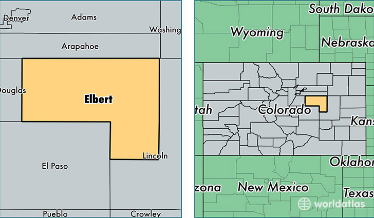
Elbert County is a county equivalent area found in Colorado, USA. The county government of Elbert is found in the county seat of Kiowa.
With a total 4,794.14 sq. km of land and water area, Elbert County, Colorado is the 355th largest county equivalent area in the United States. Home to 24,195 people, Elbert County has a total 8999 households earning 82118 on average per year.
Elbert County, Colorado - Quick Facts
| FIPS Code | 8039 |
| Area Codes | 719,303 |
| Time Zone | MST |
| Major Cities | Elizabeth (population: 12,196), Kiowa (population: 2,620), Simla (population: 922), Ramah (population: 685), Agate (population: 397), Matheson (population: 257) |
| Land Area | 9,342 sq miles |
| Water Area | 1,851 sq miles |
| Household Income | $82,118 |
| Housing Units | 8,999 |
| Median Home Value | $333,600 |
| High School Grads | 97% of population |
| Holders of Bachelors Degrees | 30% of population |
| Retail Spending | $3,558 per capita |
| Food & Accomodation Sales | $6,884 per capita |
This page was last updated on June 30, 2016.