Where is San Luis Obispo County, California?
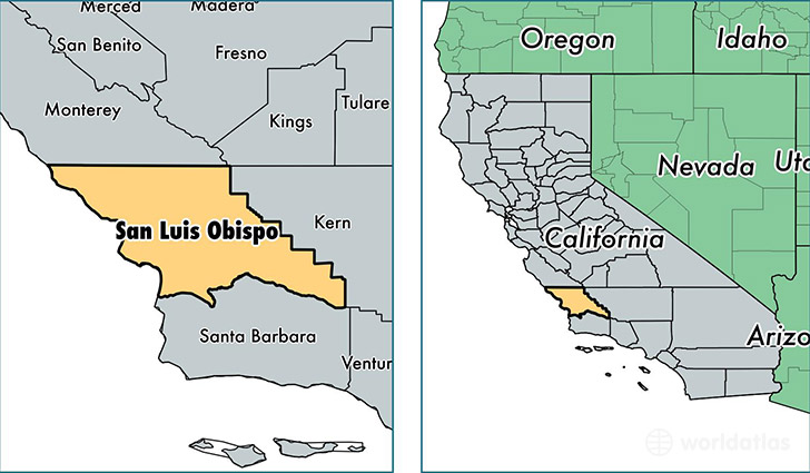
San Luis Obispo County is a county equivalent area found in California, USA. The county government of San Luis Obispo is found in the county seat of San Luis Obispo.
With a total 9,364.13 sq. km of land and water area, San Luis Obispo County, California is the 149th largest county equivalent area in the United States. Home to 279,083 people, San Luis Obispo County has a total 118198 households earning 58697 on average per year.
San Luis Obispo County, California offers the following attraction to visitors: Carrizo Plain
San Luis Obispo County, California - Quick Facts
| FIPS Code | 6079 |
| Area Codes | 805 |
| Time Zone | PST |
| Major Cities | San Luis Obispo (population: 64,689), Paso Robles (population: 45,518), Atascadero (population: 31,976), Arroyo Grande (population: 28,957), Nipomo (population: 19,612), Los Osos (population: 14,592), Grover Beach (population: 13,414), Morro Bay (population: 10,995), Templeton (population: 9,328), Pismo Beach (population: 7,803) |
| Land Area | 107,755 sq miles |
| Water Area | 3,299 sq miles |
| Household Income | $58,697 |
| Housing Units | 118,198 |
| Median Home Value | $426,600 |
| High School Grads | 90% of population |
| Holders of Bachelors Degrees | 32% of population |
| Retail Spending | $13,559 per capita |
| Food & Accomodation Sales | $767,899 per capita |
| Universities and Colleges | California Polytechnic State University-San Luis Obispo, Cuesta College |
This page was last updated on June 30, 2016.