Where is Graham County, Arizona?
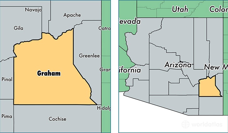
Graham County is a county equivalent area found in Arizona, USA. The county government of Graham is found in the county seat of Safford.
With a total 12,020.01 sq. km of land and water area, Graham County, Arizona is the 101st largest county equivalent area in the United States. Home to 37,957 people, Graham County has a total 13354 households earning 44943 on average per year.
Graham County, Arizona - Quick Facts
| FIPS Code | 4009 |
| Area Codes | 928 |
| Time Zone | MST |
| Major Cities | Safford (population: 19,780), Thatcher (population: 6,250), Pima (population: 3,842), Bylas (population: 2,079), Central (population: 626), Fort Thomas (population: 410), Solomon (population: 407), Eden (population: 21) |
| Land Area | 14,655 sq miles |
| Water Area | 4,622 sq miles |
| Household Income | $44,943 |
| Housing Units | 13,354 |
| Median Home Value | $122,200 |
| High School Grads | 84% of population |
| Holders of Bachelors Degrees | 12% of population |
| Retail Spending | $11,211 per capita |
| Food & Accomodation Sales | $34,671 per capita |
This page was last updated on June 30, 2016.