Where is Greenlee County, Arizona?
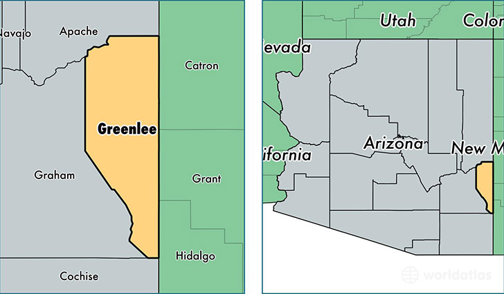
Greenlee County is a county equivalent area found in Arizona, USA. The county government of Greenlee is found in the county seat of Clifton.
With a total 4,787.42 sq. km of land and water area, Greenlee County, Arizona is the 357th largest county equivalent area in the United States. Home to 9,346 people, Greenlee County has a total 4417 households earning 47992 on average per year.
Greenlee County, Arizona - Quick Facts
| FIPS Code | 4011 |
| Area Codes | 928 |
| Time Zone | MST |
| Major Cities | Clifton (population: 3,069), Morenci (population: 2,998), Duncan (population: 2,699), Blue (population: 42) |
| Land Area | 3,609 sq miles |
| Water Area | 1,843 sq miles |
| Household Income | $47,992 |
| Housing Units | 4,417 |
| Median Home Value | $81,000 |
| High School Grads | 84% of population |
| Holders of Bachelors Degrees | 11% of population |
| Retail Spending | $4,587 per capita |
| Food & Accomodation Sales | $4,888 per capita |
This page was last updated on June 30, 2016.