Where is Pinal County, Arizona?
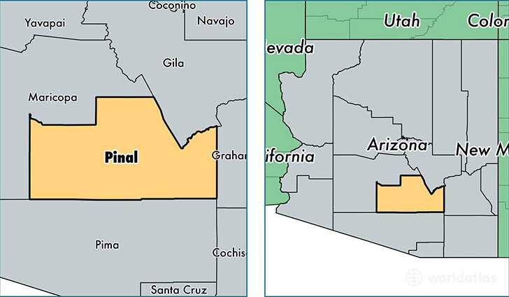
Pinal County is a county equivalent area found in Arizona, USA. The county government of Pinal is found in the county seat of Florence.
With a total 13,919.33 sq. km of land and water area, Pinal County, Arizona is the 74th largest county equivalent area in the United States. Home to 401,918 people, Pinal County has a total 164257 households earning 50027 on average per year.
Pinal County, Arizona offers the following attractions to visitors: Casa Grande Ruins NM, Hohokam Pima NM
Pinal County, Arizona - Quick Facts
| FIPS Code | 4021 |
| Area Codes | 480,520,928 |
| Time Zone | MST |
| Major Cities | San Tan Valley (population: 73,938), Casa Grande (population: 64,593), Maricopa (population: 53,204), Apache Junction (population: 50,918), Florence (population: 34,591), Eloy (population: 18,572), Tucson (population: 18,257), Coolidge (population: 15,280), Gold Canyon (population: 12,623), Arizona City (population: 11,006) |
| Land Area | 155,181 sq miles |
| Water Area | 5,366 sq miles |
| Household Income | $50,027 |
| Housing Units | 164,257 |
| Median Home Value | $120,200 |
| High School Grads | 85% of population |
| Holders of Bachelors Degrees | 18% of population |
| Retail Spending | $6,718 per capita |
| Food & Accomodation Sales | $341,933 per capita |
This page was last updated on June 30, 2016.