Where is DeKalb County, Alabama?
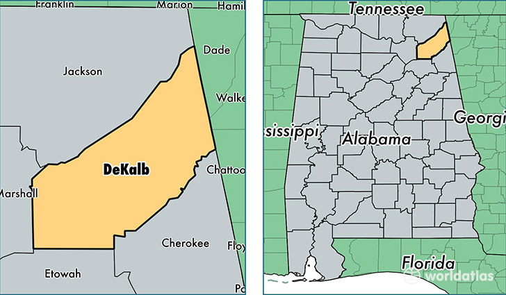
DeKalb County is a county equivalent area found in Alabama, USA. The county government of DeKalb is found in the county seat of Fort Payne.
With a total 2,016.79 sq. km of land and water area, DeKalb County, Alabama is the 1214th largest county equivalent area in the United States. Home to 71,065 people, DeKalb County has a total 30861 households earning 37851 on average per year.
DeKalb County, Alabama offers the following attraction to visitors: Little River Canyon National Preserve Fort Payne
DeKalb County, Alabama - Quick Facts
| FIPS Code | 1049 |
| Area Codes | 256 |
| Time Zone | CST |
| Major Cities | Fort Payne (population: 21,196), Crossville (population: 8,304), Rainsville (population: 7,740), Collinsville (population: 6,512), Henagar (population: 5,384), Fyffe (population: 4,911), Valley Head (population: 3,571), Ider (population: 2,140), Sylvania (population: 1,939), Mentone (population: 1,888) |
| Land Area | 27,438 sq miles |
| Water Area | 777 sq miles |
| Household Income | $37,851 |
| Housing Units | 30,861 |
| Median Home Value | $93,400 |
| High School Grads | 71% of population |
| Holders of Bachelors Degrees | 11% of population |
| Retail Spending | $9,303 per capita |
| Food & Accomodation Sales | $67,915 per capita |
This page was last updated on June 30, 2016.