Where is Pima County, Arizona?
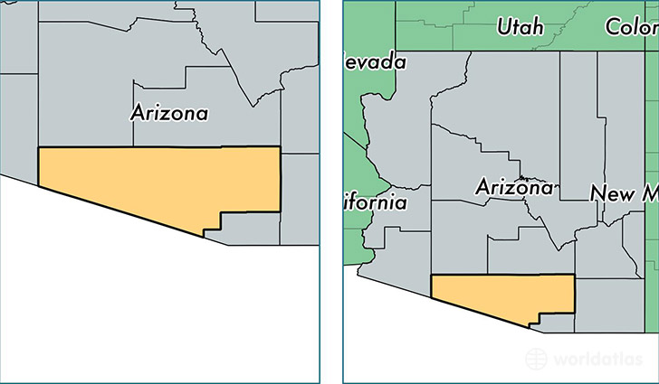
Pima County is a county equivalent area found in Arizona, USA. The county government of Pima is found in the county seat of Tucson.
With a total 23,799.6 sq. km of land and water area, Pima County, Arizona is the 35th largest county equivalent area in the United States. Home to 1,004,516 people, Pima County has a total 446967 households earning 45841 on average per year.
Pima County, Arizona offers the following attractions to visitors: Ironwood Forest NM, Organ Pipe Cactus NM, Saguaro NP
Pima County, Arizona - Quick Facts
| FIPS Code | 4019 |
| Area Codes | 520 |
| Time Zone | MST |
| Major Cities | Tucson (population: 873,192), Green Valley (population: 28,568), Sahuarita (population: 23,859), Marana (population: 23,177), Vail (population: 22,022), Sells (population: 6,572), Ajo (population: 4,492), Amado (population: 2,254), Sonoita (population: 1,268), Arivaca (population: 706) |
| Land Area | 387,846 sq miles |
| Water Area | 9,187 sq miles |
| Household Income | $45,841 |
| Housing Units | 446,967 |
| Median Home Value | $167,500 |
| High School Grads | 87% of population |
| Holders of Bachelors Degrees | 30% of population |
| Retail Spending | $11,969 per capita |
| Food & Accomodation Sales | $2,135,243 per capita |
| Universities and Colleges | Arizona Academy of Beauty-North, Tohono O'Odham Community College, University of Arizona, Pima Medical Institute |
This page was last updated on June 30, 2016.