The 10 Can't-Miss Towns On The Chesapeake Bay
The Chesapeake Bay is the largest estuary in the United States, stretching across six states and shaping thousands of miles of shoreline. Long before highways linked the region, water routes shaped how people moved, traded, and settled here. Follow the Bay closely, and you begin to notice towns that still reflect that history. Harbors sit at the center of daily life. Ferries replace bridges. Working docks matter as much as main streets.
Places like Annapolis, where sailboats crowd City Dock beneath the United States Naval Academy, and Smith Island, accessible only by boat, demonstrate how geography continues to shape daily life. From historic ports and canal towns to quiet waterfront communities, these places keep access to the water simple and immediate. These ten can’t-miss towns stand out for how clearly the Chesapeake Bay still shapes what you see, how you move, and what you experience once you arrive.
Annapolis, Maryland

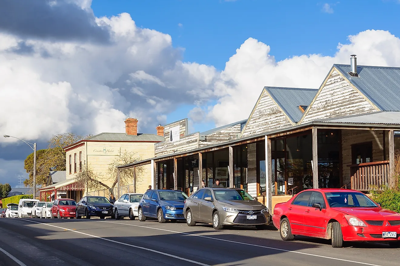
Downtown Annapolis narrows as it approaches the harbor, pulling foot traffic toward the water almost without effort. Sailboats fill the slips, and nearly every street seems to end at a dock. That layout keeps the waterfront central to daily movement rather than set apart. The United States Naval Academy anchors much of the town’s identity. Guided tours move through historic halls, the Naval Academy Museum, and the domed chapel that rises above the Severn River shoreline. Even without entering the grounds, the academy’s presence influences how the harbor operates and how the town organizes itself around the water.
Just beyond the academy gates, the City Dock marks the practical center of Annapolis. Ego Alley runs alongside the dock, a narrow inlet where boats idle close to shore and visitors pause to watch traffic move through the harbor. Wednesday evening sailboat races add steady motion to the water during warmer months. Nearby Susan Campbell Park provides open access to the shoreline, with benches and walkways facing the harbor. From the City Dock, Watermark Journey's harbor cruises and schooner sails depart regularly, reinforcing the town’s long connection to sailing. In Annapolis, the water is not a backdrop. It remains part of how the town functions day to day.
St. Michaels, Maryland

In this Maryland town, the Chesapeake Bay Maritime Museum sits directly on the waterfront, and its location matters as much as its collections. Historic vessels line the docks, a working shipyard remains active, and the restored Hooper Strait Lighthouse offers a clear view into how watermen once lived and worked along the Bay. Much of the museum experience happens outdoors, where the harbor itself becomes part of the exhibit.
From the museum pier, the Patriot Harbor Cruise follows the Miles River at an easy pace. The route passes shoreline homes, marinas, and open water, giving a sense of how closely the town remains tied to its setting without requiring a full day on the Bay. Nearby, the St. Michaels Harbor provides public access for transient boaters and reinforces the town’s role as a working port rather than a backdrop.
A short walk inland brings you to Talbot Street, where most shops, galleries, and restaurants sit within a compact stretch. Just off the main corridor, the St. Michaels Museum at St. Mary’s Square adds context through exhibits focused on local history, maritime trade, and community life. The waterfront still functions as part of everyday town life rather than as a set piece. St. Michaels still moves according to the water, and daily routines follow that rhythm.
Oxford, Maryland

The Oxford-Bellevue Ferry remains this town’s most recognizable feature, not because it is dramatic, but because it still does what it always has. Operating as one of the nation’s oldest privately run ferries, the short crossing of the Tred Avon River connects Oxford to neighboring communities while reinforcing how central water travel once was to daily life on the Eastern Shore. The ride itself is brief, but it frames the town’s relationship with the river before you ever step onto land. A few blocks inland, the Oxford Museum fills in the details. Exhibits focus on boatbuilding, maritime trade, and everyday routines in one of Maryland’s oldest ports. The collection is compact, but it provides useful context for understanding why the town developed where it did and how closely its history followed the river.
Along the shoreline, Oxford Town Park offers direct public access to the water. Benches, small piers, and open green space make it easy to pause near the harbor without committing to an activity. Nearby, Scottish Highland Creamery draws steady lines for handmade ice cream served just steps from the river. Oxford does not need to strive to impress. The river sets the pace, and the town continues to move with it.
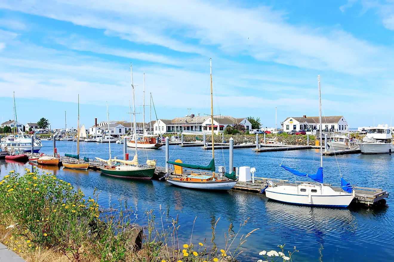
Solomons, Maryland

Solomons sits where the Patuxent River opens into Chesapeake Bay, and that transition defines how the town functions. The Calvert Marine Museum anchors the waterfront, with exhibits that cover Bay ecology, paleontology, and regional maritime history. Much of the experience extends outdoors, where exhibits and walking paths overlook the river itself. Nearby, the Drum Point Lighthouse provides a rare opportunity to step inside a preserved screwpile lighthouse once common along the Bay.
Just inland, the Annmarie Sculpture Garden and Arts Center shifts the focus away from the shoreline. Forested trails pass through rotating outdoor sculpture installations, creating a quieter counterpoint to the activity along the docks. The setting feels intentionally removed without being far away. Back on the water, the Solomons boardwalk runs past marinas, charter boats, and waterfront businesses in quick succession. The Waterside Pavilion sits along this stretch and hosts seasonal concerts and community events with the Patuxent River as a backdrop. Public access remains central here. Boats, paths, and gathering spaces overlap rather than separate. Solomons works because river access, museums, and public spaces all remain tightly connected. River, Bay, museum, and boardwalk all stay within easy reach, keeping the town oriented toward the water from every angle.
Crisfield, Maryland

Crisfield still operates as a working waterfront, and that identity remains visible across town. Long associated with the blue crab industry, the port continues to reflect daily routines shaped by harvesting, processing, and shipping seafood from the surrounding Bay. The J. Millard Tawes Historical Museum documents that legacy through exhibits on crabbing, oystering, and local maritime history. Next door, the Ward Brothers Workshop preserves the town’s nationally recognized decoy-carving tradition, focusing on the work of Lem and Steve Ward and their influence on Chesapeake waterfowl art.
The harbor itself remains active. Commercial docks, marinas, and ferry traffic reinforce Crisfield’s role as a transportation hub on the Lower Eastern Shore. From the municipal dock, ferries depart regularly for Smith Island, keeping Crisfield tied to one of the Bay’s most isolated communities. Just outside town limits, Janes Island State Park opens into thousands of acres of salt marsh and shallow waterways. Marked water trails allow kayakers and canoeists to move through creeks and coves that feel far removed from developed shorelines. The park’s proximity makes it easy to shift from harbor activity to open marsh in a matter of minutes. The National Hard Crab Derby, each Labor Day, centers the town around its signature industry. Crisfield’s appeal comes from its directness. This is still a place where daily work, transportation, and tradition remain tied directly to the Bay.
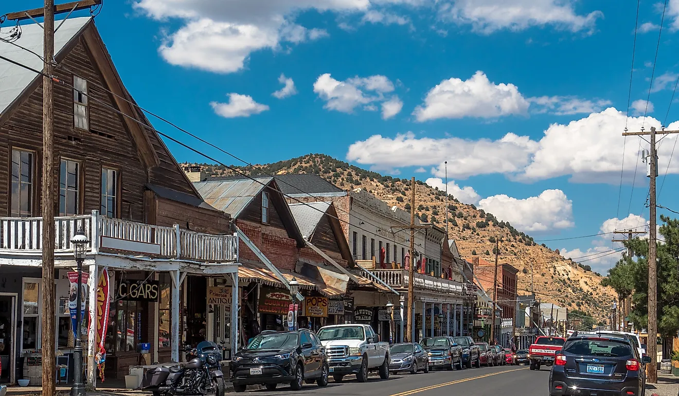
Smith Island, Maryland

Smith Island requires commitment. Reached only by boat, it remains one of the Chesapeake Bay’s most isolated communities, and that isolation shapes nearly everything about daily life. Passenger ferries operate from Crisfield and Point Lookout, reinforcing the fact that water travel is not optional here. It is the primary connection to the mainland.
The Smith Island Cultural Center serves as the island’s historical anchor. Exhibits document how generations of watermen adapted to tides, storms, and shifting shorelines while maintaining a distinct local identity. The focus stays practical, covering fishing methods, island traditions, and the challenges of living in a place where roads never replaced boats. Settlement is spread across three villages: Ewell, Rhodes Point, and Tylerton. Narrow lanes connect homes, crab shanties, and docks where workboats still tie up daily. There is no continuous road system, and bicycles and walking remain the most common ways to move between nearby points.
Smith Island Cake, now Maryland’s official state dessert, is still produced locally. It comes from home kitchens and small island eateries rather than commercial bakeries. Beyond the villages, marshland and open water dominate. Much of the island falls within protected habitat, including Martin National Wildlife Refuge. When roads end, the Bay takes over. On Smith Island, that has always been the rule.
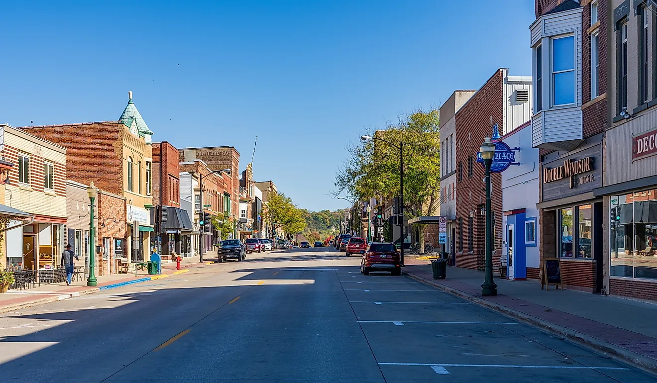
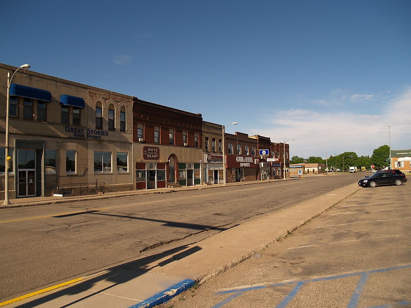
Onancock, Virginia

Onancock, Virginia, developed as a colonial port, and its harbor still shapes how the town works today. The Onancock Wharf serves as both a marina and the departure point for the Tangier Island ferry, keeping the town tied to the wider Chesapeake Bay. Public docks and walking paths make the waterfront easy to access, and small boat traffic moves steadily in and out of the harbor throughout the day.
From the shoreline, it takes only a few minutes to reach the historic center. Ker Place, a Federal-era brick mansion built in the late eighteenth century, now operates as a museum and cultural site. Exhibits and rotating programs focus on early trade, architecture, and daily life on Virginia’s Eastern Shore, while the surrounding grounds provide a quiet break from the harbor activity.
Arts and performance play a visible role in town life. The North Street Playhouse hosts live theater productions in an intimate setting that draws audiences from across the Eastern Shore. Nearby, the Roseland Theater continues to operate as a single-screen cinema, showing first-run films and special screenings inside a restored historic building. Onancock remains compact and walkable. Harbor, history, and performance spaces sit close together, allowing the town’s maritime roots and cultural life to overlap naturally.
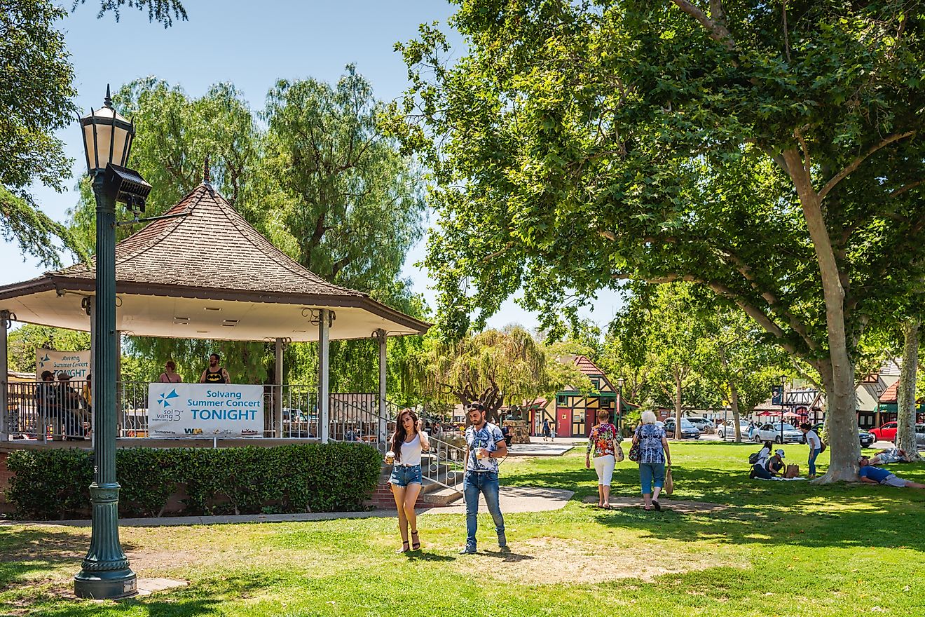
Cape Charles, Virginia

Cape Charles places its beach unusually close to its downtown, and that proximity shapes how the town is used. Cape Charles Beach runs along the Chesapeake Bay rather than the open ocean, which keeps the water calmer and generally warmer. The shoreline stays shallow for a long stretch, making it easy to walk straight from town to sand without planning a full beach day. Mason Avenue anchors most commercial activity. The street was part of the original town layout and still carries that purpose. Restored buildings house shops, galleries, and restaurants within a few short blocks, keeping everything compact and walkable. Traffic stays light, and most errands can be handled without moving a car once you arrive.
Near the center of town, the Cape Charles Museum and Welcome Center provides context for how the community developed. Exhibits focus on the railroad and ferry operations that once connected Cape Charles to major East Coast cities. Old photographs, models, and artifacts explain why the town grew quickly in the late nineteenth and early twentieth centuries, then settled into a quieter rhythm after passenger service declined. Cape Charles works because nothing feels separated. Beach, street grid, harbor, and history overlap naturally. The layout encourages slowing down and staying put rather than moving on.
Chesapeake City, Maryland

The Chesapeake and Delaware Canal explains why Chesapeake City exists at all. Completed in the nineteenth century, the canal created a direct water route between the Chesapeake Bay and the Delaware River, turning this stretch of land into a strategic transportation corridor. At the C&D Canal Museum, housed in a former pumphouse, exhibits explain how the canal was engineered, expanded, and adapted for modern shipping. Models, photographs, and maps help make sense of the canal’s outsized role in regional trade.
Just outside the museum, brick sidewalks follow the canal’s edge. The scale difference is immediate. Massive container ships and tankers pass within view, moving steadily between ports while the town remains quiet. Pedestrian bridges and observation points make it easy to stop and watch traffic slide through, turning global commerce into something you can see from a park bench. Seasonal Chesapeake City Water Tours offer a closer look from the canal itself. Narrated cruises pass beneath high-span bridges and alongside steep banks that show how much the canal has been widened over time. The experience reinforces how engineered this landscape really is.
A few blocks uphill, Bohemia Avenue forms the town’s historic core. Inns, shops, and restaurants cluster tightly together, keeping the district walkable and compact. Chesapeake City feels small, but the waterway cutting through it connects far beyond town limits.
Havre de Grace, Maryland

Havre de Grace sits where the Susquehanna River meets Chesapeake Bay, and that geography gives the town a dual identity. Freshwater flowing south meets tidal water pushing north, shaping both the shoreline and the town’s history. At that junction stands the Concord Point Lighthouse, built in the early nineteenth century and preserved today as a historic landmark and private aid to navigation. The lighthouse anchors a waterfront promenade that follows the Bay’s edge, offering clear sightlines across open water and up the river.
Just inland, the Havre de Grace Decoy Museum documents the town’s long connection to waterfowl hunting and decoy carving. Exhibits highlight regional styles and individual carvers, placing Havre de Grace within a broader Chesapeake tradition rather than treating it as an isolated craft center. A few blocks away, the Havre de Grace Maritime Museum adds another layer, focusing on canal history, commercial fishing, and the town’s relationship with the Susquehanna and the Upper Bay.
Promenade paths, parks, and museum buildings stay closely grouped, making it easy to move between them on foot. Rather than spreading attractions out, Havre de Grace concentrates them along the water. That layout makes the Upper Bay easier to understand here, where river, bay, and town meet in a single walkable stretch.
Where the Bay Still Sets the Pace
Chesapeake Bay does not reveal itself all at once. You come to understand it town by town, dock by dock, by noticing how daily life still bends around the water. In some places, that means boarding the Oxford-Bellevue Ferry as it crosses the Tred Avon River. In others, it means standing along the Chesapeake and Delaware Canal in Chesapeake City as cargo ships pass close enough to define the view. Elsewhere, it is as simple as stepping off a ferry onto Smith Island, where roads never replaced water routes. Together, these towns show how access shapes experience. The Bay stays present, usable, and close, not as scenery, but as something you move through, depend on, and learn over time.