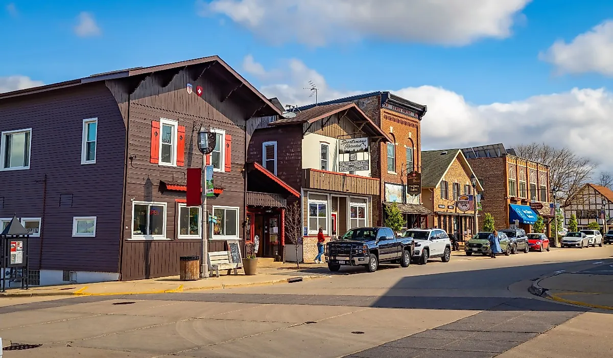
Ashland, Nebraska
Infamous for the Salt Creek, a naturally low-lying limestone ford that created the optimal crossing point on the Oxbow Trail, Ashland, Nebraska, is imprinted into the larger history of the Great American Migration of the Great Plains as a side route of the Oregon Trail. Very little has changed since the first wagons crossed the Saline Ford at what would be Ashland. Today, the brick buildings of the early businesses still stand downtown amongst the backdrop of the picturesque saline wetlands. Thus, this is why Ashland is proud to be voted one of Nebraska's ten most beautiful cities.
Geography And Climate Of Ashland
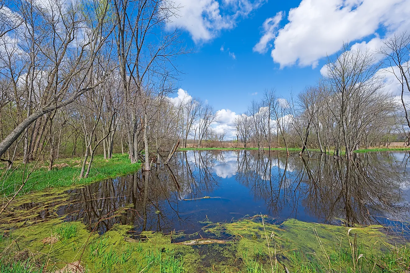
Ashland is a small city situated in Saunders County in the eastern part of the US State of Nebraska. The city covers a total area of only 2.92 sq. km, of which 0.07 sq. km is covered by water, and 2.85 sq. km is occupied by land. Ashland sits on the banks of Salt Creek, a tributary of the Platte River. Salt Creek is a part of an ecosystem known as a saline wetland that is commonly seen in southeast Nebraska. During the Cretaceous Era, shale was left behind from an ancient ocean known as the Western Interior Seaway. This ancient waterway saw North America split into two landmasses called Appalachia to the east side and Laramidia to the west. Presently, Salt Creek houses the endangered Salt Creek Tiger Beetle, of which fewer than 200 have been observed in the last decade.
Ashland experiences a humid continental climate, with notable wet and humid summers and stormy winters. Over a year, Ashland collects 87.7 days of precipitation from rains, hail, and snow. Rainfall totals 792.48 mm, and snowfall 678.18 mm. The warmest month is July, with an average high of 30.9 °C. January is the year's coldest month, having an average temperature of -10.9 °C.
History Of Ashland
Ashland got its name after Henry Clay, who called his Kentucky home Ashland. Located along the Oxbow Trail, which ran from Nebraska City to Fort Kearny and a branch of the larger Oregon Trail, Ashland saw settlers migrating across the United States in search of a better life from poverty. The Salt Creek, then called Saline Ford, presented a naturally low limestone flat that allowed wagons to cross the creek. The 1850s saw military goods transported across the Saline Ford, and as such, a military post was established in Ashland that would deflect Native American confrontations for the next decade. The Oxbow Trail became the best way to move freight; thus, it got its name from the large freight wagons pulled by oxen. Moreover, the settlement of Ashland began in 1850 as a seasonal summer roost. Businesses about harness repair or wagon repair popped up around the ford crossing and would thrive between April to October, with the settlers waiting out winter. On the other hand, Native Americans would scare settlers away in the fall. The first wintered residents who remained in 1857 were fur trappers. On March 21, 1866, Ashland was incorporated as a town.
The Population And Economy Of Ashland
Ashland has a population of 2,824 inhabitants. Covering an area of 2.92 sq. km, Ashland has a population density of 927.64 people per sq. km. Further, Ashland has a median household income of $54,220 and a gross monthly rent of $769. The average age of a resident is 38.7 years old. On the cost of living index, Ashland rates at 102, whereas the state of Nebraska is 89.1. Yet, 12.87% of the population lives below the poverty line.
The unemployment rate is 2.6%, whereas the US unemployment rate is 6%. The leading economies are made up of retail trade at 16.7% overall, healthcare and social assistance at 16.6%, and educational services. The city's highest paying industries include mining, quarrying, and oil extraction, grossing revenue of $96,250, public administration at $76,563, and transportation, warehousing, and utilities at $71,250.
Attractions In And Around Ashland
Eugene T. Mahoney State Park

A year-round destination that offers an observation tower, treetop rope course, theatre, rock climb, art center, marina, and an aquatic center, Eugene T. Mahoney State Park is more than the average state park. In the summer, visitors can hike, stargaze, fish, picnic, horseback ride, and swim. In the winter months, guests can go sledding and ice skating. The 40-room Peter Kiewit Lodge offers views of the Platte River Valley from the guest rooms with balcony views. Located 30 minutes from Omaha, Nebraska, this park can easily be incorporated as a day trip from the big city.
Strategic Air Command and Aerospace Museum
With a focus on preserving aircraft, spacecraft, and nuclear missiles from the Cold War, the Strategic Air Command and Aerospace Museum has 30,000 sq. ft of exhibition space. The Museum features a 200-seat theater, interactive restoration gallery, two large airplane hangars, and a snack bar. Upon walking into the building, the glass atrium showcases a Lockheed SR-71 Blackbird aircraft with three large missiles on display out front. Some notable aircraft include Avro, Hawker Vulcan, B1-A Lancer, B-52, F-105, and F-117.
Holy Family Shrine

A group of travelers bonded through a series of miracles set out in search of a perfect place to build a Holy Shrine. Thus, they settled on a location outside of Ashland on the bluffs overlooking the Platte River. The Holy Shrine is hidden from the main highway, but the glass-walled building is an impressive work of architecture, standing at 45 ft tall. The site showcases a chapel, way of the cross trail, crucifix spire, visitor center, and gift shop. The Holy Family Shrine is open to the public for mass and tours, and pilgrimages are welcomed.
Ashland, Nebraska, has become the home of many, from the first settlers who pulled their wagons across the Saline Ford to today's residences. Furthermore, it has become a homestead of travelers from afar with the establishment of the Holy Family Shrine and the new location of the Strategic Air Command and Aerospace Museum that operated since 1959 and once occupied the Offutt Air Force Base. Ashland welcomes all from afar to come and visit its proudly beautiful city.