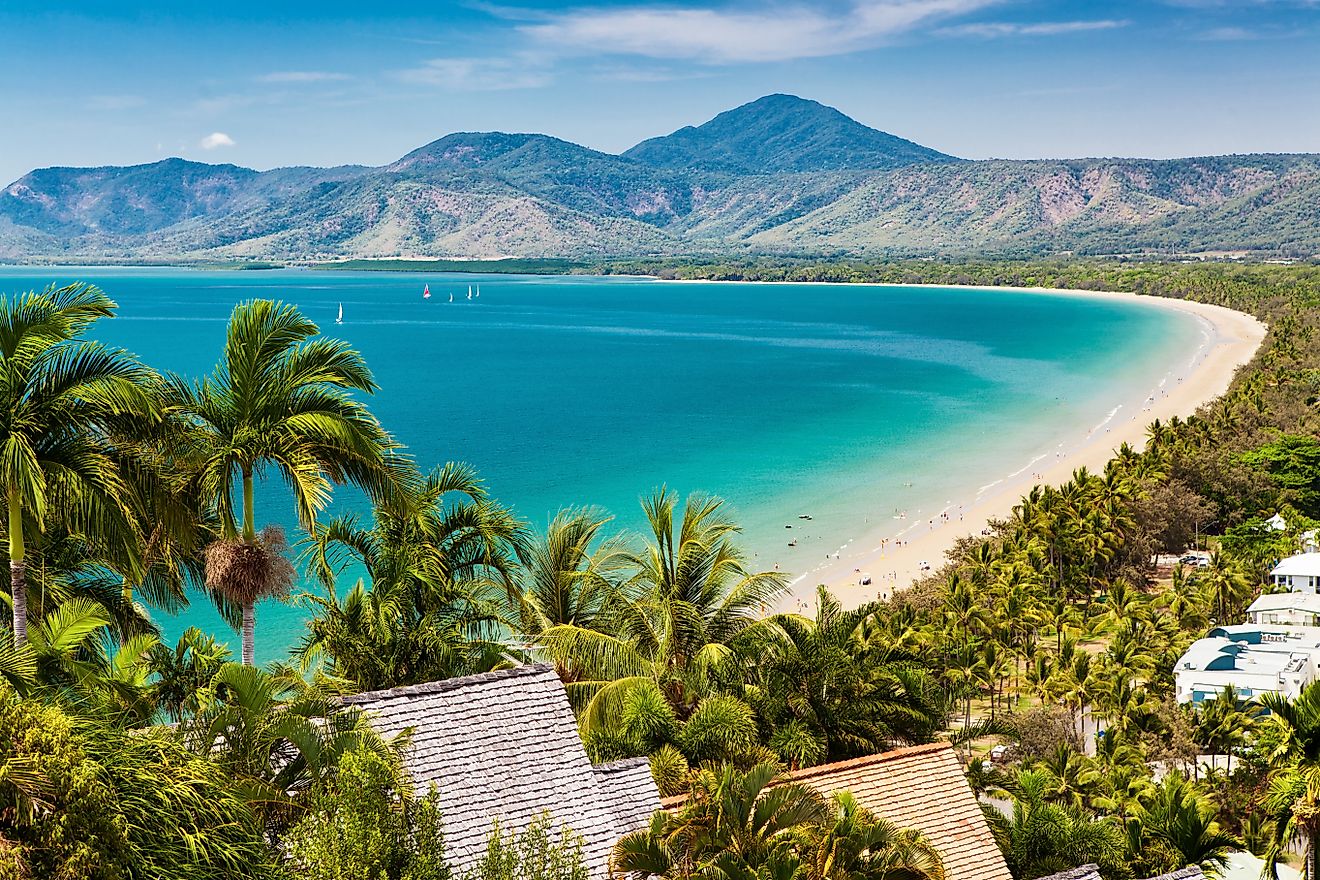
11 Undisturbed Towns To Visit In The Pacific Northwest
The Pacific Northwest is usually marketed in widescreen: glacier-capped volcanoes, city skylines reflected in harbors, ferry decks slick with rain. But the soul of this corner of the continent lives in places the billboards skip, where the loudest sound is a foghorn, not a freeway, and the night sky is interrupted more by stars than by streetlamps.
"Undisturbed" in the Pacific Northwest means communities that kept their pace when the rest of the region accelerated for tech booms and cruise ships. The following 11 towns don’t try to compete with Seattle, Portland, or Vancouver; they offer something those cities can’t: a slower, salt-tinged, rain-washed version of the Northwest that still feels anchored to water, weather, and the woods at its edge.
Port Townsend, Washington

Port Townsend was once called the "City of Dreams," a title not earned through myth but through halted ambition. In the late 1800s, it was meant to be the primary port for the Puget Sound. The rail line never came. Investors pulled out. What remains is a full Victorian seaport, banks, brothels, and steamship offices, all intact and largely unchanged. Unlike other preserved towns, Port Townsend never needed to recreate itself. The historical district wraps around a bluff above Admiralty Inlet, with the city’s maritime history still visible in its dry docks, shipwrights, and working marina.
The Northwest Maritime Center anchors the working waterfront and hosts classes in traditional navigation, sail repair, and coastal seamanship. Fort Worden State Park, a decommissioned military base, houses bunkers, bluff trails, and the Port Townsend Marine Science Center. Elevated Ice Cream, on Water Street, has churned small-batch lemon custard and amaretto since 1977. Better Living Through Coffee serves espresso facing the ferry terminal, with direct views of Whidbey Island. The Rose Theatre, a former vaudeville house turned three-screen cinema, still uses live music to open certain films. Port Townsend doesn’t cater to nostalgia.
Langley, Washington

Langley was built on a slope above Saratoga Passage, where gray whales feed in the shallows just offshore. Between February and May, they come close enough to see from First Street, which runs along the bluff. The town’s original plat follows this ridge, with wooden cottages and storefronts facing the water. Founded in 1891 and bypassed by major highways, Langley remained insulated, evolving into a concentrated mix of long-time residents, artists, and marine biologists. The Langley Whale Center tracks local sightings with printed logs and updated charts pinned to the wall.
The Clyde Theatre plays one film a night, seven days a week. Tickets are cash only. Down the block, Ulysses Coffee pours espresso and drip coffee and serves pastries in a narrow storefront that opens onto a small courtyard. Music for the Eyes sells rugs from Central Asia and antique knives from Afghanistan, displayed under carved beams salvaged from a sunken ferry. At South Whidbey Harbor, the public dock slopes gently into the channel, boats on the outer floats, herons on the inner pilings. The bell at the Inn at Langley is rung once each night before dinner service, a habit kept since the 1990s.
Coupeville, Washington

Coupeville was settled in 1852 and remains the oldest town in Washington to continuously operate under its original name. It sits inside Ebey’s Landing National Historical Reserve, the only reserve in the national park system that includes working farms and active homes. Front Street runs just above sea level, facing Penn Cove, where mussels are still harvested on rafts anchored offshore.
The Coupeville Wharf stretches into the bay and holds a marine education center above its pilings. During storms, the wharf bends with the wind but doesn’t close. The Island County Historical Museum, just above the bluff, displays Makah carving tools, settler clothing, and the original topographic survey map used to plat the town. At Little Red Hen Bakery, customers eat cinnamon rolls and thick-cut sourdough toast in a compact café on Front Street, just a few steps above the tideline. Farther west, Ebey’s Landing bluff trail follows a narrow ridge between the prairie and the sea, no fences, no signs, just an unbroken line from the Salish Sea to the Olympic Mountains.
La Conner, Washington

La Conner is built on a bend in the Swinomish Channel, where the tide flows both directions and the wind shifts three times a day. The town was founded as a steamboat landing in 1867, later attracting painters and poets drawn by flat light and open farmland. The Skagit Valley’s tulip fields begin just outside the town limits, thousands of acres planted in color blocks that peak in April. On quiet weekdays, the channel reflects the hulls of shrimp boats and tribal fishing skiffs docked along the quay. The Rainbow Bridge spans the water in a single steel arc, unlit at night, visible from nearly every part of town.
The Museum of Northwest Art stands in a converted department store and exhibits work tied to the regional landscape, Guy Anderson, Helmi Juvonen, Richard Gilkey. Nell Thorn, just down First Street, serves oysters and lamb shoulder above the tide line, where logs gather on the rocks after storms. Calico Cupboard bakes whole wheat cinnamon rolls heavy with molasses and walnuts.
Twisp, Washington

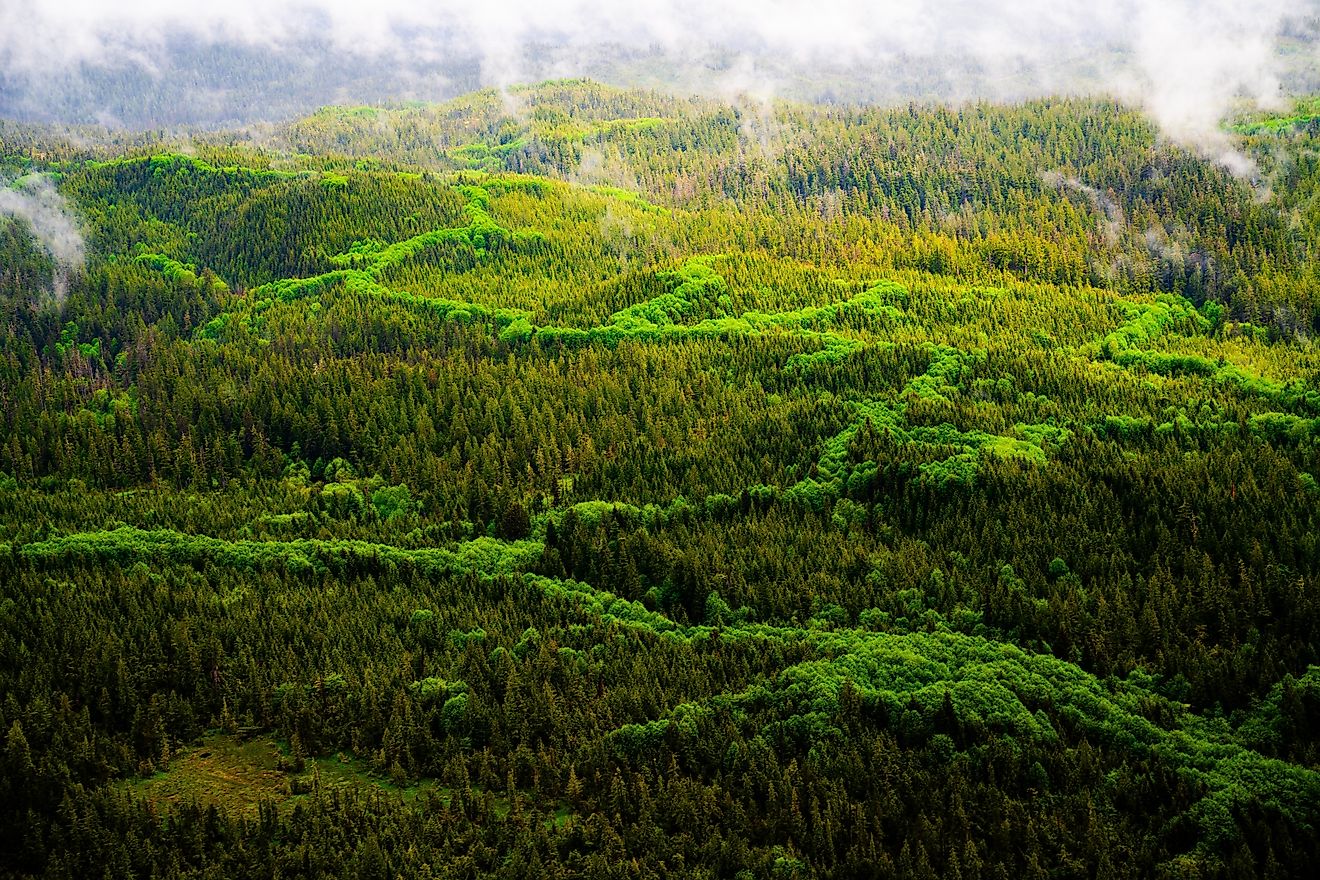
Twisp was once the supply hub for miners headed into the North Cascades. After the gold rush collapsed, the town stayed put, evolving into a service center for ranchers, forest crews, and trail builders. It sits where the Twisp River joins the Methow, just east of the rain shadow, with open sky, dry pine slopes, and a soundscape shaped by irrigation pivots and wind in cottonwoods. The old ranger station became TwispWorks, a 6-acre campus of metalworkers, printmakers, native plant growers, and distillers, anchoring the town’s small industrial core.
The Methow Valley Farmers Market runs Saturdays from April through October and takes over the parking lot beside the Methow Valley Community Center. Stalls offer tamales, duck eggs, river stone jewelry, and bitter greens harvested that morning. Cinnamon Twisp Bakery sells its namesake pastry from a case that’s rarely full past noon. Glover Street Market carries bulk grains, tinctures, and cider from nearby orchards. A mile out of town, Twisp River Road climbs toward trailheads that lead into the Lake Chelan-Sawtooth Wilderness. Scatter Lake and War Creek draw hikers in early summer when the meltwater clears.
Joseph, Oregon

Joseph sits at the end of Oregon Route 82, just before the pavement runs out and the Wallowas begin. The town was renamed in honor of Chief Joseph of the Nez Perce, whose ancestral homeland includes the surrounding valley. Bronze foundries operate on both ends of Main Street, casting work that ends up in galleries across the West. Most of the sculptures stay local, installed in front of the library, post office, or in the center of grassy lots with no signage. The entire town faces south toward the Wallowa Mountains, which rise 8,000 feet above the lake in less than four horizontal miles.
The Wallowa Lake Tramway climbs Mount Howard in fifteen minutes and tops out at 8,150 feet, where trails lead to overlooks above the glacial moraine. Jennings Hotel, a restored boarding house above a hardware store, operates without a front desk. Arrowhead Chocolates makes drinking chocolate from single-origin Ecuadorian beans, stirred into hot milk and served in stoneware cups. The Josephy Center for Arts and Culture exhibits Nez Perce baskets, beadwork, and contemporary painting in a former bank. At the south edge of town, a dock extends into Wallowa Lake, where the water drops off faster than any other lake in Oregon.
Sisters, Oregon

Sisters was built to serve the lumber mills that operated under the shadow of the Three Sisters peaks, but after the last mill closed in 1963, the town rebuilt itself without expanding. Every storefront downtown follows the same 1880s Western template, false fronts, gabled roofs, painted trim. The town sits at 3,000 feet on the dry side of the Cascades, with long winters, blue sky, and volcanic peaks visible from nearly every parking lot. The Sisters Rodeo has run every June since 1940 and still uses the original dirt arena.
Angeline’s Bakery, in a converted house off Main, bakes teff muffins and millet scones and serves chai steeped in saucepans on a gas range. The Stitchin’ Post sells quilting fabric, books, and longarm machines in preparation for the annual Sisters Outdoor Quilt Show, when thousands of handmade quilts are pinned to buildings and fences across town. The Peterson Ridge Trail System begins just south of the elementary school and runs over 20 miles through ponderosa pine and lava outcrops. Camp Sherman Store, twenty minutes north, rents fly rods and sells cold drinks on the banks of the Metolius River, where the water comes out of the ground at 50 degrees and never changes.
Yachats, Oregon

Yachats was built on basalt. The town rests directly on ancient lava flows, where the Pacific meets rock with no interruption of sand. Waves hit the edge of town hard enough to rattle glass, especially in winter. Named after the Siletz word for "dark water at the foot of the mountain," Yachats is bordered to the east by Siuslaw National Forest and to the south by Cape Perpetua, the highest point on the Oregon Coast accessible by car. At the overlook, the ocean stretches unbroken to the horizon, with fishing boats sometimes visible as small moving dots, lit against stormlight.
The Yachats State Recreation Area begins at the foot of 2nd Street and runs north along the tide pools. When the water drops, sea stars, anemones, and chitons are visible in the crevices. Green Salmon Coffee roasts in-house and serves Japanese matcha next to baked tofu wraps. The Drift Inn, a restaurant and motel under the same roof, posts a live music schedule on a chalkboard near the front door. Spouting Horn and Thor’s Well, both within Cape Perpetua Scenic Area, draw visitors during high tide surges.
Manzanita, Oregon

Manzanita is built at the base of Neahkahnie Mountain, on a fault line between forest and sea. In 1995, a small plane crashed into the hillside during heavy fog, killing a senator and two others. The mountain hasn’t been developed above the highway since. Below it, the town follows a strict grid, six blocks wide, ending in a dune system that holds one of the longest uninterrupted beaches in Oregon. Manzanita has no port, no pier, and no boardwalk. The shoreline is flat and often empty, even on holiday weekends.
Offshore Grill and Coffee House, at 154 Laneda Avenue, runs an all-day coffee bar and turns out chowder, sandwiches, and seasonal seafood plates that can be eaten at the bar or carried down toward the beach. The Hoffman Center for the Arts runs writing workshops and rotating gallery shows in a repurposed fire hall. Manzanita News & Espresso sells newspapers from Portland, London, and San Francisco alongside double Americanos and hazelnut scones. Nehalem Bay State Park begins at the south end of town and covers a four-mile sandspit with campsites, paved bike paths, and an estuary where elk often cross the inlet at dawn.
Sandpoint, Idaho

Sandpoint sits on the north shore of Lake Pend Oreille, a natural lake so deep the U.S. Navy still tests acoustic equipment in its southern basin. The town formed around the railroad lines that crossed the northern Rockies, and freight trains still thread directly through downtown, cutting across Cedar Street and passing behind brick warehouses that haven’t moved since the 1910s. The Selkirk Mountains rise straight from the water’s edge, giving Sandpoint a vertical boundary on three sides. When storms roll in, the lake and mountains merge into one color and the town seems to contract toward its grain silos and timber warehouses.
City Beach, at the tip of a peninsula, holds volleyball courts, a swimming dock, and a narrow spit where anglers cast for trout in the shallows. Evans Brothers Coffee Roasters operates out of a converted warehouse and keeps roasting drums visible from the seating area. The Cedar Street Bridge Public Market spans Sand Creek with shops selling hand-dyed yarn, metalwork, and pastries. Schweitzer Mountain Resort, twenty minutes uphill, runs a high-speed chairlift in summer and fall, carrying hikers to ridge trails above the lake. The view from the summit, water on one side, Idaho forest on the other, feels disconnected from everything below it.
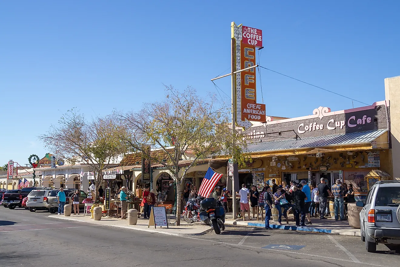
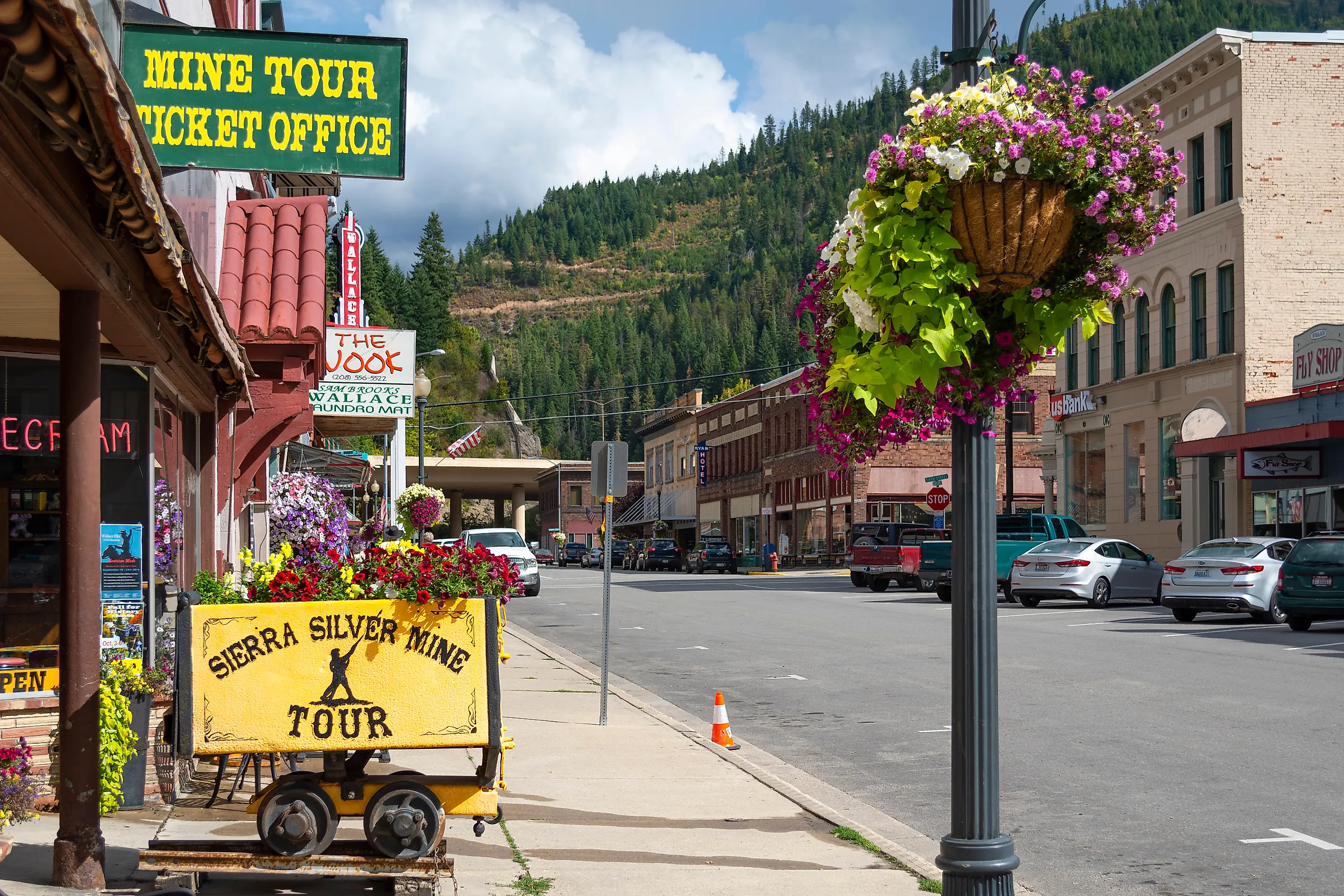
Wallace, Idaho

Wallace declared itself the "Center of the Universe" in 2004, marking the intersection of Bank and Sixth Streets with a manhole cover engraved to prove it. The town sits in a narrow canyon in the Silver Valley, where some of the richest lead and silver deposits in North America were pulled from the ground. After fires in 1890 and 1910 destroyed most buildings, Wallace rebuilt entirely in brick, creating a dense, fire-resistant core that remains unchanged. Interstate 90 was forced to rise above it on an elevated viaduct, leaving the original grid untouched beneath.
The Wallace District Mining Museum on Cedar Street documents the region’s labor strikes, mine disasters, and geology with equipment pulled from nearby shafts. The Northern Pacific Depot Museum, relocated board by board to avoid freeway demolition, displays timetables and passenger records from the rail era. The Fainting Goat Wine Bar pours Idaho and Washington reds in a former storefront hotel. Just outside town, the Trail of the Coeur d’Alenes begins a 73-mile paved route along rivers, wetlands, and the old Union Pacific railbed. Back in Wallace, the smoke from the 1313 Club’s grill drifts into the street, mixing with mine dust from work trucks rolling downhill at shift change.
Taken together, these eleven towns prove the Pacific Northwest’s quietest stories aren’t told in cities at all, but on foggy docks, cafe stools, and trailheads at the end of the road. Each place holds its own version of undisturbed living, boats still working, quilts still hanging, forests still advancing to the edge of town. You don’t just pass through these communities; you slow down enough to notice what never sped up.