11 Offbeat Utah Towns To Visit In 2026
Utah's five national parks are worth the drive. The towns you blow past to reach them are the surprise. A limestone dome in Midway hides a 10,000-year-old geothermal crater warm enough to scuba dive in. A canyon wall outside Bluff holds rock art carved as far back as 3,000 years ago. The rest of this list runs through railroad towns, desert river stops, a would-be capital, and coal country. Here are 11 offbeat Utah towns worth a stop in 2026.
Price

Break the drive to Moab in Price. On East Main Street, the Utah State University Eastern Prehistoric Museum keeps a full Utahraptor skeleton and real tracks pulled from eastern Utah. Utahraptor was not the animal behind the raptors in Jurassic Park, but it proved they could grow to movie-monster size.
Thirty miles south, the story gets stranger. Cleveland-Lloyd Dinosaur Quarry, part of Jurassic National Monument, has yielded more than 12,000 fossils, weighted oddly toward Allosaurus. Paleontologists still cannot agree on why so many predators died in one spot, which makes the quarry read less like a display and more like an unsolved scene.
Price also holds Carbon County's coal history. Greek immigrants came for the mining work and built Assumption Greek Orthodox Church, dedicated in 1916 and among the oldest Greek Orthodox churches in continuous use west of the Mississippi River.
Green River

Green River has thrown a party for its melons since 1906. The harvest still plays like a homecoming. Every third weekend in September, Melon Days hands out free slices and rolls a parade past the giant fiberglass watermelon that first appeared in 1960. The melons grow sweet here on sandy soil, hot days, and cool desert nights along the river.
The river itself is the other draw. From Green River State Park, boaters launch into Labyrinth and Stillwater Canyons, a flatwater route through deep desert country. The Labyrinth Canyon stretch alone covers 68 river miles down to Mineral Bottom and takes most paddlers three to four days.
On the bank, the John Wesley Powell River History Museum tracks the biggest river story in the West. Powell ran the Green and Colorado rivers in 1869, and the museum lays out that expedition alongside the wider history of river running in the region.
Midway

Midway's Swiss streak is the real thing, not a costume for tourists. Swiss immigrants settled the valley in the 1860s and 1870s because it reminded them of home, and the town still marks it every Labor Day weekend at Swiss Days, a two-day run of food booths, music, and a Saturday parade on the town square. In 2026 it lands September 4 and 5, and Main Street gets far busier than the town's size suggests.
The bigger surprise sits under Homestead Resort. The Crater at Homestead is a geothermal spring inside a 55-foot limestone dome, its mineral water holding 90 to 96 degrees year-round. You enter through a tunnel cut into the rock, then soak, swim, snorkel, run through paddleboard yoga, or dive. Homestead bills it as the only warm-water scuba destination in the country.
Wasatch Mountain State Park keeps Midway from being only a festival and a hot spring. Its trails carry hikers and bikers in summer and skiers, snowshoers, and snowmobilers once the snow falls.
Torrey

Torrey sits eight miles west of Capitol Reef National Park, but its best hours come after sundown. In 2018 it became Utah's first International Dark Sky Community, after residents tightened the lighting rules and swapped out the streetlights. On a clear, moonless night the Milky Way needs no telescope. You just look up.
The Entrada Institute, in the old Robber's Roost Bookstore, runs the town's arts calendar: the Torrey Chamber Music Festival, author readings, poetry nights, concerts, and gallery shows. On Saturdays from late May to mid-October, the Capitol Reef Farmers' Market fills in with local produce, crafts, and music. Grab breakfast at the Wild Rabbit Cafe on the main road before you head into the park.
Manti

The Manti Utah Temple looks like it grew out of Temple Hill, and in a sense it did. Built between 1877 and 1888, it was cut from the cream-colored oolite limestone quarried from the same hill it stands on. Its 179-foot east tower rises over the Sanpete Valley. Even from the outside, the hilltop view earns the climb.
Eighteen miles north on US-89, detour to Spring City. The whole town is on the National Register of Historic Places, its streets still lined with pioneer limestone, adobe, brick, frame, and log buildings. The art scene fits the setting, especially during the Spring City Arts Plein Air and Studio Tour, when painters set up in the valley and open their studios. From nearby Ephraim, Skyline Drive climbs into Manti-La Sal National Forest past high meadows, reservoirs, and long views across central Utah.
Fillmore

Fillmore aimed higher than the town around it lets on. The Territorial Statehouse was meant to be a full capitol, four wings around a Moorish dome. The money ran out after the south wing. The legislature met there once, and in 1856 it voted to move the capital to Salt Lake City. That lone wing is now the Territorial Statehouse State Park Museum, Utah's oldest existing government building, with an 1867 schoolhouse, pioneer cabins, and early settler portraits on the grounds.
A short drive south, Meadow Hot Springs sits on private land with three clear pools holding around 100 degrees. Access is free, though donations are asked, and visitors are expected to follow the posted rules and leave it clean.
Farther south near the I-15 and I-70 junction, Cove Fort went up in 1867 from volcanic rock and limestone as a waystation for travelers. Free guided tours now run through the restored fort, the barn, the blacksmith shop, and the outbuildings.
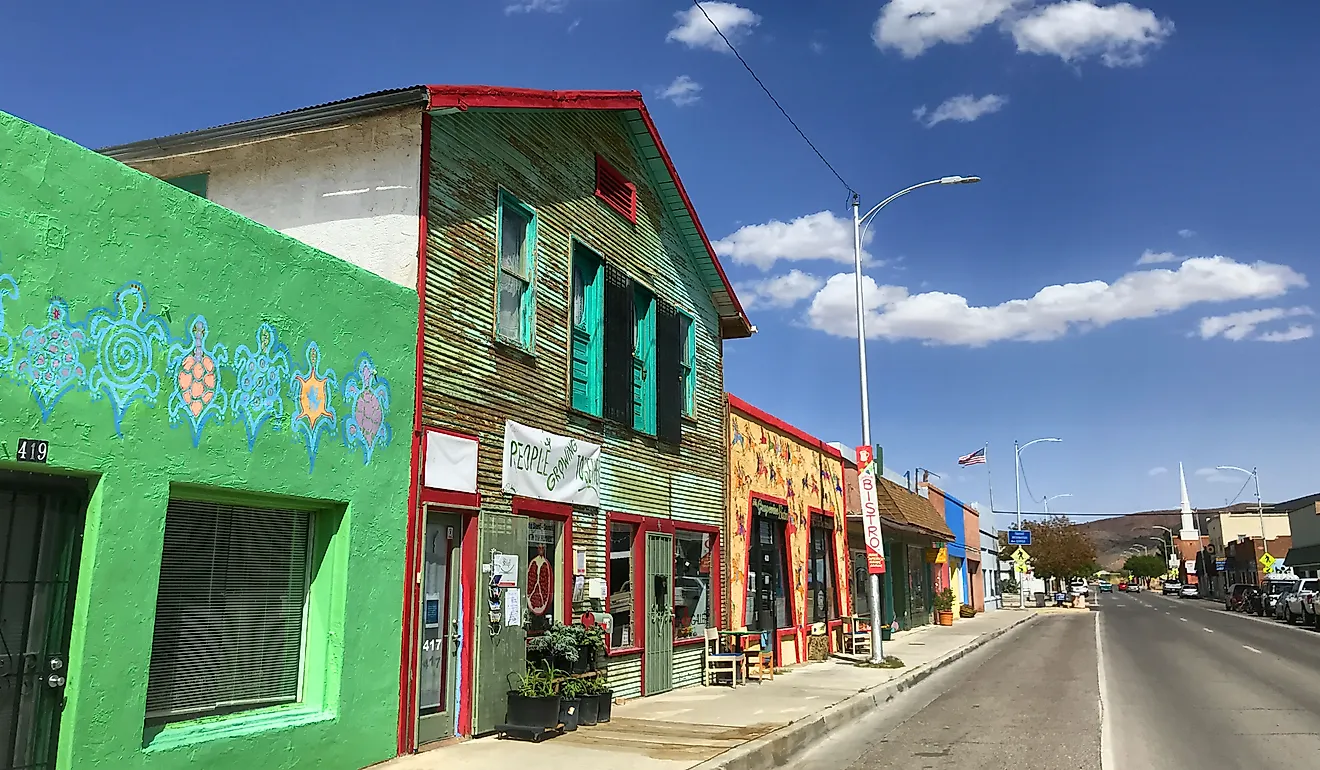
Helper

Helper is named for the extra "helper" engines that once waited here to shove heavy trains up Price Canyon toward Soldier Summit. That railroad past still runs down Main Street, where old mining-town storefronts now hold galleries, shops, and cafes without scrubbing the coal out of the story.
The Helper Museum makes the most of it. The lower level is a walk-through mock coal mine, canary cages and all, while the upper floors pack in old hotel rooms, a company store, model trains, dinosaur fossils, and a window over the working rail yard. The exhibits trace the miners and railroad crews, immigrants from 27 countries, who kept Carbon County's coal towns running.
Out front of the Civic Center and library stands Big John, an 18-foot fiberglass coal miner and the easiest landmark in town. A few miles west, Spring Canyon Road runs past the ruins of abandoned coal camps like Standardville and Spring Canyon, where schools, stores, homes, and mines once filled the canyon.
Bluff

Three miles west of Bluff, the Sand Island Petroglyph Panel turns a canyon wall into a record of everyone who lived and traveled along the San Juan River. The rock art runs more than 100 yards, its images dated from about 300 to 3,000 years old. Most of it dates to the Basketmaker and Pueblo III periods, with later Ute and Navajo carvings lower on the wall. It is free, listed on the National Register of Historic Places, and a short walk from the parking area.
Bluff also makes a good base for Bears Ears National Monument, a 1.36-million-acre landscape with more than 100,000 known archaeological and cultural sites. The Trail of the Ancients National Scenic Byway starts in town and runs 120 miles past ruins, rock art, and Four Corners history. For the river, Wild Expeditions has guided San Juan trips since 1957, running day floats and multi-day journeys out of the Bluff area.
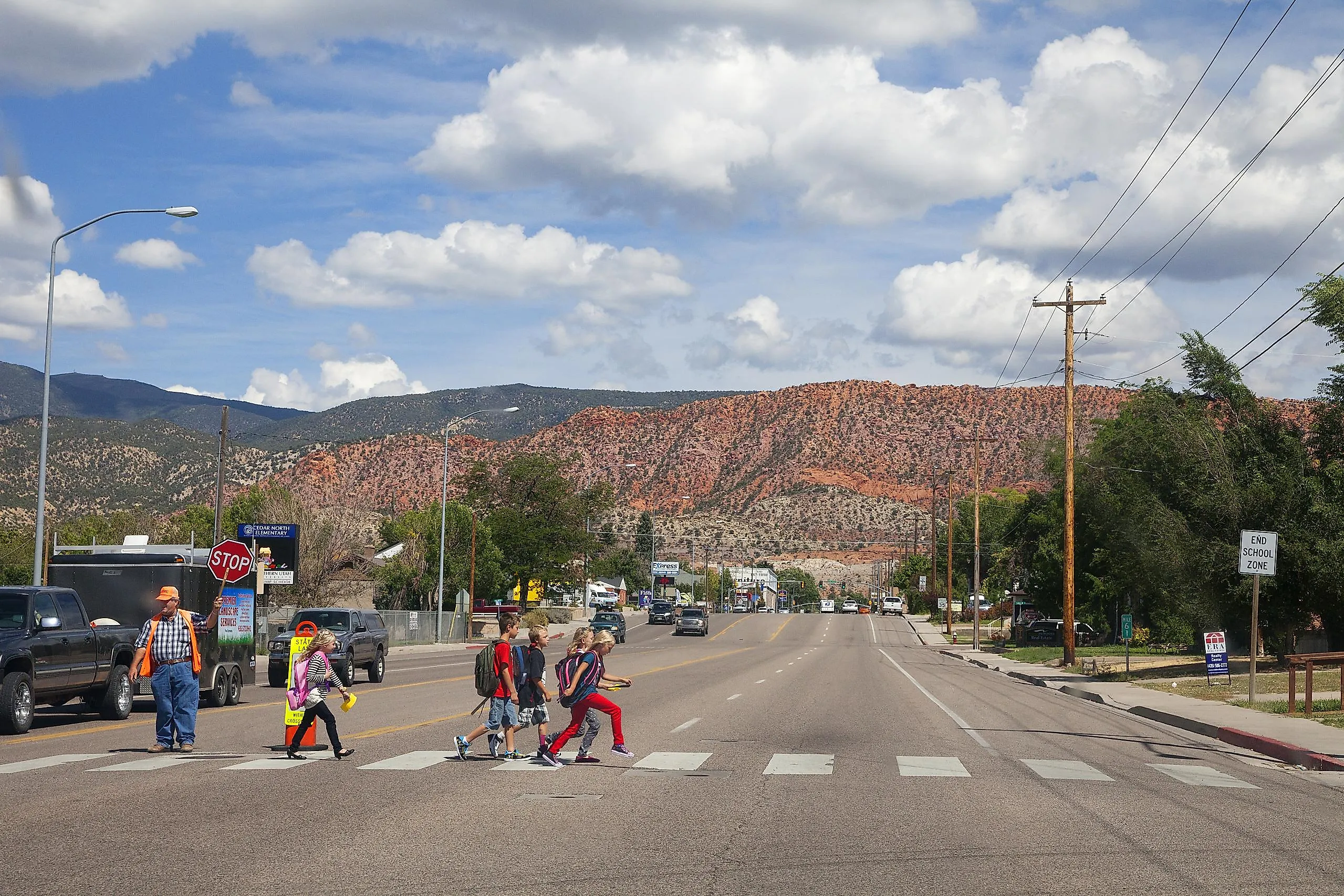
Cedar City

A Tony-winning theater company in a former iron town is not the pairing you expect off I-15. The Utah Shakespeare Festival started in 1961 on a makeshift stage, ran its first season in 1962, and took the 2000 Tony Award for America's Outstanding Regional Theatre. From June through October it stages Shakespeare and more across three theaters on the Southern Utah University campus, including the Globe-style Engelstad, and the free nightly Greenshow runs whether or not you hold a ticket.
The iron came first. Brigham Young sent settlers here in 1851 to work the Iron Mission, and a small blast furnace was turning out ore within a year. The Frontier Homestead State Park Museum keeps that history, with a replica furnace, pioneer wagons and stagecoaches, and a 250,000-pound steam shovel out front that you can climb into.
For the other side of town, drive east and up. Cedar Breaks National Monument sits about 23 miles out at roughly 10,000 feet, a red-rock amphitheater rimmed with bristlecone pines and, in July, meadows of wildflowers. You can watch a matinee downtown and reach the rim in time for sunset.
Escalante

Hole-in-the-Rock Road runs 62 miles out of Escalante toward Lake Powell, most of it crossing Grand Staircase-Escalante National Monument. It is unpaved, dry-weather country, and it is how most visitors reach Peekaboo Gulch and Spooky Gulch, where the sandstone pinches down until you turn sideways to squeeze through. Check the road conditions first. Do not assume the car can handle it.
Closer in, Escalante Petrified Forest State Park runs a much older clock. Its trails climb past petrified wood from trees buried 135 to 155 million years ago, then drop back near Wide Hollow Reservoir for fishing, swimming, kayaking, and paddleboarding.
On Main Street, Escalante Outfitters handles the practical side with pizza, cabins, gear, and tours. East of town on Scenic Byway 12, Kiva Koffeehouse is the prettier finish, serving espresso and Southwest food in a sandstone-and-pine building perched on the rim of the Escalante River Canyon.
Boulder

Mail reached Boulder by mule train until the 1930s, and reliable year-round roads did not arrive until around 1940. Before that, getting in and out came down to weather, terrain, and patience. The easiest place to unpack that history is the Anasazi State Park Museum on Scenic Byway 12.
It preserves part of Coombs Village, one of the largest Ancestral Puebloan communities west of the Colorado River, occupied from about A.D. 1050 to 1200, with original ruins and a life-sized six-room pueblo replica outside. A few miles south, the trail to Lower Calf Creek Falls leaves the Calf Creek Recreation Area and runs 6 miles round-trip through sandstone canyon to a 126-foot waterfall.
Back in town, Hell's Backbone Grill and Farm is Boulder's best-known modern stop. It cooks seasonal Four Corners food from its own organic farm and has been a James Beard semifinalist for Outstanding Restaurant.
Take The Detour
Utah's national parks will always pull the biggest crowds, and these towns are what most people miss on the way. The fossil quarries, rail yards, temple hills, river launches, mining streets, hot springs, and canyon roads all sit within a short detour of the main route. Next time the parks are the plan, build in a stop at one of these 11 towns. The stories hold up better than the highway does.