Which Water Bodies Border The Indian Peninsula?

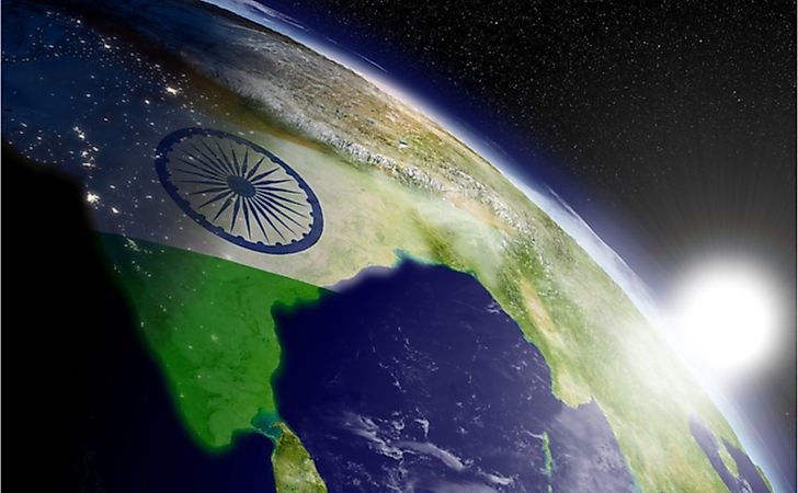
A peninsula can be defined as a landmass that extends from a larger body of land and is surrounded by water bodies on all other sides. The Indian Peninsula consists of a vast region in South Asia that is in the shape of an inverted triangle. The Indian Peninsula borders the Bay of Bengal to the east, the Arabian Sea to the west, and the Vindhya and Satpura ranges to the north. The entirety of the peninsula is located within the territory of modern-day India. Some of the states of India that are situated in the region include Odisha, West Bengal, Andhra Pradesh, Kerala, Tamil Nadu, Karnataka, Maharashtra, Goa, and Gujarat. The Indian Peninsula is also referred to as the Deccan Peninsula and is one of the oldest landmasses on earth. Some geographers refer to the peninsula as a subcontinent due to its sheer size and its isolation from the rest of the continent of Asia. The peninsula consists of the Deccan plateau, Eastern Ghats, Western Ghats, and the Vindhya and Satpura ranges.
Bay Of Bengal
The Bay of Bengal is a large and somewhat shallow embayment that is part of the northeastern section of the Indian Ocean. It occupies an area that is approximately 839,000 square miles with India and Sri Lanka to the west, Myanmar, and the Malay Peninsula to the east and Bangladesh to the north. The Bay of Bengal is 1,000 miles wide and has an estimated average depth of about 8,500 feet. Some parts of the bay have an estimated maximum depth of 15,400 feet. The Andaman and Nicobar islands separate the Andaman Sea from the bay. The bay plays a pivotal role in the drainage of areas in and around the Indian Peninsula. Some of the notable rivers that drain into the bay include the Ganges and Brahmaputra to the north and the Krishna, Godavari, and Mahanadi to the west.
The Economic Significance Of The Bay Of Bengal
The bay plays a significant economic role for the inhabitants of the Indian peninsula. The bay’s distinct tropical marine ecosystem coupled with river drainage, marshes, wetlands, and mangroves around the bay allows for increased productivity of nearshore species of fish. Small and medium scale fisheries primarily exploit the resource while commercial fishing is carried out in deeper waters. Significant amounts of prawns and tuna are obtained from the area. Natural gas and petroleum discoveries have also been made in the area, specifically offshore of the Mahanadi and Godavari deltas. The hydrocarbon resources are typically found in deeper areas compared to similar findings in the Arabian Sea. Titanium deposits are also found off the northeastern shore of Sri Lanka. The Bay of Bengal also has strategic trade routes used by tankers from the Persian Gulf that connect to the Strait of Malacca.
Arabian Sea
The Arabian Sea is found in the northwestern section of the Indian Ocean. It covers an area totaling 1.49 million square miles and forms the principal shipping route between India and Europe. The Arabian Sea is bordered by India on the eastern side by the Arabian Peninsula on the western side, by Pakistan and Iran on the northern side, and by the rest of the Indian Ocean on the southern side. The sea is connected to the Persian Gulf in the north through the Strait of Hormuz. It is also joined by the Gulf of Aden to the Red Sea through the Bab al-Mandeb Strait. Some of the islands on the Arabian Sea include Lakshadweep (which consists of the Minicoy, Laccadive, and Amindivi islands), all part of India, Socotra, which is Yemeni territory, and Khuriyya Muriyya Islands found off the Omani coast. The main waterways that drain into the sea are the Narmada and Indus rivers. The Arabian Sea formed roughly 50 million years ago when the Indian Subcontinent collided with the main landmass that makes up Asia.
The Economic Significance Of The Arabian Sea
The Arabian Sea is known for its abundance of natural resources, which include fish, petroleum, and natural gas deposits, as well as its strategic importance in global trade. Petroleum and natural gas deposits in the sea are found off the coast of the Indian Peninsula. Deposits found to the northwest of Mumbai have been exploited extensively. High nutrient levels found in the sea support rich fish life that includes sardine, tuna, billfish, wahoo, sharks, and moonfish. The sea, however, is also known for the high mortality of fish, a phenomenon that is attributed to a layer of subsurface water (which has low levels of oxygen) originating from the topics. Fishing off the Indian Peninsula is carried out by small scale fishing vessels and larger commercial shipping vessels from many countries including, India, Pakistan, Japan, Yemen, Oman, and Sri Lanka. The sea’s proximity to the Persian Gulf and Suez Canal (some of the busiest shipping transit routes in the world) means that its strategic importance cannot be understated. Large tankers from the Persian Gulf transit the sea while headed to destinations such as East Asia, Europe, and the Americas. The Red Sea-Suez Canal sea route is mainly used by general-cargo ships. Some of the principal ports on the Indian peninsula that border the sea include Mumbai and Kochi.
Monsoons In The Indian Peninsula
The Indian monsoon affects India, specifically the Indian peninsula and water bodies that surround the region. It blows from the southwest during the warmest months and reverses direction to blow from the northeast in the coldest months of the year. Some of the factors that influence the monsoon include the distinct characteristics of the Indian Peninsula as well as oceanic, atmospheric, and geophysical factors. The monsoon brings large amounts of rainfall to the Indian peninsula in June and July. The monsoon is one of the most studied weather phenomena in countries such as India, Sri Lanka, Nepal, and Pakistan due to its effect on agriculture and other social-economic aspects in the region.


