Which River Forms Part of the Border Between the United States and Canada?
The Saint Lawrence: Part of the US-Canada Border
The Saint Lawrence River system runs a total of 1,900 miles (3,057 kilometers), with the river itself being 743.8 miles (1,197 kilometers) in length. Most of the river runs through the Canadian provinces of Ontario and Quebec, with only 144 miles (70.8 kilometers) of the St. Lawrence going through the American state of New York. With the river running from the Great Lakes all the way to the vital mouth of the Gulf of St. Lawrence, which deposits into the Atlantic, it is a vital maritime passageway for trade.
US-Canada Border Disputes Involving the Saint Lawrence
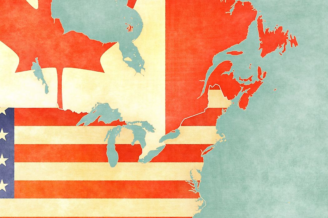
The United States and Canada share the longest international border on Earth between any two countries. Counting maritime boundaries the border runs 5,525 miles (8,891 kilometers). Eight Canadian provinces and territories and 13 American states are located along the border. Despite the Saint Lawrence River only covering a small portion of this, it has been the source of several border disputes and their resolutions.
In 1783, the Treaty of Paris was signed which ended the American Revolutionary War (1775-83) and established boundaries between the British colony of Canada and the newly formed United States. This declared that the Saint Lawrence River and the Great Lakes would become the far west boundary between the two.
In 1842, the Webster-Ashburton Treaty resolved a dispute between the border that Maine shared with New Brunswick and the Province of Canada. It also reanalyzed the border situation between the Province of Canada and the states of New York, New Hampshire, and Vermont, which involved area near the Saint Lawrence.
The Treaty of 1908 set the current border boundaries that the United States and Canada share today. As part of Article IV, the border going through the Great Lakes and Saint Lawrence River where surveyed using modern techniques, with a couple of changes being made.
A Brief History of the Saint Lawrence River
In 1535, Jacques Cartier (1491-1557) became the first European explorer to sail up the Saint Lawrence River during his second trip to the region. Of course, he was not the first European to have explored the Gulf of Saint Lawrence and at the time the area was home to the St. Lawrence Iroquoians. Cartier named the river after Saint Lawrence (225-58), as he arrived in its tidal mouth on August 10th, which is his feast day.
However, Cartier ended up being blocked from going further just southwest of where Montreal now stands because of the Lachine Rapids. Over time, the waterway was shaped to become a way to navigate into the interior of the North American continent. The major catalysts for this over the 19th century were the building of the Erie Canal (1825), the first canal near Niagara Falls (Welland Canal, 1829) and the first locks at Sault Sainte Maire, Michigan (1855).
However, the United States was reluctant to open the Saint Lawrence to accommodate sea traffic to the Great Lakes throughout the first half of the 21st century. It took until 1954 for Congress to approve the country's participation in the joint effort to build the Saint Lawrence Seaway after two rebuffed efforts in the previous decades. The seaway then formally opened five years later in a joint ceremony lead by President Dwight D. Eisenhower (1890-1969) and Queen Elizabeth II.


