Which Is The Highest Continuous Paved Road In The US?
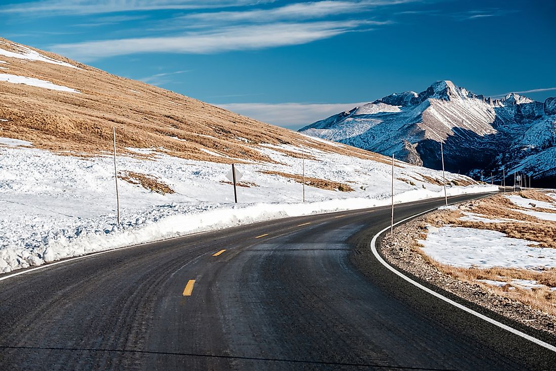
The Trail Ridge Road ranks as the highest uninterrupted surfaced road in the US and has a length of 48 miles. The road is part of the US Route 34 and cuts across Rocky Mountain National Park in the state of Colorado. Major junctions are at Estes Park in the eastern end and Grand Lake in the western end. Due to traffic, among other reasons, one can take up to two hours to drive on the Trail Ridge Road.
Description
Starting at the road’s entrance at Grand Lake, the Trail Ridge Road goes north via the Kawuneeche Valley where numerous trailheads exist. At Milner Pass, the road cuts across the Continental Divide at an elevation of 10,758 feet and rises to 12,183 feet adjacent to Fall River Pass. A conspicuous trailhead in the valley is the Colorado River Trailhead that is always closed during the winter season. Near the topmost part of the route, the Iceberg Pass stands at 11,827 feet above sea level. The eastern end is at the Fall River Entrance although a few guides will place it at Deer Ridge Junction. Off the high paved road, there was a local ski attraction between the years 1955 and 1991 at Ski Estes Park that is no longer functional.
History of Trail Ridge
The first road in the elevated region of Rocky Mountain National Park was Fall River Road that opened in 1921. Fall River Road had very steep grades, was too narrow, and had a short annual season due to snow. Construction of a new road began in September 1929 and 1932 reached Fall River Pass. With 7% as its maximum grade, Trail Ridge’s construction ended in 1938 at Grand Lake. The National Park Service’s director at the time, Horace Albright, overruled resistance to the development of the road inside the park as he viewed Trail Ridge as a way of encouraging people to visit. The 150 workers had to work from mid-June to mid-October to avoid frost. Equipment used included horses, graders, and tractors.
Routes Before the Road
Native Americans crossed the mountains between their homes and hunting grounds using a route that the Trail Ridge Road now follows. The trail was so steep to carry children that the Arapahoe Indians named it “taienbaa” meaning “where the children walked.” The present Ute Trail in the park moderately follows the route marked with stone cairns by the Ute Tribe on the eastern side. Around 1880, the western side had a wagon road that ran along the Kawuneeche Valley starting at Grand Lake heading to Lulu City, where mining camps lie abandoned.
Use of the Road
Use of Trail Ridge Road is between late May and October as this is the best time with no ice and snow on the road. Temporary closure of the road comes in September and October with the onset of some snow. People are advised to call ahead before embarking on a journey through Trail Ridge. Trail Ridge Road offers spectacular views of wildlife from the comfort of vehicles as it sits at a very high altitude.


