Where are the Barisan Mountains?
The Barisan mountain range is located on the west of Sumatra in Indonesia and traverses approximately 1,050 miles from the island’s north to south. The mountain range is also known as Bukit Barisan, a name that means “hills making a row.” There are about 35 active volcanoes found in the Barisan Mountains with the range’s crown peak being Mount Kerinci. The most significant volcano in the ranges is Toba, a super volcano within Lake Toba, estimated to have erupted about 74,000 years ago creating the lake.
Highest Peaks of the Barisan Mountains
Kerinci
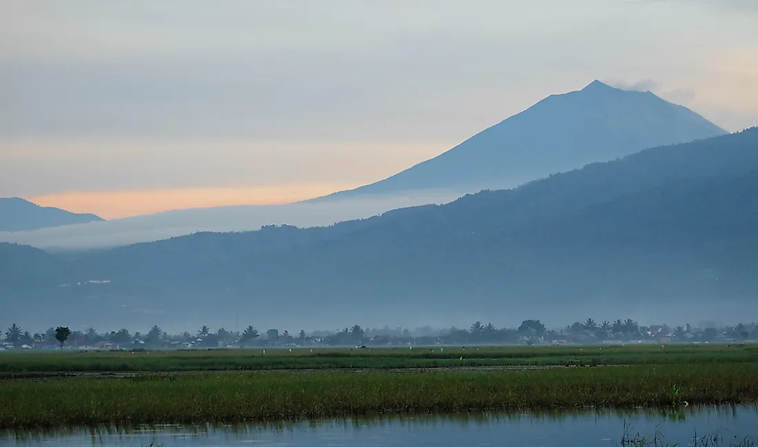
Mount Kerinci has the highest peak in the Bukit Barisan and is also the highest known volcano in Indonesia. The forest found within Kerinci Seblat National Park surrounds the mountain and is home to the Sumatran rhinoceros and the Sumatran tiger, which are both endangered species. The mountain has an elevation reaching 12,500 feet, located about 81 miles south of Padang. A crater that stretches 1,969 feet wide is found at the top of the summit, and to the northeast, there is a crater lake. The mountain is the most active of all the Indonesian volcanoes. Its last eruption was on June 22, 2004, and the Volcanic Explosivity Index (VEI) was 2. The mountain continues to pour out clouds of sulfurous smoke that reaches 3,281 feet above the mountain summit.
Dempo
Mount Dempo has an elevation that reaches 10,410 feet, and it is the highest stratovolcano in South Sumatra. Dempo is part of the ranges that make up the Bukit Barisan. The summit of this mountain has seven craters with a lake that measures 1,312 feet wide at the north-west end. The last eruption was in October 1994, and the VEI was 1. The latest volcanic activity was in 2009, a small-to-moderate explosion that formed ashfall near the volcano.
Talakmau
Mount Talakmau has an elevation of 9,557 feet and also goes by the names Talamau or Ophir. The mountain is a volcano located in West Sumatra, Indonesia, and it is ranked third highest of the Barisan Mountains. The last eruption of Mount Talakmau is unknown.
Marapi
Mount Marapi is also called Merapi or Berapi and has an elevation of 9,485 feet being the fourth largest among the 35 active volcanoes of the Barisan Mountain Ranges. The name means “Mountain of Fire.” Legend has it that the Minangkabau people settled on the mountain when their ship landed on it when it was just the size of an egg. There are some cities and towns around Mount Marapi. The last eruption was on August 5, 2004, and VEI recorded was 2.
Recent Activity in the Barisan Mountains
Recently, on February 19, 2018, Mount Sinabung erupted. The eruption sent a cloud of ash over 3.1 miles into the air and altered the summit, with the Associated Press reporting that the mountain lost a significant portion of its peak in the eruption. Fear has gripped the islanders of Sumatra since 34 more volcanoes threaten the region. Indonesia as a country has a total of 147 volcanoes with 120 of them being active. Indonesia has experienced some of the most and devastating volcanic eruptions in history. The eruption of Tambora in 1815 caused what is known as the Year without summer in Europe in 1816.
Highest Peaks of the Barisan Mountains
| Rank | Name | Elevation | Last eruption (VEI) |
|---|---|---|---|
| 1 | Kerinci | 3,800 metres (12,500 ft) | 22 June 2004 (2) |
| 2 | Dempo | 3,173 metres (10,410 ft) | October 1994 (1) |
| 3 | Talakmau | 2,919 metres (9,577 ft) | unknown |
| 4 | Marapi | 2,891 metres (9,485 ft) | 5 August 2004 (2) |
| 5 | Geureudong | 2,885 metres (9,465 ft) | 1937 |
| 6 | Patah | 2,817 metres (9,242 ft) | unknown |
| 7 | Peuet Sague | 2,801 metres (9,190 ft) | 25 December 2000 (2) |
| 8 | Talang | 2,597 metres (8,520 ft) | 12 April 2005 (2) |
| 9 | Sumbing | 2,507 metres (8,225 ft) | 23 May 1921 (2) |
| 10 | Bukit Daun | 2,467 metres (8,094 ft) | unknown |
| 11 | Sinabung | 2,460 metres (8,070 ft) | 07-Sep-10 |
| 12 | Tandikat | 2,438 metres (7,999 ft) | 1924 (1) |
| 13 | Kembar | 2,245 metres (7,365 ft) | Pleistocene |
| 14 | Sibayak | 2,212 metres (7,257 ft) | 1881 |
| 15 | Toba | 2,157 metres (7,077 ft) | cca 75.000 years ago |
| 16 | Kunyit | 2,151 metres (7,057 ft) | unknown |
| 17 | Sorikmarapi | 2,145 metres (7,037 ft) | 1986 (1) |
| 18 | Bukit Lumut Balai | 2,055 metres (6,742 ft) | unknown |
| 19 | Hutapanjang | 2,021 metres (6,631 ft) | unknown |
| 20 | Belirang-Beriti | 1,958 metres (6,424 ft) | unknown |
| 21 | Kaba | 1,952 metres (6,404 ft) | 22 August 2000 (1) |
| 22 | Besar | 1,899 metres (6,230 ft) | April 1940 (1) |
| 23 | Ranau | 1,881 metres (6,171 ft) | unknown |
| 24 | Lubukraya | 1,862 metres (6,109 ft) | unknown |
| 25 | Sibualbuali | 1,819 metres (5,968 ft) | unknown |
| 26 | Seulawah Agam | 1,810 metres (5,940 ft) | 1839 (2) |
| 27 | Sekincau Belirang | 1,719 metres (5,640 ft) | unknown |
| 28 | Imun | 1,505 metres (4,938 ft) | unknown |
| 29 | Rajabasa | 1,281 metres (4,203 ft) | 1798 |
| 30 | Helatoba-Tarutung | 1,100 metres (3,600 ft) | Pleistocene |
| 31 | Hulubelu | 1,040 metres (3,410 ft) | 1836 |
| 32 | Suoh | 1,000 metres (3,300 ft) | 10 July 1933 (4) |
| 33 | Weh | 617 metres (2,024 ft) | Pleistocene |
| 34 | Sarik-Gajah | unknown | unknown |
| 35 | Pendan | unknown | unknown |


