What Is Bouvet Island Famous For?
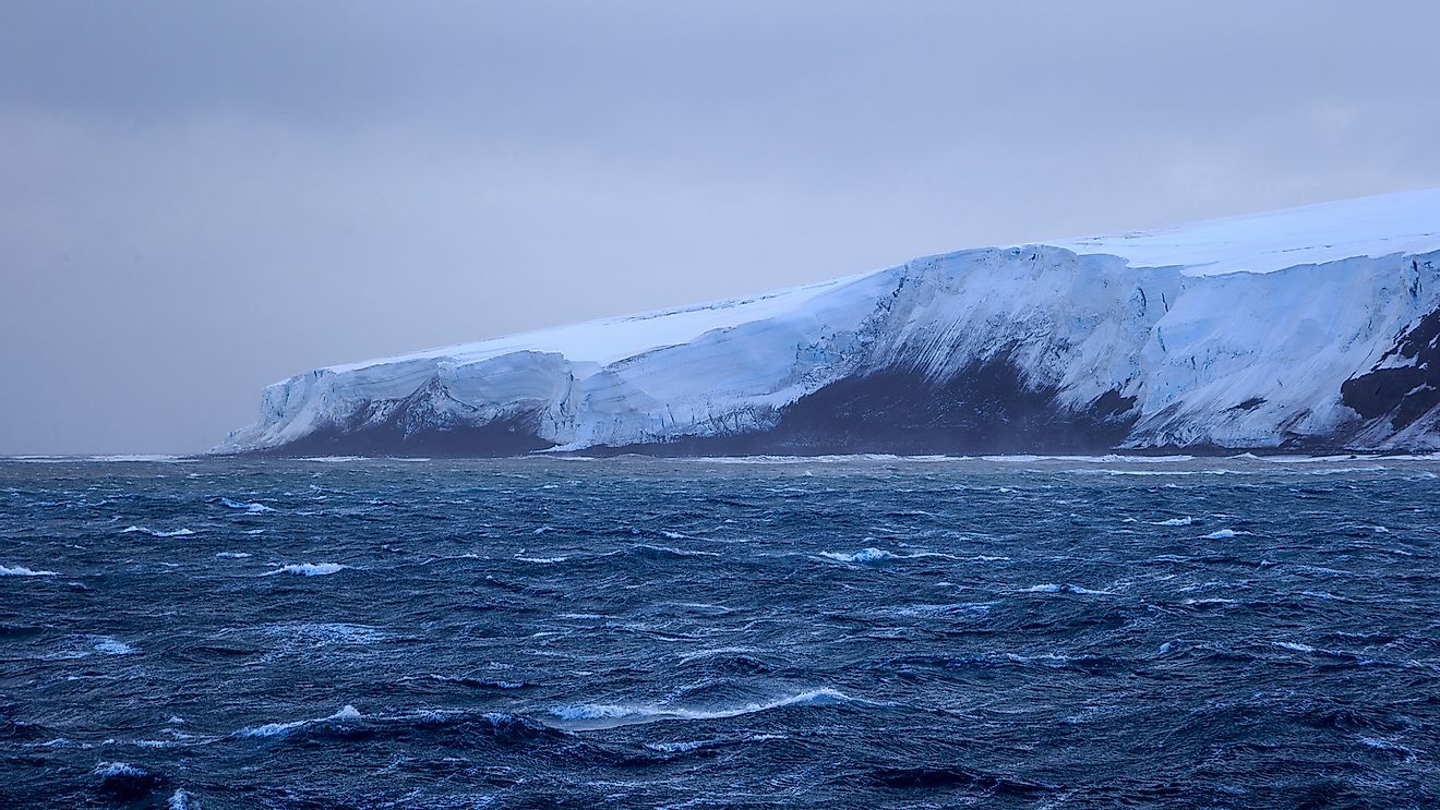
Bouvet Island is an uninhabited subantarctic volcanic island that occupies an area of about 19sq miles. The island is made up of one sizeable island, and numerous skerries and small rocks. Bouvet Island measures 5.9miles by 4.3miles, and glaciers cover 93 % of its area. Bouvet Island is one of Norway’s dependency territories, that is in the South-Atlantic Ocean, just outside the Antarctic-Treaty System. The first man to spot this island was Jean-Baptiste Bouvet. Jean-Baptiste saw this island on January 1, 1739, while he was on a French exploration mission. The island became a Norwegian dependency in 1930.
What Is Bouvet Island Famous For?
Bouvet Island is the world’s most remote island with the closest land being Gough Island, which is 990miles to the north, and Queen Maud Land, which lies 1,100miles to the southern side. The closest uninhabited island is Tristan da Cunha Island (1,400miles to the northwestern side). Prince Edwards Island is 1,600miles to the east. The nearest land to the west is South-Sandwich islands (1,200miles). Although there are several uninhabited islands on the planet, this island is famous for being covered by glaciers. Only 7% of the island is glacier-free. There is an inactive volcano at the center of the island that is covered by ice. The volcano is believed to be in its declining state since its last eruption took place in 2000BC.
Geography Of Bouvet Island
The glaciers that cover over 93% of the island gives it a domed shape. The island’s summit area is known as Wilhelmplataet. It is situated on the western side of the island’s center. There is a plateau on the island, which is 2.2miles wide and surrounded by numerous peaks. The tallest mountain on the island is Olavtoppen (2,560ft), followed by Mosbytoppane (2,200ft) and Lykketoppen (2,513ft). The island has an 18.4miles long coastline. Landing on Bouvet Island can be very challenging since it has a steep coast and experiences high seas. The island is usually surrounded by pack-ice during winter. The only easy place to land in Bouvet Island is Nyroysa. Nyroysa was created during the 1950s by a rock-slide.
Flora
The ice-bound terrain and harsh climate limit the growth of non-vascular plants and fungi on the island. Vegetation is limited in 93% of the island that is covered by glaciers, although snow algae have been recorded. Vegetation can be found in the snow-free parts of Bouvet island like nunatak ridges and some parts of the beaches, capes, coastal cliffs, and summit plateau. About 20 algae, 6 ascomycetes, and 5 species of moss have been recorded at Nyroysa. A considerable percentage of the snow-free parts of the island is steep; therefore, they are subjected to avalanches. Only algal crustose algal and lichens are sustainable in the region.
Fauna
BirdLife International identified Bouvet Island as an Important-Bird-Area since it serves as a crucial breeding area for seabirds. There were over 117,000breeding penguins on this island in 1978 and 1979. Some of the penguin species found on the island include Adelie penguins, Chinstrap penguins, and macaroni penguins. The most crucial colony for penguins in the region is Nyroysa. Other breeding seabirds found on the island include snow petrel, southern-giant petrel, Antarctic prion, and Cape petrels, among others. Some of the non-breeding birds found in Bouvet island include fairy prion, Kerguelen petrel, parasitic jaeger, Campbell albatross, wandering albatross, and king penguin among others. Seals, particularly Antarctic fur seals and southern elephant seals, are the only non-bird vertebrates found on the island. Killer whales and humpback whales can be found in the surrounding waters.


