What Continent Is Chile In?
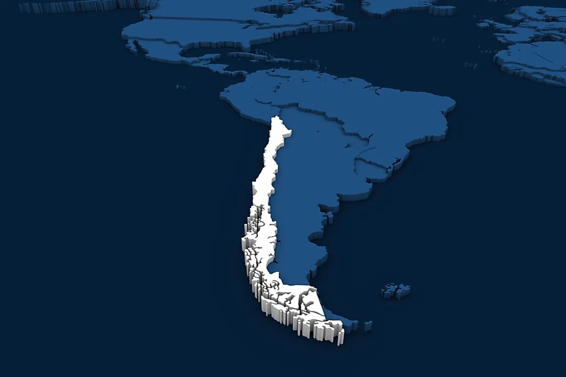
The Republic of Chile is located on the southwestern portion of the continent of South America, with the Andes to the west and the Pacific Ocean to the east. It borders Peru, Bolivia, and Argentina. Its longest land border is with Argentina to the east. The Pacific islands of Salas y Gómez, Easter Island, Desventuradas, and Juan Fernández, are also Chilean.
Geography of Chile
Chile is a long narrow coastal strip on the western part of the Andes. It stretches for 2,670 miles from the northern most point to the southernmost point and 217 miles at its widest point. Its total land area is 292,260 square miles. It is among the most north-south countries in the world alongside Brazil, Canada, Russia, and the United States. The Sala y Gómez and the Easter Island are the easternmost islands of the Polynesia and are both under Chilean control. Chile also claims the Robinson Crusoe Island which is 370 miles from the shore. The small islands of San Felix and Ambrosio are also owned by Chile although they are occupied by a small number of fishermen. The Atacama Desert is known to contain substantial mineral deposits particularly copper and nitrates The Central valleys, including the capital city Santiago, are densely populated unlike the mountainous regions. Southern Chile is covered by forests and grazing land, volcanoes, and lakes. The southern coast is characterized by twisting peninsulas, fjords, canals, and deltas. The Andes covers the eastern stretch of Chile. Although Chile claims an area of 480,000 square miles of Antarctica, it is not recognized under the Antarctic Treaty.
Topography of Chile
Chile is located in the Pacific Ring of Fire, a highly seismic and volcanic zone within the Antarctic and Nazca plates. In the late Paleozoic period, about 250 million years ago, Chile was part of a large plate known as the Gondwana. Sixty-six million years ago much of Chile was a depression; marine sediments began to settle on the depression after the collision of the South American and the Nazca depressions. The Andes was also formed out of the collision. Much of the today's terrain was shaped by millions of years of earth movements. The Andes mountain range occupies much of the eastern part of Chile. The central part consists of wide coastal plains that allow the development of urban environments along the coast of the Pacific Ocean. As the Andes mountains descend, the valleys formed allow agriculture and human settlement due to the accumulation of fertile sediments. The Cordillera de la Costa appears to the south of the Andes where the melting glacial forms a series of lakes.
Hydrography of Chile
Due to the nature of Chile’s terrain, it is crisscrossed by several rivers. Most of the rives are short with low torrential flow, they originate from the Andes and drain into the Pacific Ocean. River Loa is the longest in the country at 248 miles. A large number of rivers are located in the center-north of the country where most of the agriculture is conducted.


