The Most Extreme Points Of Denmark
Denmark is a country in Europe composed of the Jutland Peninsula and numerous islands of which only 74 islands are inhabited. The Scandinavian nation is located south-west of Sweden, south of Norway, and Germany borders it to the south. There are two autonomous islands namely Greenland and Faroe in the North Atlantic Ocean which are constituent countries. Denmark occupies an area of approximately 16,576 square miles but with the inclusion of Greenland and Faroe the area is approximately 853,509 square miles. According to the 2018 census, the population is 5.78 million. Copenhagen is the capital city. The general terrain is flat with minor elevations. The extreme locations in Denmark are located in the east, west, north, and south of the country. This article explores these extreme points as well as the highest and lowest locations in the country.
6. Northernmost Point In Denmark
The northernmost point in the Denmark mainland is Skagen at 57°45’9”N 10°37’1”E coordinates in North Jutland region. Located on the east of Skagen Odde Peninsula, the region is within the Frederikshavn municipality. The coastal area has a well-established harbor hence a major fishing port and a thriving tourism sector. It has been busy since the first century AD with the first building dating back to the 12th century while the first school was built in the 15th century. Skagen railway terminus is the exact northernmost point in the mainland. Birdlife is well preserved with many species foraging and breeding in Skagen. However, if the entire territory including the islands are considered, then the North Jutlandic Island becomes the northernmost point in Denmark. Vendsyssel is the furthest area on the Jutlandic Island. North Jutlandic Island is also the second largest Island in Denmark and has a population of 296,700 as of 2014.
5. Southernmost Point In Denmark
Padborg town located in South Jutland County of Aabenraa municipality is the southernmost point at 54°58’N 9°21E coordinates. The border point with Germany, Padborg has a population of over 4,000 people. It is at this town that the railway, E45 motorway, and the Danish Army Road crosses over to Germany. The region has grown tremendously as a result of being a transport center and customs checks point. On the other hand, Gedser is the southernmost point in Denmark if the entire territory including the islands is considered the islands. Gedser, a town located at the tip of the island of Faster is within Guldborgsund municipality. The small town has a population of less than 1,000 people. It is a prominent port on the Baltic Sea with car ferry operating from there to Rostock in Germany. Gedser is also the Scandinavian and Nordic countries’ southernmost location.
4. Westernmost Point In Denmark
Blåvandshuk, located in Ribe County, Varde municipality is the westernmost point in Denmark metropolitan at 55°33’45”N 8°4’21”E coordinates. The building on the extreme west location is the Blåvand lighthouse. Blåvandshuk is surrounded by a lot of water since it is located on the coast and has a Peninsula that extends to the Southeastern side. The Southwest coast is dangerous with landmines as placed by the Germans as defense line during World War Two. Most of the land in Blåvandshuk is mash land, dunes, moor and sandy beaches. When the entire Danish territory is considered, Cape Alexander in Greenland becomes the westernmost location. The cape is a headland in Baffin Bay and one of the most significant landmarks in Greenland.
3. Easternmost Point In Denmark
Grenaa (or Grenå) is a seaport at the Jutlandic peninsula and the easternmost location in Denmark mainland. Tourism and commerce are thriving economic activities on this Danish town located in Norddjurs municipality in Mid Jutland region in the county of Aarhus at coordinates are 56°27’N 10°37’E coordinates. The seaport occupies a total area of 721.2 square kilometers. Grenaa has a 5-kilometer long sandy beach. Thus, heavy investment in tourism has taken place with modern hotels constructed. Østerskær is the easternmost point if we consider the entire Danish territory. The skerry is situated about 18 kilometers from Bornholm Island at coordinate 55°19’06”N 15°11’50”E. It belongs to the Ertholmene archipelago. Østerskær is approximately 106 miles from Copenhagen.
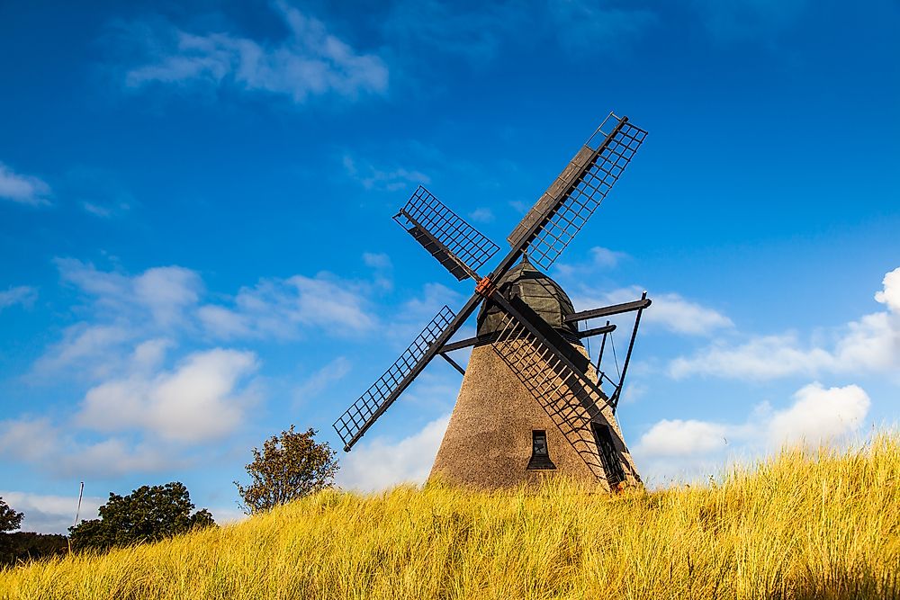
2. Highest Point In Denmark
The highest natural point in Denmark is Møllehøj at 560.56 feet above the sea level. It is located in the Ejerbjerge hills in the Municipality of Skanderborg. A landmark man-made feature of a millstone was built at the summit. The mill constructed in 1838 had 8 sides with onion-shaped roofing. Denmark is generally a flat land with rolling plains hence not many places are of high altitude. From the top of the Møllehøj hills, one can have a magnificent view of moraine landscape which developed during the ice age. From the summit, one can also be able to see the Samsø Islands located miles away, especially when the weather is clear. There were disputes on the highest point in the country until 1847. Before then, many thought that Himmelbjerget hill was the highest point. In 1874 and 1953 more discussions were held leading to measuring the height of various mountains. The findings were that Møllehøj was the tallest by a very small margin.
1. Lowest Point In Denmark
The lowest point in Denmark is the Lammefjord at 23.0 feet below the sea level. The site was reclaimed from the water at the base of the Odsherred Peninsula. The area was a deeply branched part of the sea that extended west from the Isefjord. The region is currently a thriving agricultural field for crops such as Carrots and potatoes. The reclamation efforts began in 1873 and by 1943 the lowest point was pumped dry. The point could also be the lowest point is Western Europe.


