The Eight Physiographic Regions Of The United States
The United States (US) is one of the world’s largest countries. It has an area of 9,826,675 square km. The geography of the country varies widely across its massive area. To aid studies and research, the US has been divided into eight distinct physiographic divisions/regions. Each division is further divided into smaller subdivisions. The eight divisions are mentioned below:
8. The Atlantic Plain
The flattest of all the eight physiographic regions of the US, the Atlantic Plain includes the subdivisions of the Coastal Plain, the Gulf Coast, and the Continental Shelf. This region includes the coastal parts of southern and eastern US. The Atlantic Plain gradually slopes down into the Atlantic Ocean and the Gulf of Mexico in a series of terraces that end up in the ocean as the continental shelf. The coastline here is characterized by numerous barriers, drowned river valleys, inlets of the sea, marshes, and other wetland habitats.
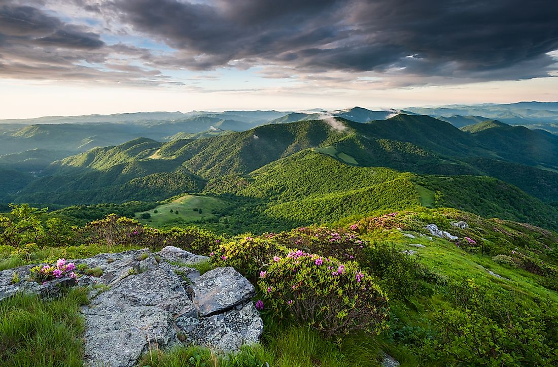
7. The Appalachian Highlands
This physiographic region of the US is located on the eastern side of the country. It includes the Appalachian Mountains, the Adirondacks, and the Watchung Mountains. The region also encompasses the province of New England that features vast tracts of forests of mixed and subtropical montane vegetation. The Appalachians formed about 480 million years back during the Ordovician Period. These mountains are thus lower than the Rockies.
6. The Interior Plains
This region covers parts of the interior continental area of the country. It includes the Great Plains and the Tallgrass prairie regions of the US. The latter extends east to the Appalachian Plateau. Most of the Interior Plains region has low relief, a fact that indicates the relative tectonic stability of the region. It is believed that inland seas covered the area millions of years ago. Sediment deposition over the years led to the formation of the plains seen today.
5. The US Interior Highlands
Located between the Rockies and the Appalachians, this mountain region is located in Central US. It spans parts of Kansas, Oklahoma, Arkansas, and Missouri. The Interior Highlands region includes three distinct mountain ranges. These are the St. Francois Mountains, the Boston Mountains, and the Ouachita Mountains. The vegetation cover in this region is dominated by mixed and temperate broadleaf forests. Thee national forests are also present here.
4. Rocky Mountain System
The Rocky Mountain System is also one of the eight physiographic regions of the US. The Rockies are the country’s major mountain range. It is a branch of the Cordilleran system that is located far inland in the western states of the US. The Rockies formed about 80 to 55 million years back due to tectonic activity. Later, glacial action shaped the mountains and valleys in the region resulting in the dramatic landscape that we see today. Today, large parts of this mountain range are protected as public parks and national forests. Popular tourist recreational activities like mountaineering, camping, mountain biking, hiking, skiing, etc., are enjoyed by visitors to the Rockies.
3. Intermontane Plateaus
This physiographic region of the US features a system of mountain ranges, intermontane plateaus, basins, gorges, and other features. These landforms lie between the Pacific Mountain System to the west and the Rocky Mountains to the east. Some of the major plateaus in this region are the Colorado Plateaus and the Columbia Plateau. The Basin and Range Province is also another important subdivision of this region. The most dramatic landscapes of the US like the Death Valley, Grand Canyon, and the Great Basin are all part of this region.
2. The Pacific Mountain System
This physiographic region of the US stretches along the western coast of the country all the way from Alaska to the neighboring country of Mexico. It includes mountain ranges of the North American Cordillera and other ranges, basins, and plateaus. Some of the main mountain ranges found here include the Coat Mountains, Saint Elias Mountains, California Coast Ranges, etc. The nature of these mountain ranges is not the same throughout the region. The coastline here often has a dramatic landscape with tall, steep cliffs dropping down directly into the sea. Such places are highly photogenic. At places, the coast is also riddled with numerous bays, capes, fjords, islands, coves, caves, and other coastal features. Coastal plains form at the mouths of rivers flowing down the mountains and valleys of the region. Overall, the Pacific Mountain System represents one of the most naturally beautiful regions of the US.
1. Laurentian Upland
The Laurentian Upland is also one of the eight physiographic regions of the US. It is basically a part of the Canadian Shield that extends into the northern part of the US. It encompasses the Great Lakes region of the country.


