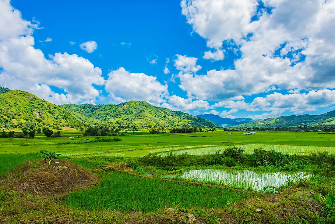
The 17 Administrative Regions Of The Philippines
There are 17 administrative regions in the Philippines which have been established to allow efficient flow, coordination, planning, and organizing of government services. The laws in the Philippines allow for the creation of autonomous regions, and currently, there is only one autonomous region of Bangsamoro in the Muslim Mindanao. The Congress of the Philippines delegates some responsibilities and powers to the autonomous region and would typically have a government.
Southwestern Tagalog Region
Southwestern Tagalong is one of the administrative regions of the Philippines, and it is also known as MIMAROPA region. The name is an acronym of the provinces located in the region. Southwestern Tagalog is the largest in terms of the land area covering 11,436.69 square miles, and it is located on Luzon Island. In 2015, the population in the region was about 2.96 million people, which accounted for 2.95% of the total population of the Philippines. Before 2016, the region was known as region IV-B. The regional center of southwestern Tagalog is the city of Calapan.
Cagayan Valley
Cagayan Valley is one of the administrative regions in the country found in the North-Eastern part of Luzon Island. The region has five provinces of Quirino, Nueva, Izcaya, Isabella, Cagayan, and Batanes. It is the second-largest region in the country and covers an area of 10,899.1 square miles with a population of 3.45 million people as of 2015, which accounted for 3.42% of the total population in the Philippines. The administrative center of the region is the city of Tuguegarao. The region is also home to three other cities of Santiago, Ilagan, and Cauayan
Eastern Visayas
Eastern Visayas is another administrative region in the Philippines and is home to six provinces. The region is located on the Visayas group of islands. The City of Tacloban is the administrative center of the region. Eastern Visayas covers an area of 8,977.30 square miles and has a population of 4.4 million people as of 2015, accounting for 4.40% of the total population in the Philippines. Eastern Visayas is adjacent to the Philippine Sea, and San Juanico Bridge, which is the longest bridge in the Philippines, is found in the eastern Visayas.
Soccsksargen
Soccsksargen is one of the administrative regions of the Philippines found in South Central part of Mindanao. The name of the region is an acronym of the four provinces in the region. Initially, the area was known as Central Mindanao. The regional headquarters is in the city of Koronadal in South Cotabato province. The leading center of commerce and industry is located in the city of General Santos, which is also the 'region's most populous city. The region is located in the Mindanao Island and covers an area of 8,692.43 square miles, and as of 2015, it had a population of 4.54 million people accounting for 4.5% of the country's population.
The Origin Of The Name The Philippines
The name Philippines was given to the island nation in honor of King Philip II of Spain. In 1542 Ruy Lopez de Villalobos, a Spanish Explorer named the islands of Samar and Leyte as Filipinas after the 'Austria's prince. Over the years the name Las Islas Filipinas was used in reference to all the islands in the archipelago. Before the name became popular other names were used such as Islas del Poniente which means the Islands of the West. The Spanish also used the name San Lazaro to refer to the islands.
The 17 Administrative Regions Of The Philippines
| Rank | Region (regional designation) | Island group | Regional center | Area | Population (2015) |
|---|---|---|---|---|---|
| 1 | Southwestern Tagalog Region | Luzon | Calapan | 29,620.90 km2 (11,436.69 sq mi) | 2,963,360 (2.93%) |
| 2 | Cagayan Valley | Luzon | Tuguegarao | 28,228.83 km2 (10,899.21 sq mi) | 3,451,410 (3.42%) |
| 3 | Eastern Visayas | Visayas | Tacloban | 23,251.10 km2 (8,977.30 sq mi) | 4,440,150 (4.40%) |
| 4 | SOCCSKSARGEN | Mindanao | Koronadal | 22,513.30 km2 (8,692.43 sq mi) | 4,545,276 (4.5%) |
| 5 | Central Luzon | Luzon | San Fernando (Pampanga) | 22,014.63 km2 (8,499.90 sq mi) | 11,218,177 (11.11%) |
| 6 | Caraga Region | Mindanao | Butuan | 21,478.35 km2 (8,292.84 sq mi) | 2,596,709 (2.57%) |
| 7 | Western Visayas | Visayas | Iloilo City | 20,794.18 km2 (8,028.68 sq mi) | 7,536,247 (7.46%) |
| 8 | Northern Mindanao | Mindanao | Cagayan de Oro | 20,496.02 km2 (7,913.56 sq mi) | 4,689,302 (4.64%) |
| 9 | Davao Region | Mindanao | Davao City | 20,357.42 km2 (7,860.04 sq mi) | 4,893,318 (4.85%) |
| 10 | Cordillera Administrative Region | Luzon | Baguio | 19,422.03 km2 (7,498.89 sq mi) | 1,722,006 (1.71%) |
| 11 | Bicol Region | Luzon | Legazpi | 18,155.82 km2 (7,010.00 sq mi) | 5,796,989 (5.74%) |
| 12 | Zamboanga Peninsula | Mindanao | Pagadian | 17,056.73 km2 (6,585.64 sq mi) | 3,629,783 (3.59%) |
| 13 | Southern Tagalog Mainland | Luzon | Calamba | 16,873.31 km2 (6,514.82 sq mi) | 14,414,774 (14.27%) |
| 14 | Central Visayas | Visayas | Cebu City | 15,487.69 km2 (5,979.83 sq mi) | 7,396,903 (7.33%) |
| 15 | Ilocos Region | Luzon | San Fernando (La Union) | 13,012.60 km2 (5,024.19 sq mi) | 5,026,128 (4.98%) |
| 16 | Bangsamoro Autonomous Region in Muslim Mindanao | Mindanao | Cotabato City | 12,535.79 km2 (4,840.10 sq mi) | 3,781,387 (3.74%) |
| 17 | National Capital Region | Luzon | Manila | 619.57 km2 (239.22 sq mi) | 12,877,253 (12.75%) |


