Biggest Islands And Atolls In The Marshall Islands
The Marshall Islands is a nation comprised of around 30 atolls, which in turn house more than 1,000 islands and islets in two parallel chains. These chains are the Ratak coral atolls to the east and the Ralik in the west. The chains are 125 miles apart extending 800 miles northwest to southeast. Majuro is the capital city of the Republic where government offices are located in the Delap—Uliga_Djarrit region. Kwajalein Atoll is the largest in the Island country. The Marshall is administered as part of the Trust Territory of the Pacific Islands when the United States dissolved the Trust Territory. The service sector drives the economy of Marshall Islands.
Kwajalein Atoll
Kwajalein Atoll in is the biggest in the Marshall Island at around 6.18 square miles in area. It comprises of 97 islands and islets. The islands population is approximately 1,000 Americans with a small population of Marshall Islanders and other nationalities. The whole atoll has a population of around 13,500. The dry season occurs from January through April. Average annual rainfall is around 101.2 inches with an average humidity being between 78% and 83%. The highest temperature recorded was 36° Celsius. Before the nuclear testing and way back in January 1543 when Europeans first saw the Island, the atoll was all green with trees. The island provided a home to the Marshallese people of the Ralik Chain where the zebrawood tree flowered. Today, around 13,500 Marshall Islanders live on the atoll. Residents spearfish, carry out deep-sea fishing and scuba diving on the atoll. There are bars and diners for residents looking out to relax. There are also many recreation facilities with pools, tennis courts, basketball courts, and racquetball courts.
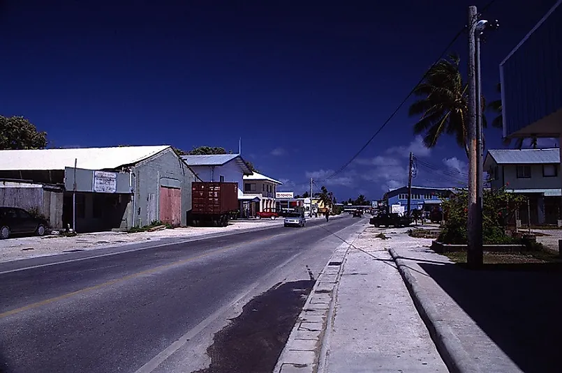
Majuro
Majuro is the capital and largest city of Marshall Islands. The legislative district of the Ratak Chain is centered from here. Majuro is 3.75 square miles enclosing a lagoon of 114 square miles. The atoll consists of small land masses. The Atoll has a tropical climate with temperatures of around 21° Celsius. Humans have inhabited Majuro for more than 2000 years. Similar to the rest of the Marshall Islands, the island fell into the hands of Germany in 1884. Later, the Imperial Japanese Navy captured in 1941 and made it part of the Empire of Japan. Following World War II, the US controlled Majuro as part of the Trust Territory of the Pacific Islands. Majuro became the administrative center supplanting Jaluit. As of 2008 the island had a population of around 27,797. Major population centers are the Delap-Uliga-Djarrit islets on the eastern edge of the atoll. Most of the population is Christian though Islamic influence is rising. The service sector drives the economy of the island with Majuro having a post, many hotels, and an international airport and shopping district.
Enewetak
Enewetak Atoll is a large coral atoll in the Marshall Islands having 40 islands. It has a population of around 850 people. With a land area of around 2.26 square miles, the atoll surrounds a deep central lagoon of 80 kilometers in circumference. The atoll lies around 305 kilometers west of Bikini making it the second most western atoll of the Ralik Chain. The Enewetak Atoll stands atop a seamount formed in the late Cretaceous with a base 1,400 meters below sea level. During the cold war, the atoll provided a nuclear testing area of more than 30 megatons of TNT. Betweenn 1977 and 1980 the Runit Dome, a concrete dome, was built on the Runit Island to deposit the radioactive debris and soil. Today the Runit Dome is deteriorating, and a typhoon could possibly breach it, even though the lagoon’s sediments are more radioactive that the soils and debris contained. However, continuous decontamination and environmental remediation provide sufficient dose reductions of the nuclear material deposited in the country and by 2026–2027 the whole island will be fit for human habitation.
Bikini Atoll
The Bikini Atoll consists of 23 islands with a total of 2.32 square miles of land area surrounding a deep central lagoon of 229.4 square miles at the northern end of the Ralik Chain, around 530 miles northwest of Majuro. The atoll provided Nuclear Testing Areas during the cold war. The hydrogen bombs deposited vaporized the islands of Nam, Aerokojlol, and Bokonijien. Coral limestone and sand make up the island. Before the nuclear tests, the Islanders cultivated native foods such as pandanus, coconut, banana, taro, arrowroot, breadfruit, pumpkin, and limes. The people were skilled fishermen using coconut husk and hooks from sharpened shells as fishing lines. They also raised ducks, pigs and chicken for food and kept cats and dogs as pets. The bomb testing severely impacted animal life in the atoll. Today, land species include small lizards, coconut crabs, and hermit crabs. By 2008, 65% of the biodiversity that existed before the radioactive contamination had recovered, but 28 species of corals appear to be locally extinct. The atoll is hot and humid with constant temperatures of between 27 and 29 Degrees Celsius on both land and water all year round. The wet season starts in May to December. The trade winds running from January through may provide higher wave action. The small population of around 600 people living in Kili Island live in cinder block houses. Currently, setting aside the radioactive components in the region, global warming threatens to submerge the island, and plans are underway to relocate the residents from the Marshall Islands.
Environmental Threats and Territorial Disputes
There are no current territorial disputes over these islands and atolls in the island nation of the Marshall Islands. However, the state claims that Wake Island, a US territory belongs to them. The Marshall Islands provided nuclear testing areas in the Cold War. As a result, some of the native flora and fauna were driven to extinction. Even though plans are underway to decontaminate the affected areas, it will take time for all the nuclear materials to decay. As such, the environment of the island is still dangerous, and many tests need to be carried out often to evaluate the safety levels of the islands.
Biggest Islands And Atolls In The Marshall Islands
| Rank | Major Atolls of the Marshall Islands | Land Area |
|---|---|---|
| 1 | Kwajalein | 6.18 square miles |
| 2 | Majuro | 3.75 square miles |
| 3 | Rongelap | 3.09 square miles |
| 4 | Bikini | 2.32 square miles |
| 5 | Enewetak | 2.26 square miles |
| 6 | Utirik | 0.94 square miles |


