Maps of Palau

Covering an area of 466 sq.km (177 sq mi), the island nation of Palau comprises of 340 coral and volcanic islands located in the western Pacific Ocean. Palau consists of the far-western portion of the Caroline Islands, including the larger islands of Babeldaob, Angaur, Babulthuap, EilMalk, Koror, Peleiu and Urukthapel.
Palau is a beautiful tropical paradise, and one of the true unspoiled destinations on earth. Most of the 100-plus islands are small low-lying coral islands, ringed by barrier reefs. The exception is the mountainous Babulthuap which is volcanic in origin. The highest point is Mount Ngerchelchuus at an elevation of 715ft (215m). The point has been marked by yellow triangle on the map above. The lowest point is the Pacific Ocean (0m).
Political Map of Palau

Palau (officially, the Republic of Palau) is divided into 16 states. These states are: Aimeliik, Airai, Angaur, Hatohobei, Kayangel, Koror, Melekeok, Ngaraard, Ngarchelong, Ngardmau, Ngatpang, Ngchesar, Ngeremlengui, Ngiwal, Peleliu and Sonsorol.
Covering an area of 466 sq.km, the island nation of Palau comprises of 340 coral and volcanic islands located in the western Pacific Ocean. Located on Babeldaob (the largest island of Palau), in the state of Melekeok is Ngerulmud – the capital of Palau. It is the world’s least populous capital city. Koror is the largest and the most populous city of Palau. It acts as the main commercial center of Palau.
Where is Palau?

Palau, an island nation and an archipelago of 340 coral and volcanic islands, is located in the western Pacific Ocean. It is geographically positioned both in the Northern and Eastern hemispheres of the Earth. Palau shares maritime borders with the Federated States of Micronesia to the east; with Indonesia to the south; with Philippines to the west and with the international waters to the north.
Regional Maps: Map of
Outline Map of Palau

The above blank map represents Palau - an island nation and an archipelago of 340 coral and volcanic islands located in the western Pacific Ocean. The above map can be downloaded, printed and used for geography education purposes like map-pointing and coloring activities.

The above outline map represents Palau - an island nation and an archipelago of 340 coral and volcanic islands located in the western Pacific Ocean.
Key Facts
| Legal Name | Republic of Palau |
|---|---|
| Flag |
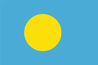
|
| Capital City | Ngerulmud |
| 7 30 N, 134 37 E | |
| Total Area | 459.00 km2 |
| Land Area | 459.00 km2 |
| Water Area | N/A |
| Population | 18,008 |
| Currency | US Dollar (USD) |
| GDP | $283.99 Million |
| GDP Per Capita | $15,859.43 |
This page was last updated on November 23, 2020