Biggest Islands Of Palau
Babeldaob is the largest island in Palau, and covers 70% of Palau's land area, and it is home to the national capital city of Ngerulmud. Angaur, Koror, and Peleliu Islands are also populous, with around 11,000 people living on Koror. Angaur is an oceanic island to the south of Palau mainland while the other three lie in the same barrier reef. Even with the many islands only 8 of them are permanently inhabited. Many of the islands are covered with forests and Babeldaob is mountainous. Mount Ngerchelchauus in the Isle of Babeldaob is the highest point in Palau with an elevation of 242 meters above sea level.
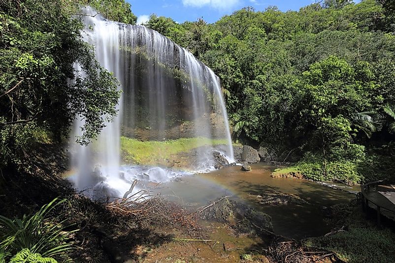
Babeldaob
Babeldaob is the largest island of Palau, and the capital city of the country is also found on the same island. It is 368 square kilometers in area with close to 30% (6,000 people) of the country’s population living on the island. The country’s main airport, of Airai, is in the state to the south of the island. The mountainous island has world class sandy beaches to the east and mangrove shorelines to the west. The island of Babeldaob provides the biggest source of fresh water to the people of Palau. The Lake Ngardok and Ngerkall pond and other watersheds provide the nation with drinking water. In the recent past, development projects have ruined these sources water, but nature conservancy plans are helping restore and protect the freshwater resources.
Peleliu
Located in the northeast of Palau, Peleliu is famous as the site for the Battle of Peleliu in World War II. The island is around 368 square kilometers in area, lying northeast of Angaur and almost 40 kilometers to Koror. It has a population of 571 according to the census of 2000, making it the third most populous island in the Republic of Palau. Kloulklubed, the capital state of the north is home to most of the islanders. Other prominent villages in the islands are Ongeuidel and Lademisang.
Oreor
Koror, or Oreor, is the main commercial center of Palau, and has an area of 9.3 square kilometers. It has several islands, but Oreor Island is the most prominent. The island has a population of around 14,000, people which is equivalent to 70% of the country’s population. The island was the capital city of Palau until 2006 when Ngerulmud replaced it. Tourism is the primary economic activity of these islanders. The tourists visiting Palau stay in Koror because there are modern houses, resort services, and the multilingual environment. Koror is also home to the world largest dolphin research facility called the Dolphins Pacific. The inmates of Koror Jail also attract tourists with their wooden storyboards. The island connects to other islands via bridges.The Malakal Island is the port of Palau, Ngerekebesang the second largest town in the Koror and Meyuns to the east.
Angaur
The coral reef island of Angaur sits upon a volcanic substructure, and the major city there is Ngeremasch. Located in the southwest of Peleliu, the state of Angaur is famous for the surfing sports activities. The Eastern side of the island is sandy with rocky outcropping and fishing and a transport port lie on the western side. The island is accessible via boats and small planes as it has the Angaur airstrip. The island had a population of around 130 as of 2012 within its area of 8.06 square kilometers. There are no restaurants, tourists’ resorts, or large grocery stores on the island, but the small population lives peacefully. The little island was a phosphate gold mine in the first half of the 20th Century. The Germans, Japanese, and Americans fought over the phosphate mines from 1909 to 1954.The island is famous for the Battle of Angaur which ran from June to November of 1944. The ghosts of World War II still linger on an island with the overgrown vegetation hiding the shipwrecks used in the war. The jungles of the island also conceal a Japanese lighthouse, a remnant of the Japanese in the mines. There is also a miniature wooden Shinto shrine in the northwest coast, and Buddhist carry out memorials to honor the fallen Japanese soldiers.
Other Major Islands in the Republic of Palau
Sonsorol is a state in Palau that has Dongosaru as its administrative center. The island has an area of 3.1 square kilometers and the residents speak Sonsorolese, a Trukic language, and Palauan. Ngerekebesang has an area of around 2.44 square kilometers, and is also where the former capital of Koror and the President’s office were located before the relocation to Melekeok. Meyun Town has the largest hospital in Palau and people from Koror can access the small town via a causeway built by the Japanese. Palau is highly urbanized with more than 70% of the population living in the modern Koror and Airai. The Bai Gable is the common culture of the people and is used to decorate architectural features in the country. The people speak English, Palauan, and Japanese as the national languages. Over time, Palauans have learned to tolerate outsiders who come to invest in the country for a peaceful coexistence. The people also identify as one nation and not individual ethnic groups though individuals have retained their cultural identity.
The Biggest Islands Of Palau
| Rank | Biggest Islands in Palau | Area |
|---|---|---|
| 1 | Babeldaob | 368 square kilometers |
| 2 | Peleliu | 18.5 square kilometers |
| 3 | Oreor | 9.3 square kilometers |
| 4 | Angaur | 8.06 square kilometers |
| 5 | Sonsorol | 3.1 square kilometers |
| 6 | Ngerekebesang | 2.44 square kilometers |
| 7 | Kayangel | 1.68 square kilometers |
| 8 | Ngercheu | 1.10 square kilometers |
| 9 | Malakal | 0.86 square kilometers |
| 10 | Tobi | 0.84 square kilometers |


