Maps of Guam

Covering an area of 540 sq.km (210 sq mi), Guam is an organized unincorporated territory of the United States in Micronesia; and the southernmost and largest island in the Mariana Island chain, located in the western North Pacific Ocean. The island is volcanic in origin, and ringed by steep coastal cliffs and sandy beaches.
As observed on the physical map of Guam, mountains are primarily located on the southern end of Guam, with the northern region of the island sloping into low hills. Presence of a northern limestone plateau with a general elevation of 500ft (150m). the plateau is covered with a thick growth of jungle.
Deepwater channels and a coral table reef are located along much of the coast. The highest point is Mount Lamlam at an elevation of 1,338ft (408m) located in the southwest part of the island and marked on the map by a yellow triangle, and the lowest point is the North Pacific Ocean (0m).
Political Map of Guam

Guam (officially, the U.S. Territory of Guam) is divided into 19 villages. In alphabetical order, the villages are: Agana Heights, Agat, Asan, Barrigada, Chalan Pago-Ordot, Dededo, Hagatna, Inarajan, Mangilao, Merizo, Mongmong-Toto-Maite, Piti, Santa Rita, Sinajana, Talafofo, Tamuning, Umatac, Yigo and Yona.
Covering an area of 540 sq.km, Guam is an organized unincorporated territory of the United States in Micronesia, located in the Western North Pacific Ocean. Guam is the westernmost territory of the United States and the largest territory in Oceania. The island territory is a part of the Mariana Islands archipelago, being the southernmost of the Mariana Islands and the largest Island in Micronesia.
Located on the western coast of Guam at the mouth of the Hagatna River is, Hagatna – the capital village of Guam. Hagatna hosts the arms of the Government and its commercial districts. Situated on the coral plateau in the north-central part of Guam is, Dededo – the largest and the most populous village in Guam.
Where is Guam?

Guam is an organized unincorporated territory of the United States in Micronesia, located in the Western North Pacific Ocean. It is geographically positioned both in the Northern and Eastern hemispheres of the Earth. Guam is situated to the east of Philippines; to the north of Papua New Guinea; to the west of Hawaii and to the southeast of North Korea. Guam’s southern maritime boundary forms a border with the Federated States of Micronesia; while its northern maritime boundary forms a border with the Commonwealth of Northern Mariana Islands.
Regional Maps: Map of
Outline Map of Guam

The above map represents Guam - an organized unincorporated territory of the United States in Micronesia, located in the Western North Pacific Ocean. The above map can be downloaded, printed and used for geography education purposes like map-pointing and coloring activities.

The above outline map represents Guam - an organized unincorporated territory of the United States in Micronesia, located in the Western North Pacific Ocean. It is the westernmost territory of the United States and the largest territory in Oceania.
Key Facts
| Legal Name | Guam |
|---|---|
| Flag |
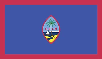
|
| Capital City | Hagatna (Agana) |
| 13 28 N, 144 44 E | |
| Total Area | 544.00 km2 |
| Land Area | 544.00 km2 |
| Water Area | N/A |
| Population | 167,294 |
| Currency | US Dollar (USD) |
| GDP | $5.92 Billion |
| GDP Per Capita | $35,712.56 |
This page was last updated on February 25, 2021