This North Carolina Scenic Byway Is The Road Trip Of A Lifetime
When Congress designated the route through North Carolina’s Outer Banks as a National Scenic Byway in 2009, it was a tip of the cap to something that most North Carolinians already knew. And that was the fact that this 138-mile stretch of asphalt winding through the state’s barrier islands is undoubtedly one of America's best road trips.
Now one of 185 routes deemed worthy of this distinction, the Outer Banks Scenic Byway follows the state's coastline and connects 21 coastal villages that have weathered centuries of storms and shipwrecks. In the process, the quaint communities have managed to preserve a unique maritime culture found nowhere else in the country.
Starting north at Whalebone Junction in Nags Head, where US Highway 64, US 158, and NC Highway 12 converge, the route heads south through a landscape bordered by the Atlantic Ocean on the east side and Pamlico Sound to the west. Along the way, you’ll experience two ferry crossings and 25 miles of open water before ending at the intersection of US 70 and Merrimon Road near Beaufort. And unlike most scenic drives that pass through pretty countryside, it’s a journey that requires commitment as the whole route takes at least six hours to complete, including ferry time (longer if you plan on stopping frequently; if that sounds like you, book an overnight stay along the way).
The First Leg of the Journey
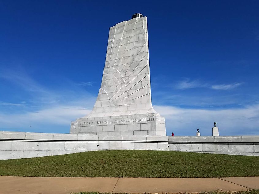
The first major destination on your Barrier Island adventure is the Wright Brothers National Memorial in Kill Devil Hills. Just a few minutes north of Whalebone Junction, this famous spot commemorates December 1903 when Orville and Wilbur Wright successfully made the world’s first powered flight from Big Kill Devil Hill. Be sure to also pop into the visitor center, where you’ll see a full-scale reproduction of the plane they did it in, the Wright Flyer.
Returning south to the byway proper, the NC 12 crosses two bridges, the second of which passes over Oregon Inlet, formed during a hurricane in 1846 that severed Bodie Island from Pea Island to the south just before the bridges is Bodie Island Lighthouse, built in 1848 and well worth grabbing a photo of (you’ll also see it in your rearview mirror as you cross the bridges).
Next Up: Pea Island National Wildlife Refuge

The byway enters Pea Island National Wildlife Refuge just south of Oregon Inlet. This 13-mile protected habitat is a crucial stopover on the Atlantic Flyway, the north-south migratory route countless bird species use. Established in 1938 specifically for migratory waterfowl, the refuge now hosts 365 documented bird species annually.
You can learn about these birds (and much more) at the Pea Island National Wildlife Refuge Visitor Center, which has a lengthy boardwalk trail leading to observation platforms overlooking North Pond. Wading birds feed year-round here, and thousands of snow geese gather each winter.
Village Life in the Barrier Islands

The first village south of the refuge, Rodanthe, gained fame as the setting for Nicholas Sparks' Nights in Rodanthe, but its real significance lies in the Chicamacomico Life-Saving Station. This complex preserves the original 1874 station and its 1911 replacement. It documents the evolution from the volunteer-based U.S. Life-Saving Service to the professional U.S. Coast Guard, with original rescue equipment including beach carts and a Lyle gun to shoot rescue lines to stranded vessels.
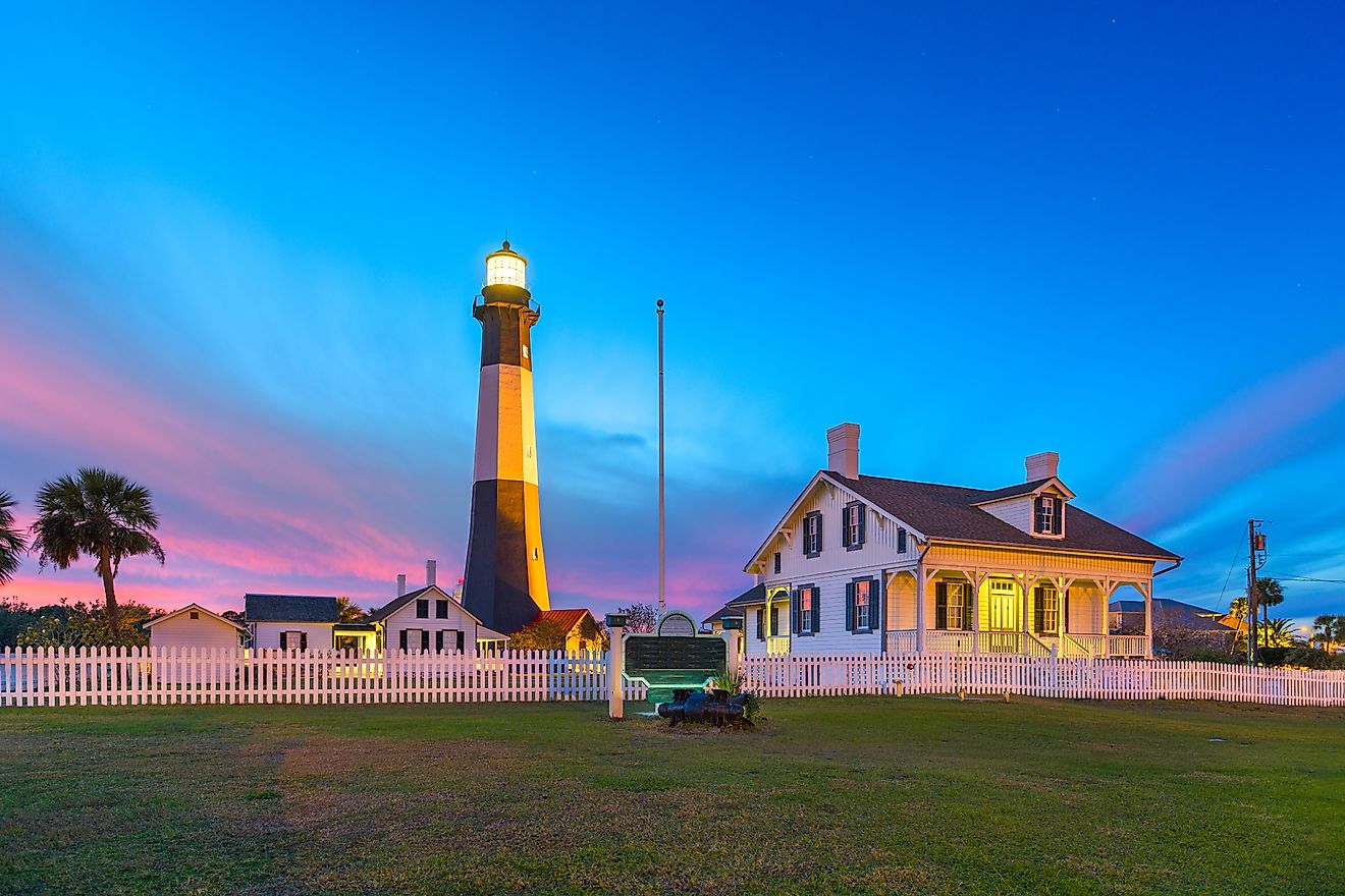
The byway enters Buxton and continues south through the Waves, Salvo, and Avon villages. Here you’ll see the route's most recognizable landmark, Cape Hatteras Lighthouse. Standing 210 feet tall and the tallest brick lighthouse in the United States, this photogenic black-and-white light station has warned mariners away from Diamond Shoals since 1870. In 1999, however, coastal erosion forced the National Park Service to move the 4,800-ton structure 2,900 feet inland, a remarkable engineering feat that took 23 days to complete.
The lighthouse grounds include the original keepers' quarters, which now house a museum explaining the lighthouse's history and the maritime heritage of the Outer Banks. If you have the time and energy, climb the lighthouse's 257 steps (equivalent to a 12-story building) for incredible views of Hatteras Island.
The Ferry Crossings and Ocracoke Island

At Hatteras Village, a fishing community and the southernmost settlement on Hatteras Island, you’ll drive aboard a North Carolina Ferry for the 60-minute crossing to Ocracoke Island. Operating since 1950, this free service runs year-round with departures roughly every hour during peak season. Undoubtedly one of the best free things to do in North Carolina, you’ll likely see pelicans, dolphins, and occasionally sea turtles in the same waters where pirates like Blackbeard and German U-boats once prowled.
Ocracoke Island is where you’ll truly experience that unique Outer Banks character. Clustered around the working waterfront of Silver Lake Harbor, commercial fishing boats tie up alongside charter vessels, all under the watchful eye of the Ocracoke Lighthouse, built in 1823 and North Carolina's oldest operating lighthouse.
The island's British Cemetery contains the graves of four sailors from HMS Bedfordshire, torpedoed by a German submarine in 1942. Residents recovered and buried the bodies, and the small plot remains as a small parcel of British territory, maintained by the U.S. Coast Guard in perpetual remembrance of wartime alliance.
Mainland Return

From Ocracoke, a longer ferry journey of 2.5 hours (this time with a fee) crosses Pamlico Sound to Cedar Island, where the byway continues through a region known as Down East. Here, you’ll experience a different side of coastal North Carolina, one largely untouched by tourism and rooted in traditional maritime occupations. Check out the conventional flared-bow designs of Harkers Island workboats, resulting from centuries of regional boatbuilding expertise explicitly adapted to handle local waters.
Suppose you’ve made it this far (and there’s no easy way back!). In that case, the Core Sound Waterfowl Museum & Heritage Center celebrates this maritime culture through exhibits on decoy carving, boat building, and commercial fishing. Local craftsmen still build boats using patterns passed down through generations, while decoy carvers create working decoys and collectible art pieces that command high prices from collectors worldwide.
As memorable an ocean drive as my Miami to Key West adventure (possibly even more so), the Outer Banks Scenic Byway is an ideal North Carolina road trip. Crossing barrier islands and passing coastal villages, you’ll gain a first-hand understanding of American maritime history from the age of sail through fishing vessels crafted using centuries-old designs. And while you can do this epic scenic route in a day, consider planning for at least two days to properly experience the route and see everything there is to see in North Carolina’s spectacular Outer Banks.
