Sint Eustatius
The island of Sint Eustatius is a special municipality of the Kingdom of the Netherlands that is positioned in the northern part of the Leeward Islands in the northeastern Caribbean Sea. Along with the islands of Saba and Bonaire, Sint Eustatius forms a part of the Caribbean Netherlands. The island was initially known as Nieuw Zeeland and was renamed Sint Eustatius in the honor of the Christian martyr, Saint Eustace.
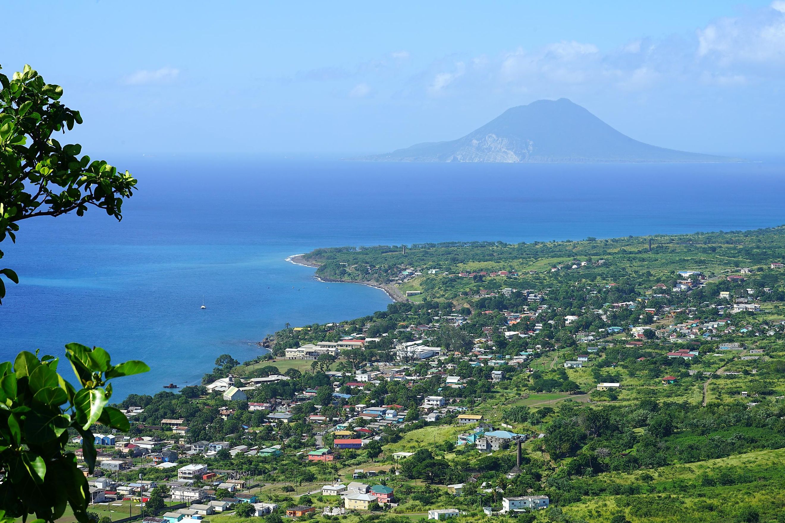
Covering an area of only 21 km2, Sint Eustatius is located to the southeast of Saba and northwest of Saint Kitts. The small town of Oranjestad serves as the regional capital of the island.
Geography

This roughly saddle-shaped island forms the northwestern-most volcanic island of the inner volcanic arc of the Lesser Antilles. Locally referred to as Statia, Sint Eustatius is approximately 10 km in length and has a maximum width of about 5 km. The island features two extinct volcanoes separated by a flat central plain. Mount Mazinga, colloquially known as the Quill is a 602 m stratovolcano located in the southeastern part of the island. It is the highest point on Sint Eustatius and is also Netherlands’ second-highest mountain. The other summits, Boven Mountain and Little Mountain (Signal Hill), are located in the island’s northwestern portion.

Sint Eustatius experiences a tropical monsoon climate. Hurricanes and tropical storms are quite frequent and the island receives about 1,125 mm of annual rainfall, mostly during the Atlantic hurricane season from June to November.
Wildlife

The eastern part of the island is covered by low vegetation, whereas thick banana groves, breadfruit trees, and tall palms are found in the western part. Xerophytic plants, which are plants that have adapted to a harsh climate, are observed in the southern slopes of the volcano and dark forests with orchids and other tropical plants are observed within the volcano’s crater as well as along its rim. Several deciduous trees and thorny bushes are also found in various parts of the island. The beaches of this small volcanic island are mainly composed of black volcanic sand. The island’s Zeelandia beach serves as the chief nesting site for the different endangered sea turtle species including green turtle, hawksbill, leatherback, and loggerhead. There are three nature parks on the island that have been designated as Important Bird Areas by BirdLife International. These are Quill and Boven National Park, Miriam C. Schmidt Botanical Garden, and the Sint Eustatius National Marine Park. All the nature parks on Sint Eustatius are maintained by the St. Eustatius National Parks Foundation (STENAPA).
Brief History

It is believed that the island was first spotted by the famous explorer Christopher Columbus in 1493. From the 17th century till the late 19th century the island was colonized by the Europeans. During this period, it changed hands more than 20 times between the French, English, and Dutch.
The Dutch settled finally on the island in 1636. In 1678, the island of Sint Eustatius, along with the islands of Saba and Sint Maarten, came under the Dutch West India Company. Due to its favorable geographic location between Danish, British, French, and Spanish territories, the island became a supplier of arms and ammunition to anyone willing to buy, including the many rebellious North American British colonies.
This trade between Sint Eustatius and the United States became the sole reason for the fourth Anglo-Dutch War. After this war, the powerful English fleet took over Sint Eustatius Island on February 3, 1781. The island was subsequently conquered by France after 10 months. The plundered island was then eventually taken over by the Dutch again in 1784. In 1828, along with Saba, Sint Eustatius became a colony of the Dutch West Indies. The island became a part of the erstwhile Netherland Antilles in 1954. After the dissolution of the Netherland Antilles in October 2010, the island of Sint Eustatius became a special municipality (“public body”) of the Kingdom of the Netherlands.


