Saba
Saba is the smallest special municipality of the Netherlands that is located in the northeastern Caribbean Sea. Along with the islands of Sint Eustatius and Bonaire, it forms a part of the Caribbean Netherlands. Covering an area of only 13 km2, Saba is located to the northwest of Sint Eustatius and southwest of Sint Maarten and Saint Barthélemy (St. Barts) Islands.
Geography

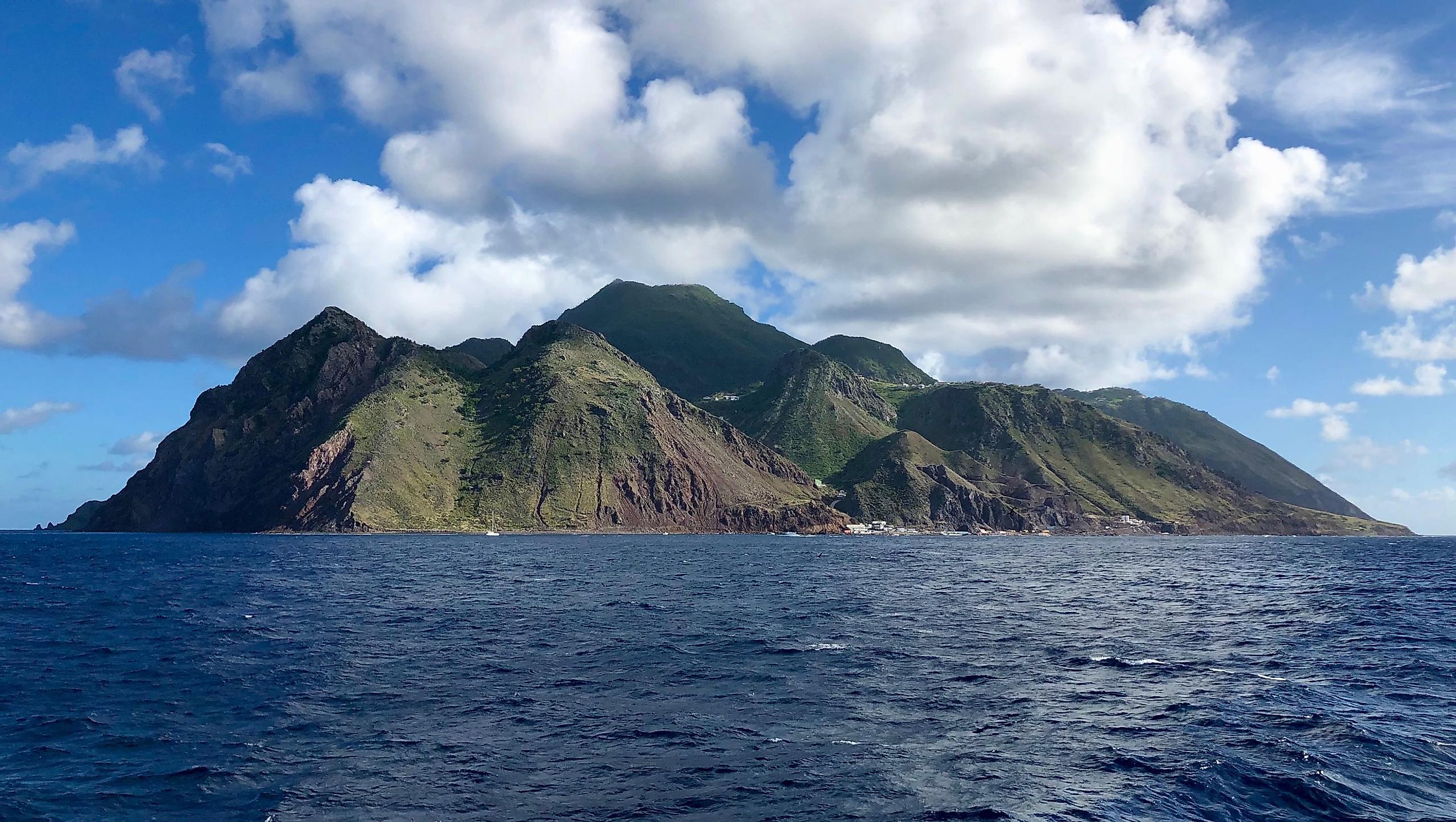
This roughly circular-shaped island is the northernmost volcanic island of the inner volcanic arc of the Lesser Antilles. Saba mainly comprises a potentially active stratovolcano known as Mount Scenery. This volcano which rises to an elevation of about 887 m is the highest point in the Kingdom of the Netherlands.

This Caribbean island has a rugged and steep terrain and is surrounded by high rocky cliffs on all sides. There are many bays situated around the island. These are Cove Bay, Core Gut Bay, Cave of Rum Bay, Fort Bay, Ladder Bay, Tent Bay, Spring Bay, and Wells Bay. Many hot springs are also found on the northwestern and southeastern coasts of the island.
Wildlife

The Elfin Forest Reserve is a cloud forest that covers an area of 8.6 hectares and is located on the top of Mount Scenery. This cloud forest is dominated by mahogany trees, mainly the Mountain mahogany. The undergrowth of mahogany trees is occupied by Sierran palm and tree ferns. The tree trunks and branches are covered by different varieties of orchids and epiphytes. The foothills of the mountain are covered by sub-montane forest, with trees like redwood, mountain fuchsia, prickly pear, and seagrape trees. The eastern and southern slopes of the island are covered by grassy meadows with scattered shrubs.
More than 60 species of seabirds are found on the island’s shoreline which has been designated an Important Bird Area by BirdLife International. Some of the notable seabirds that are found here include bridled terns, brown noddies, sooty terns, storm petrels, gulls, and pelicans. The cliffs of the island serve as important nesting areas for the Audubon’s shearwater and the red-billed tropicbird. Many endemic species are found on Saba island. These include the Saban anole lizard, the non-poisonous red-bellied racer snake, Saban black iguana, and the Lesser Antillean funnel-eared bat.
Located on the northern part of the island is the Saba National Park, which covers an area of 0.35 km2 and was established in 1999. The Atlantic Ocean’s largest submerged atoll, the Saba Bank, is located to the southwest of Saba Island. It was designated as a National Park in 2010 to protect the bank’s rich biodiversity which consists of humpback whales, sea turtles, different varieties of seabirds, and more than 200 species of fish.
Brief History

The Indigenous peoples of the island were the Ciboney people as early as 1100 BCE, who were later joined by Arawak peoples around 800 CE. The island was first spotted by Christopher Columbus in 1493, but the rocky coastline of the island deterred him from landing there. Along with Sint Eustatius, Saba became a colony of the Dutch West Indies in the 1640s, but the British maintained a presence on the island for nearly the next 200 years. The island eventually became a favorite hiding place for the pirates and smugglers. In 1816, the island completely came under the possession of the Netherlands. Saba then became a part of the Netherland Antilles in 1954. After the dissolution of the Netherland Antilles in 2010, the island of Saba became a special municipality of the Kingdom of Netherlands.
The island’s economy is entirely based on tourism and more than 25,000 tourists visit the island annually. Located in the western part of the island is The Bottom, the capital and the largest town of Saba. Some of the other notable settlements on the island are St. Johns, Windwardside, and Zion’s Hill.


