Landforms of North America, Mountain Ranges of North America, United States Landforms, Map of the Rocky Mountains - Worldatlas.com

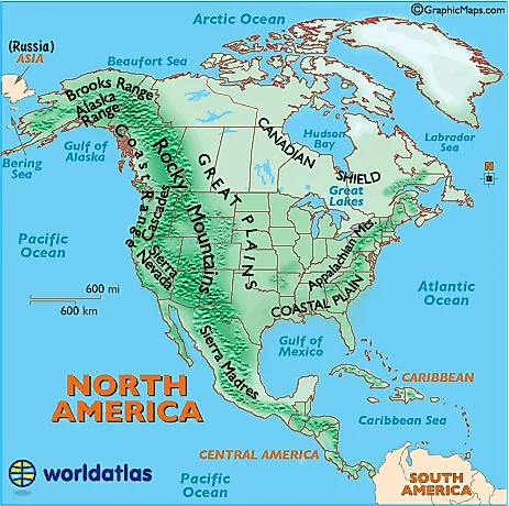
This plateau region of eastern and northern Canada and the Great Lakes area of North America mainly includes rough and rocky surfaces, and large areas of coniferous (evergreen) forests. In addition, the northern regions along the Arctic Circle are comprised of rocky frozen tundra. The highest elevation is estimated at 1,640 ft (500 meters).
Cascades:
A mountain range stretching from northeastern California across Oregon and Washington. Major peaks included Mt. Hood, Mt. Ranier, and Mt. St. Helens.
Coast Range:
Mountains running along the Pacific Ocean coastlines of California, Oregon, Washington. They also extend along the western border of British Columbia, Canada, and the southern edge of Alaska, all the way to Kenai Peninsula and Kodiak Island.
Coastal Plain:
This area of the southern and southeastern U.S extends to the continental shelf and is generally characterized by level (flat) land with assorted mixed forests. The coastal areas include bayous, deltas, marshes, mud flats and swamps.
Continental Divide:
In North America the Western Continental Divide is an imaginary line that sits atop a continuous ridge of mountain summits that divide the continent into two main drainage areas. Details and map

print this map show Major Rivers show Country and State Names