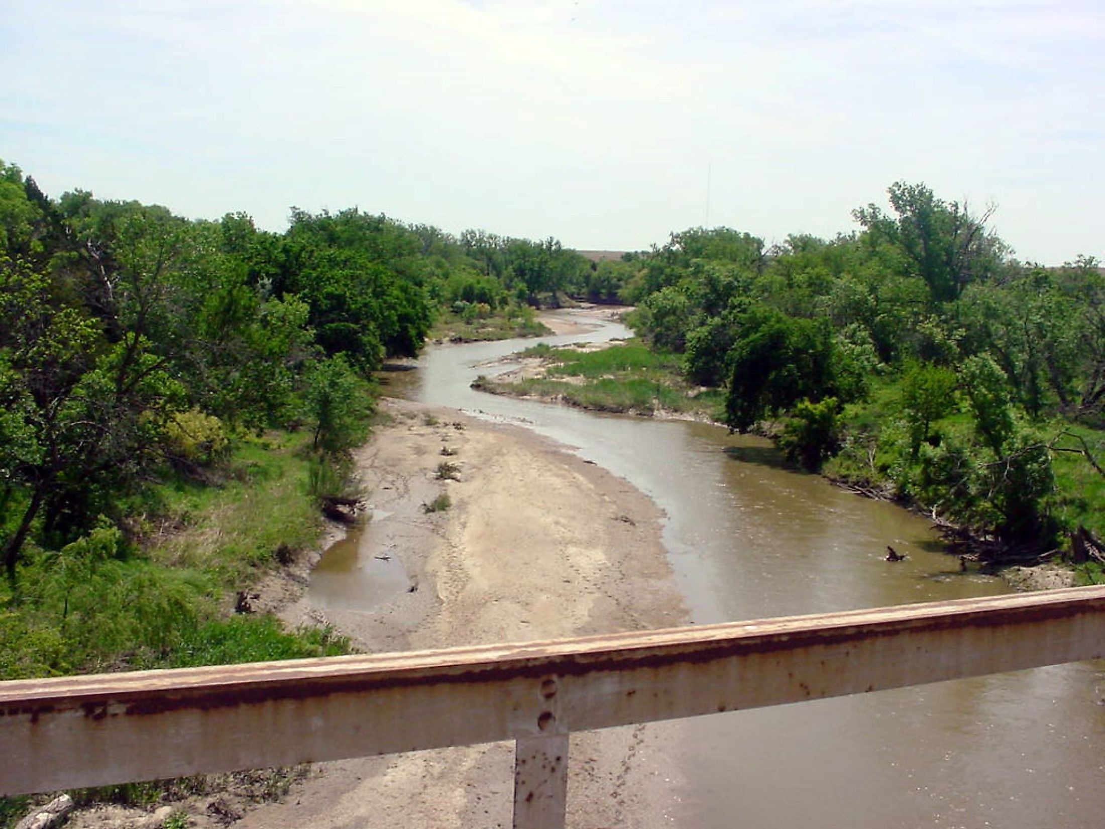
Smoky Hill River
The Smoky Hill River is a 925 km long river that flows through the heart of the Great Plains in the US States of Colorado and Kansas. The hills in Abilene and Lindsbord areas of Kansas appear to be surrounded by constant smoke and are named Smoky Hills. Therefore, the river gets its name from this region through which it flows. The Smoky Hill River has played a vital role in the region's history from the time before European settlers arrived. Agriculture is still the main activity in the area, along with the Smoky Hill River Festival of arts and music, which takes place over three days each summer.
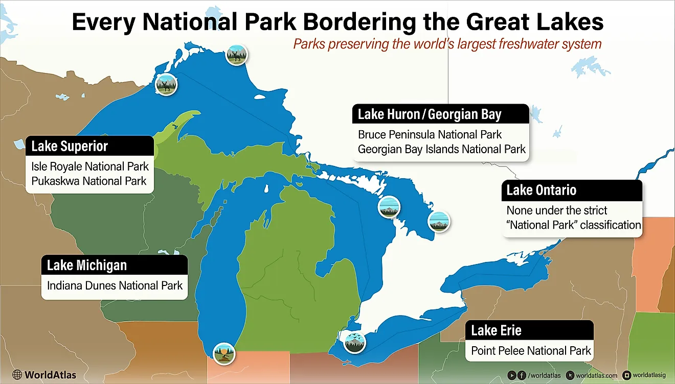
Course Of The Smoky Hill River

The Smoky Hill River begins as two headstreams that rise in Cheyenne County in the High Plains region of eastern Colorado. Its main tributaries are the Saline and Solomon rivers. The North Fork Smoky Hill River enters Kansas near Sherman County and flows in the eastern direction before turning southeast. The South Fork Smoky Hill River originates in the Kit Carson and Cheyenne Counties. It flows east into Kansas, uniting with the north fork near Russell Springs. From there, it flows east, then turns southeast before making a sharper turn to the north and then northeast into Geary County, where it joins with the Republican River to form the Kansas River. The Smoky Hill River directly drains an area of 22,800 square km, while the Kansas River drains an area of approximately 158,770 square km.
Climate Of Smoky Hills
The Smoky Hills region experiences a humid subtropical climate with hot, humid summers and extremely cold, snowy winters. The average temperatures range from -6 °C in January, the coldest month, to 34 °C in July and August. The average annual precipitation ranges from about 600 to 735 mm. Swimming and boating were common along the river in the early 20th century, but flooding was also frequent. A major flood in 1951 left many of the communities along the river, including Salina, heavily damaged. Flood control measures reduced the flow to a trickle, and resulted in a saltier water, due to its tributaries that pick up salt and other minerals along their flow. Flooding remains an issue along many areas of the Smoky Hill as well as the Kansas River in the 21st century.
Ecology Of Smoky Hill River

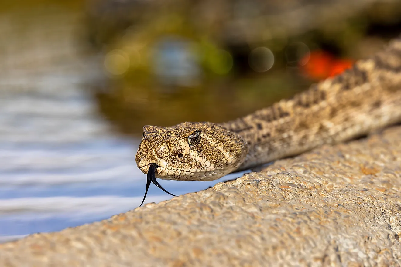
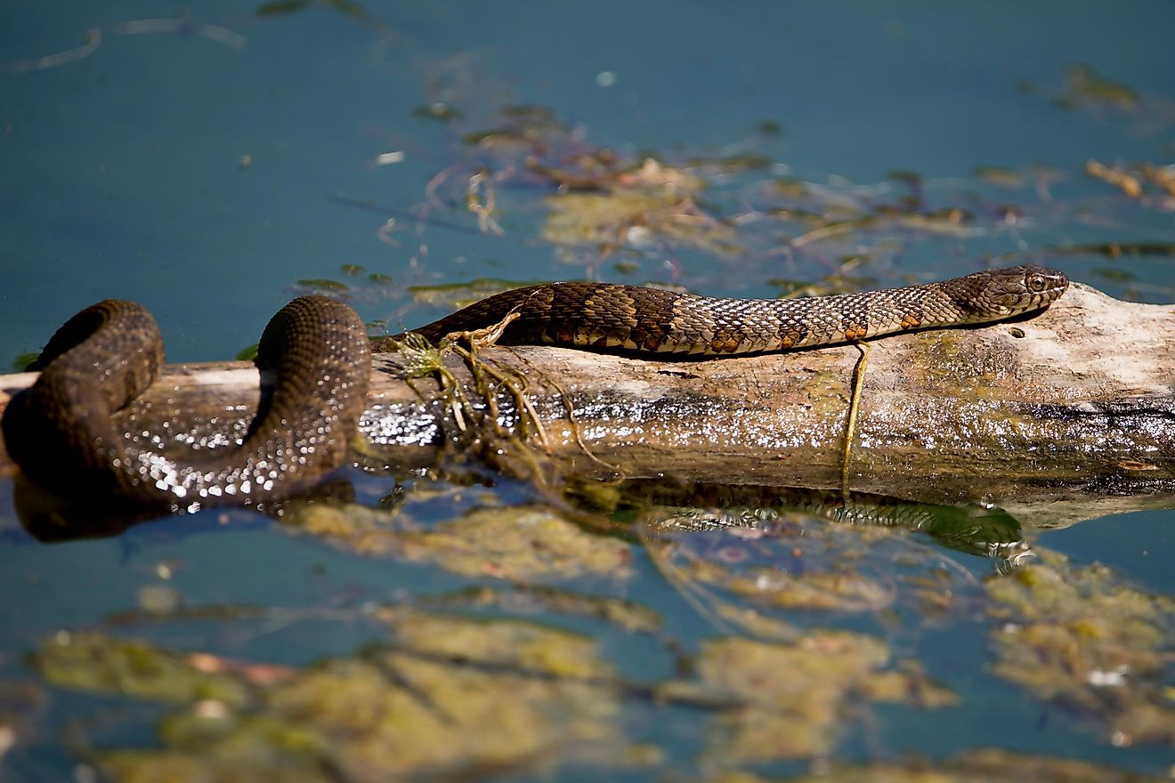
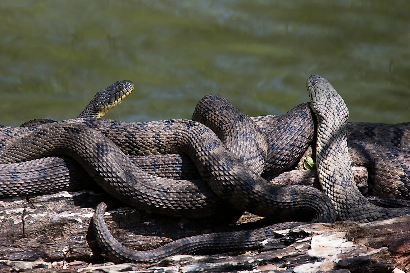
The Smoky Hill River and its valley created a fertile environment for fish and game and served as a regular hunting ground for Plains Indian tribes thousands of years ago. Plants native to the area include the sunflower, verbena, and coneflower, along with the eastern cottonwood. Several species of snakes and other animals live along its banks, including the common garter snake, eastern racer, and Woodhouse's toad. Native birds include the northern cardinal, mourning dove, blue jay, and red-bellied woodpecker. Mule deer are plentiful, along with prairie chickens and coyotes.
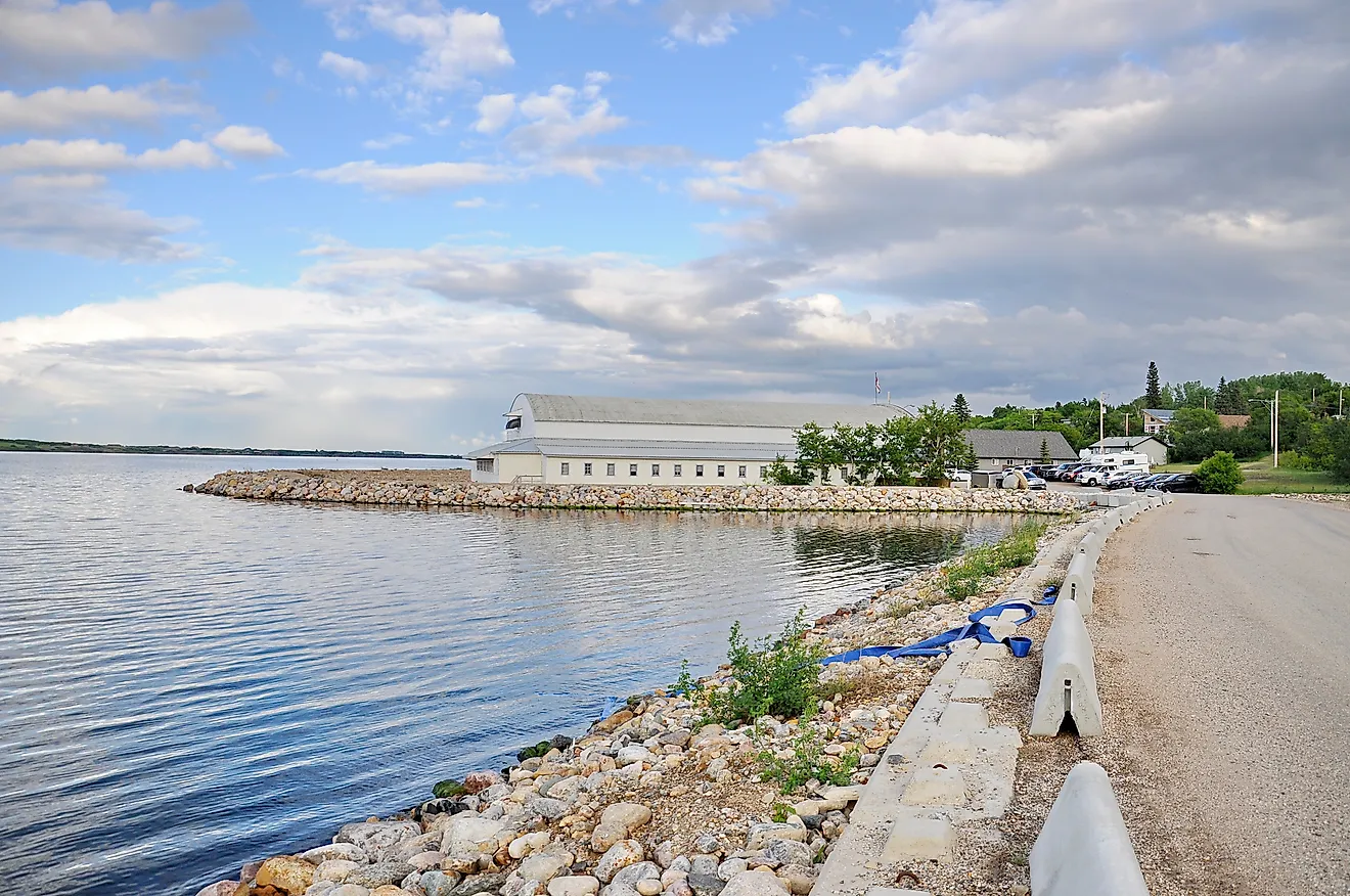
The Kansas portion of the River has developed into a popular area for recreational tourism, including fishing in the Kanopolis Lake area. While most of the River is not navigable, kayaking and canoeing are allowed on the last 17 or 18 km of the River leading into Kanopolis Lake. There are many fish in Smoky Hill River and Kanopolis Lake, including catfish, white bass, crappie, and walleye.
Brief History Of Smoky Hill River
The Native American inhabitants who hunted in the area for about 10,000 years before Europeans arrived considered the Smoky Hill River to be a part of the Kansas River rather than a separate stream. The Comanche, also called the Padoucas, moved into the Smoky Hill River area during the late 17th century and began to spread throughout the region. After years of conflict with Spanish settlers to the south, Comanche leaders signed a treaty with the US government in Wichita, Kansas. The Comanche, however, were still allowed hunting rights in Kansas until the late 19th century.
Spanish conquistador and colonizer Francisco Vázquez de Coronado y Luján led an expedition through the western United States, and it is believed he reached central Kansas in 1540. The river was first mentioned by Europeans on a map dated 1732. The French cartographer Jean Baptiste Bourguignon d’Anville called it the “River of the Padoucas” after the Native American tribe he encountered there. In 1758, another map called it the Padoucas River. American settler Zebulon Pike documented the river in 1806, calling it the south branch of the Kansas River. The Smoky Hill River is generally not navigable, but there is a record of two steamboat trips completed in 1854 and 1859 during times of flooding and high waters in the area.
The Gold Rush began in Colorado in 1858, and an old Native American route along the river was used to travel across Kansas. It became known as the Smoky Hill Trail. The Colorado Gold Rush brought immigrants flocking to the Midwest, many of them through the Smoky Hill Trail. It was touted as the quickest and shortest route to the gold mine fields. Stagecoach service along the Smoky Hill Trail began in 1865. The stagecoaches ran until 1870, when the Kansas Pacific Railroad was completed. In 1948, a dam was constructed as a flood control measure, part of the Missouri River Basin project. It created Kanopolis Lake in Ellsworth County. Another dam was completed in 1951, which created the Cedar Bluff Reservoir.
Salina, the largest city near the Smoky Hill River, was established on the westernmost end of the Smoky Hill Trail. The city and the area grew rapidly pre-Civil War as a trading post and again during and just after the Second World War when a military airfield was built there. Agriculture is the principal human activity in the region, including the cultivation of wheat, alfalfa, and other grains.