Ems River
Also referred to as Eems in Dutch, the Ems is a 225.2-mile-long river that flows through the North Rhine-Westphalia, and Lower Saxony states in the northwestern portion of Germany. The river drains into Dollart Bay, which forms a part of the Wadden Sea between the northern portions of the Netherlands and Germany. The exact course of the state boundary that passes through the Ems estuary between East Friesland’s Lower Saxon area and Netherland’s Groningen province was a subject of serious boundary dispute between the two nations. Germany and Netherlands are currently friendly states, and in October 2014, the boundary dispute matter was settled amicably by the two countries.
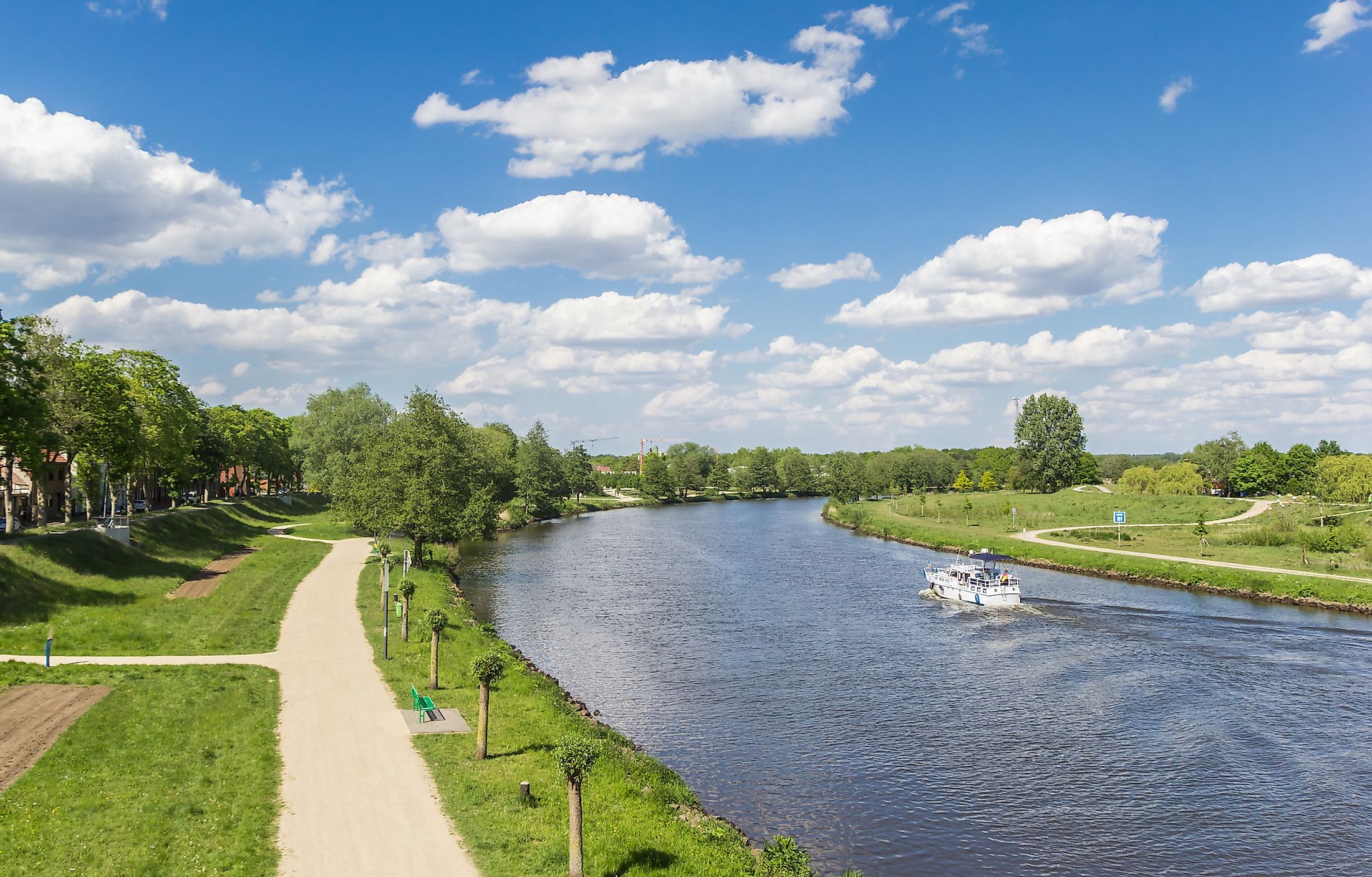
Course Of The Ems River

The Ems River begins its journey as a brook from the southern slopes of the Teutoburg Forest close to the cozy town of Schloß Holte-Stukenbrock in Gütersloh district in the German State of North Rhine-Westphalia. As it flows northwestwards through the German State of Lower Saxony, the brook becomes a comparatively bigger river and shares its name with the adjoining swampy region of Emsland. The Ems River is joined by its biggest tributary, the Hase River, in the German town of Meppen. In addition to the Hase River, some other tributaries that join the Ems River in its course include Wapelbach, Lutter, Hessel, Werse, Große Aa, Nordradde, Dalke, Axtbach, Bever, Eltingmühlenbach, and Leda.
The river then flows in the northern direction into the East Frisia region close to the German-Netherlands boundary. The Ems River drains into Dollart Bay immediately south of the German city of Emden and continues its journey toward the Dutch town of Delfzijl as a tidal river. Flowing past Delfzijl, the river empties into the Wadden Sea, an intertidal zone in the North Sea’s southeastern portion. At its mouth, the Ems is divided into two arms: Westere(e)ms and Osterems by the island of Borkum. The river’s mean annual discharge measured at the Versen gauging station is 80 cubic meters per second, with often exceptional peak values as high as 1200 cubic meters per second. Located about 24.85 miles upstream of Herbrum, the Versen gauging station is the last gauging station before the river’s mouth that is without tidal influence.
The total area occupied by the Ems River basin is approximately 6,924 sq. mi, of which 84% is in Germany, 13% in the Netherlands, and 3% forms a part of the Ems-Dollart estuary. About 65% of the Ems River basin is used for agricultural purposes, whereas pastures cover the remaining portion. In order to provide a German waterborne outlet for the Ruhr Industrial District and link the river with the Dortmund-Ems Canal, the Ems River was canalized between 1892 and 1899. Some important canals include within the river basin include the Dortmund-Ems Canal, Mittelland Canal, Küsten Canal, and Eemskanal.
History Of The Ems River

The Ems River was well-known to many ancient authors, namely the Roman author – Gaius Plinius Secundus, the Roman historian – Publius Cornelius Tacitus, the Roman geographer – Pomponius Mela, the Greek geographer – Strabo, and an Alexandrian geographer – Claudius Ptolemy. In fact, the river was named “Amisios potamos” by Ptolemy. It was consistently listed between the mighty Rhine and Weser Rivers and was the sole river that led to the Teutoburg Forest.
The Teutoburg Forest was home to several Germanic tribes, including Cherusci, Bructeri, and others. The Romans built a fort named Amisia at the mouth of the Ems River. As the river was navigable by the Roman ships, the Romans thought of using the river to reach out to the tribes residing at the river’s upper end. However, as bogs, swamps, and marshes surrounded the river for most of its length, the Romans failed to find any favorable ground and follow the strategies developed by the Roman army. Nevertheless, in AD 9, the Roman legions and their aides led by the Roman general Publius Quinctilius Varus were ambushed by an alliance of Germanic people at the Battle of the Teutoburg Forest. About six years later, a second attempt by the Roman forces was once again thwarted by the Germanic tribes.
As per legends, a catastrophic storm surge in 1277 led to the creation of Dollart Bay, encompassing significant portions of the Reiderland and Oldambt districts. It has been estimated that this devastating storm surge killed about 80,000 people and flooded 43 parishes. From the 16th to the early 20th century, several initiatives were taken to reclaim two-thirds of the drowned area. Many canals have been constructed in modern times to link the Ems River with other waterways, making it a vital highway for industrial transportation.
River Islands
A naturally formed tiny river island named Bingumer Sand is located in the Ems River, just off the Rheiderland region’s shore close to Bingum in Germany’s East Frisia. The island forms a part of the Emsauen zwischen Ledamündung und Oldersum nature reserve and currently acts as a shelter for Bingum’s marina. During the summer months, the island is used as a pasture for the cattle, whereas during winters, the cattle are shifted by a ferry to the mainland.
Cities Along The Ems River

Some picturesque towns and cities that are located along the Ems River include Schloß Holte-Stukenbrock, Rietberg, Rheda-Wiedenbrück, Gütersloh, Harsewinkel, Warendorf, Telgte, Greven, Emsdetten, Rheine, Lingen, Meppen, Haren, Papenburg, Weener, Leer, Emden, and Delfzijl. Schloß Holte-Stukenbrock, a city in the Gütersloh district of the German state of North Rhine-Westphalia, is known for its old churches and the annual Harvest Festival. The next scenic town within the Ems River Valley is the twin community of Rhine-Wiedenbrück which features a several-kilometer-long green strip along the Ems River, beginning at Emssee in downtown Wiedenbrück and finishing close to the water castle in Rheda. The town of Warendorf, which serves as the capital of the Warendorf District, is famous for its well-preserved medieval town center and the opportunities it provides for cycling and horse riding.
From its headwaters at the base of the Teutoburg Forest all the way to its mouth at the North Sea, the Ems River is followed by the Ems cycle route. Although ships can only navigate the Ems River's lower half, cyclists can follow the entire watercourse along the quiet, tarmacked paths. As the river cycle path passes through the idyllic countryside, it provides cyclists with scenic views of landscapes, spectacular towns, and cities filled with medieval castles and forests on both sides of the Ems River.


