Amargosa River
The Amargosa River, commonly referred to as “the Crown Jewel of the Mojave Desert,” is the only free-flowing waterway in the Death Valley. It flows for approximately 298 kilometers and drains a desert region, including the Mojave Desert, Amargosa Desert, and the Death Valley in eastern California and southern Nevada, United States. Unlike most rivers that drain into another water body, such as a river, lake, or ocean, the Amargosa River does not feed into any water body. Instead, it disappears underground into an aquifer. The river supports a wide variety of unique and rare species, with over 100 species targeted for conservation. The Amargosa River basin has been home to several tribes for more than 8,000 years.
Overview

The Amargosa River is the 7th longest river that flows through California and one of the major rivers in the Great Basin. It flows for about 298 kilometers from its source in the Oases Valley in Nye County, Nevada, to its mouth in the Badwater Basin in the Death Valley, California. The river rises at an elevation of 1,208 meters above sea level and drops to 86 meters below sea level at its mouth in the Death Valley. The intermittent waterway flows underground for most of its journey and only flows above the ground, near Beatty County and Amargosa Canyon. It drains an area of approximately 14,000 square kilometers and discharges an average of 0.11 cubic meters per second at the mouth. Approximately 42 kilometers of the river’s length from Shoshone to Dumont Dune is designated National Wild and Scenic River.
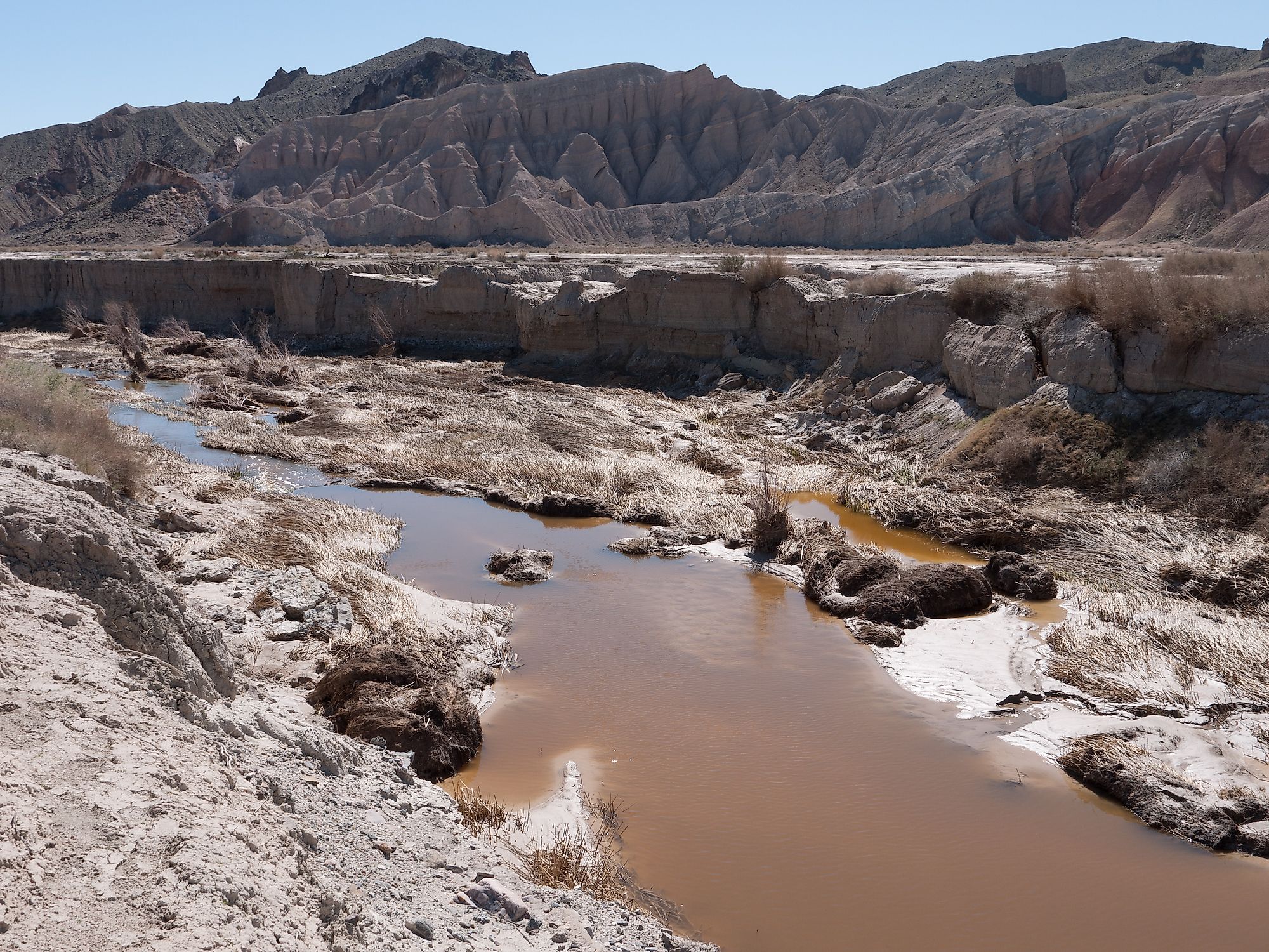
Course

Except during rainstorms in the region, the Amargosa River flows underground and remains dry above the ground for most of its length. It appears above the ground only near Beatty, a small town in Nye County, Nevada, and the Amargosa Canyon in Tecopa, a census-designated place in Mojave Desert, California. The river rises in the Oases Valley, Nye County, at an elevation of about 1,208 meters above sea level. It begins in the Pahute Mesa, located within the Nellis Air Force Range, where it receives the Thirsty Canyon Wash. The river flows southwestwards through the Oases Valley, and then runs parallel to US 95. It receives Sober-Up Gulch and Beatty Wash at the Bullfrog Hills. Then the Amargosa flows for about five kilometers through Beatty before turning south-southeastwards to Amargosa Desert through the Amargosa Narrow.
As it flows through the Narrow, the river is flanked by Funeral and Grapevine Mountains on the right and Bare Mountain on the left. Downstream, the Amargosa flows past Big Dune, then the Amargosa Valley town before entering California. In California, the river runs parallel to State Route 127 through the Death Valley Junction. The river is joined by the Curson Slough and then it passes between Greenwater Range and Resting Spring Range on its way to Shoshone. Between Shoshone and Tecopa, the Amargosa is sandwiched between Dumont Hills and State Route 127. It flows through the Amargosa Canyon from Tecopa to San Bernardino County. Then it flows past the Dumont Dunes and turns left into the Death Valley National Park. The Amargosa enters Inyo County again and flows between Ibex Hills and Owlshead Mountains, where it receives Confidence and Rhode Washes. Shortly after the river enters the Badwater Basin, it disappears underground, and feeds into an aquifer.
Flora and Fauna

The section of the Amargosa River that flows through the Mojave Desert was designated an Area of Critical Environmental Concern to protect endangered species. Some of the species that are listed as endangered include the southwestern willow flycatcher and the Amargosa vole. Marshes, springs, and seeps contain desert oases that support over 100 species, of which most have been identified for conservation. The wetland areas are a hot desert region that is home to 50 endemic species, including eight pupfish subspecies, spring snails, Amargosa toads, and beetles. Hundreds of migratory birds make a stopover at the Amargosa Canyon, including least bell’s vireo, southwestern willow flycatcher, and yellow-billed cuckoo.


