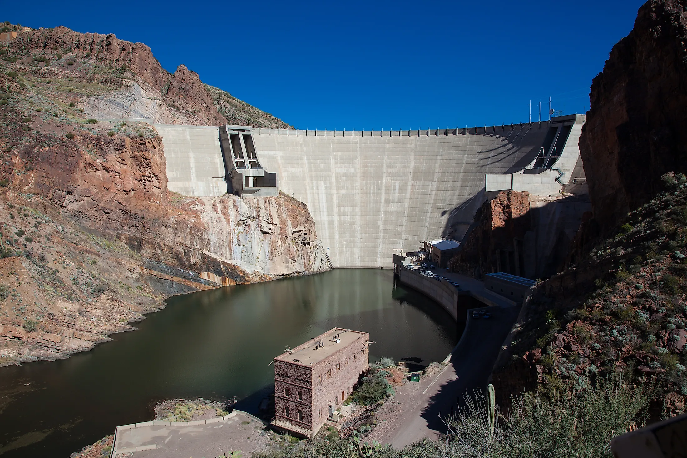
Theodore Roosevelt Dam, Arizona
The Theodore Roosevelt Dam, built in 1911, is a dam on the Salt River in Arizona. The dam forms the Theodore Roosevelt Lake and mainly exists for irrigation in the dry state of Arizona. The dam is also there to prevent floods, and it has hydroelectric capacities. The Theodore Roosevelt Dam was the largest masonry dam in the world at the time of its completion. For a time, the dam was the largest artificial reservoir in the world. The dam is named after the 26th president of the United States, Theodore Roosevelt.
History Of Construction
The land that went on to host the dam, between the Salt River and Tonto Creek, was surveyed by Billy Breakenridge in 1888. The project was approved in 1903 under the Newlands Reclamation Act. The Theodore Roosevelt Dam was the first project undertaken under this act, previously ratified in 1902. The Newlands Reclamation Act was enacted to help irrigate the arid state of Arizona during a time of far fewer settlers and much less industrialization. The act ended up forming the United States Reclamation Service, which aimed to aid westward settlement in new territories. Arizona was a land that was only settled by the Americans in the previous few decades during the western expansion of United States territory. This dam became a huge boon to the new residents who did not have the same convenience as countrymen in the east and south.The dam was redeveloped in 1989 by the J.A. Jones Construction Company. The height and capacity of the dam were increased, and the project was completed in 1996 and costed around 430 million dollars. The redesign completely altered the original appearance of the dam. Therefore the dam's designation as a historical landmark, originally earned in 1963, was withdrawn in 1999.
Structure Of The Theodore Roosevelt Dam

The Theodore Roosevelt Dam stands at a staggering 357 feet, or 109 meters. The length sits at 1,210 feet or 369 meters. The dam is 21.6 feet in width at the crest and 196 feet at the base (6.6 meters and 60 meters, respectively). The Theodore Roosevelt Dam is an arch-gravity dam that combines the functions and appearances of an arch dam and a gravity dam. This type of dam moves most of its water against the rock walls of canyons in a curved formation. This method is convenient because it demands less construction material than the arch and gravity dams. The associated power station to the dam generates approximately 36 megawatts of electric power. The dam is still owned by the Bureau of Reclamation, which largely oversees water management and distribution in the modern-day.
The Theodore Roosevelt Lake, which formed as a result of the dam, is 22.4 miles long and 188 feet deep. The total capacity of the dam is 2,910,200 acre-feet, while the total surface area is 21,493 acres. The dam itself runs along the Apache Trail and is 116 miles from Phoenix, Arizona. The closest settlement to the Theodore Roosevelt Dam is the town of Roosevelt, Arizona. The permanent population sits at only about 28 people. Roosevelt, Arizona is only 3.2 miles from the dam itself.