Where is Wilson County, Texas?
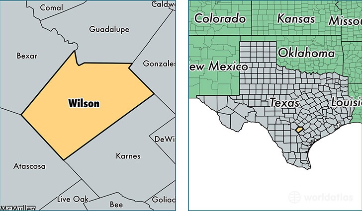
Wilson County is a county equivalent area found in Texas, USA. The county government of Wilson is found in the county seat of Floresville.
With a total 2,093.77 sq. km of land and water area, Wilson County, Texas is the 1153rd largest county equivalent area in the United States. Home to 46,402 people, Wilson County has a total 16812 households earning 64571 on average per year.
Wilson County, Texas - Quick Facts
| FIPS Code | 48493 |
| Area Codes | 830 |
| Time Zone | CST |
| Major Cities | Floresville (population: 20,783), La Vernia (population: 11,796), Stockdale (population: 4,417), Poth (population: 1,983), Sutherland Springs (population: 893), Pandora (population: 87) |
| Land Area | 17,916 sq miles |
| Water Area | 804 sq miles |
| Household Income | $64,571 |
| Housing Units | 16,812 |
| Median Home Value | $143,500 |
| High School Grads | 85% of population |
| Holders of Bachelors Degrees | 18% of population |
| Retail Spending | $4,609 per capita |
| Food & Accomodation Sales | $20,847 per capita |
This page was last updated on June 30, 2016.