Where is Panola County, Texas?
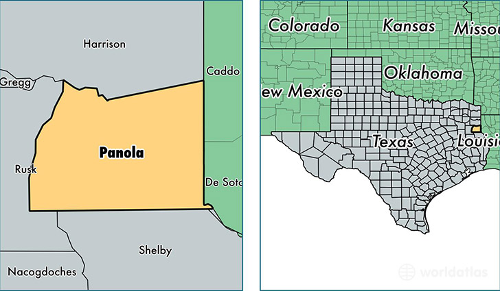
Panola County is a county equivalent area found in Texas, USA. The county government of Panola is found in the county seat of Carthage.
With a total 2,127.17 sq. km of land and water area, Panola County, Texas is the 1130th largest county equivalent area in the United States. Home to 23,769 people, Panola County has a total 10878 households earning 52453 on average per year.
Panola County, Texas - Quick Facts
| FIPS Code | 48365 |
| Area Codes | 903 |
| Time Zone | CST |
| Major Cities | Carthage (population: 14,108), De Berry (population: 3,492), Beckville (population: 2,813), Gary (population: 2,094), Long Branch (population: 612) |
| Land Area | 9,177 sq miles |
| Water Area | 802 sq miles |
| Household Income | $52,453 |
| Housing Units | 10,878 |
| Median Home Value | $83,900 |
| High School Grads | 84% of population |
| Holders of Bachelors Degrees | 12% of population |
| Retail Spending | $9,638 per capita |
| Food & Accomodation Sales | $18,337 per capita |
This page was last updated on June 30, 2016.