Where is Haskell County, Texas?
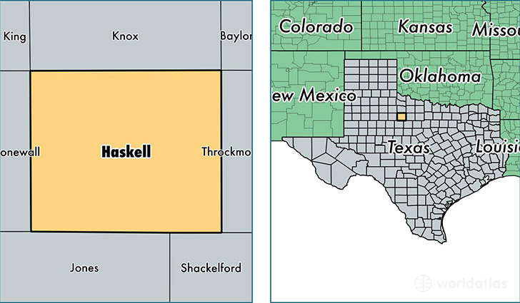
Haskell County is a county equivalent area found in Texas, USA. The county government of Haskell is found in the county seat of Haskell.
With a total 2,357.57 sq. km of land and water area, Haskell County, Texas is the 921st largest county equivalent area in the United States. Home to 5,769 people, Haskell County has a total 3429 households earning 36857 on average per year.
Haskell County, Texas - Quick Facts
| FIPS Code | 48207 |
| Area Codes | 940 |
| Time Zone | CST |
| Major Cities | Haskell (population: 3,981), Rule (population: 932), Rochester (population: 512), Weinert (population: 203), O Brien (population: 178) |
| Land Area | 2,227 sq miles |
| Water Area | 903 sq miles |
| Household Income | $36,857 |
| Housing Units | 3,429 |
| Median Home Value | $45,200 |
| High School Grads | 74% of population |
| Holders of Bachelors Degrees | 12% of population |
| Retail Spending | $11,504 per capita |
| Food & Accomodation Sales | $4,662 per capita |
This page was last updated on June 30, 2016.