Where is White County, Tennessee?
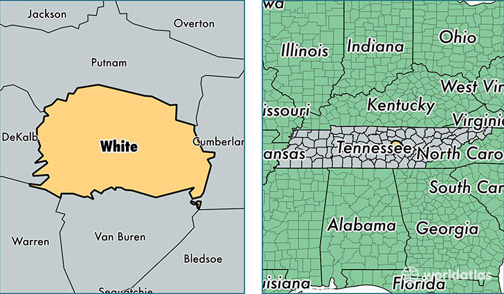
White County is a county equivalent area found in Tennessee, USA. The county government of White is found in the county seat of Sparta.
With a total 982.71 sq. km of land and water area, White County, Tennessee is the 2662nd largest county equivalent area in the United States. Home to 26,301 people, White County has a total 11470 households earning 34474 on average per year.
White County, Tennessee - Quick Facts
| FIPS Code | 47185 |
| Area Codes | 931 |
| Time Zone | CST |
| Major Cities | Sparta (population: 24,058), Doyle (population: 1,353), Walling (population: 1,313), Quebeck (population: 1,072) |
| Land Area | 10,155 sq miles |
| Water Area | 377 sq miles |
| Household Income | $34,474 |
| Housing Units | 11,470 |
| Median Home Value | $98,000 |
| High School Grads | 78% of population |
| Holders of Bachelors Degrees | 11% of population |
| Retail Spending | $7,828 per capita |
| Food & Accomodation Sales | $16,760 per capita |
This page was last updated on June 30, 2016.