Where is Chester County, Tennessee?
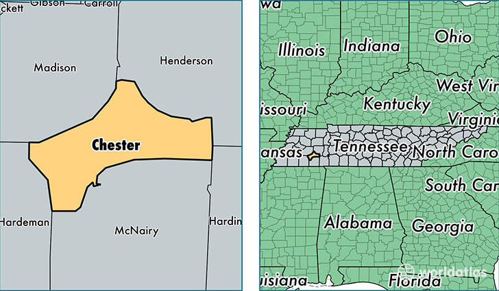
Chester County is a county equivalent area found in Tennessee, USA. The county government of Chester is found in the county seat of Henderson.
With a total 740.63 sq. km of land and water area, Chester County, Tennessee is the 2872nd largest county equivalent area in the United States. Home to 17,379 people, Chester County has a total 6980 households earning 41875 on average per year.
Chester County, Tennessee - Quick Facts
| FIPS Code | 47023 |
| Area Codes | 731 |
| Time Zone | CST |
| Major Cities | Henderson (population: 12,957), Enville (population: 1,122), Luray (population: 495), Milledgeville (population: 278), Jacks Creek (population: 270) |
| Land Area | 6,710 sq miles |
| Water Area | 286 sq miles |
| Household Income | $41,875 |
| Housing Units | 6,980 |
| Median Home Value | $102,300 |
| High School Grads | 81% of population |
| Holders of Bachelors Degrees | 16% of population |
| Retail Spending | $7,319 per capita |
| Food & Accomodation Sales | $11,578 per capita |
This page was last updated on June 30, 2016.