Where is Carter County, Tennessee?
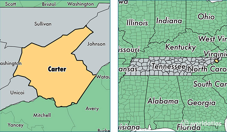
Carter County is a county equivalent area found in Tennessee, USA. The county government of Carter is found in the county seat of Elizabethton.
With a total 900.37 sq. km of land and water area, Carter County, Tennessee is the 2738th largest county equivalent area in the United States. Home to 56,886 people, Carter County has a total 27650 households earning 31842 on average per year.
Carter County, Tennessee - Quick Facts
| FIPS Code | 47019 |
| Area Codes | 423 |
| Time Zone | EST |
| Major Cities | Elizabethton (population: 33,648), Roan Mountain (population: 5,031), Hampton (population: 4,380), Watauga (population: 1,954), Milligan College (population: 666) |
| Land Area | 21,964 sq miles |
| Water Area | 341 sq miles |
| Household Income | $31,842 |
| Housing Units | 27,650 |
| Median Home Value | $101,100 |
| High School Grads | 80% of population |
| Holders of Bachelors Degrees | 16% of population |
| Retail Spending | $7,826 per capita |
| Food & Accomodation Sales | $41,911 per capita |
| Universities and Colleges | Milligan College |
This page was last updated on June 30, 2016.