Where is Harding County, South Dakota?
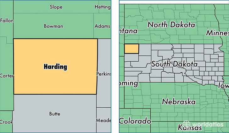
Harding County is a county equivalent area found in South Dakota, USA. The county government of Harding is found in the county seat of Buffalo.
With a total 6,935.86 sq. km of land and water area, Harding County, South Dakota is the 209th largest county equivalent area in the United States. Home to 1,250 people, Harding County has a total 725 households earning 44353 on average per year.
Harding County, South Dakota - Quick Facts
| FIPS Code | 46063 |
| Area Codes | 605 |
| Time Zone | MST |
| Major Cities | Buffalo (population: 682), Camp Crook (population: 219), Ludlow (population: 121), Reva (population: 120), Ralph (population: 30), Redig (population: 15) |
| Land Area | 483 sq miles |
| Water Area | 2,671 sq miles |
| Household Income | $44,353 |
| Housing Units | 725 |
| Median Home Value | $69,400 |
| High School Grads | 92% of population |
| Holders of Bachelors Degrees | 35% of population |
| Retail Spending | $7,458 per capita |
| Food & Accomodation Sales | $868 per capita |
This page was last updated on June 30, 2016.