Where is Oconee County, South Carolina?
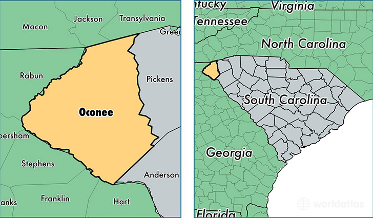
Oconee County is a county equivalent area found in South Carolina, USA. The county government of Oconee is found in the county seat of Walhalla.
With a total 1,744.39 sq. km of land and water area, Oconee County, South Carolina is the 1512th largest county equivalent area in the United States. Home to 75,192 people, Oconee County has a total 38677 households earning 41394 on average per year.
Oconee County, South Carolina - Quick Facts
| FIPS Code | 45073 |
| Area Codes | 864 |
| Time Zone | EST |
| Major Cities | Seneca (population: 33,703), Westminster (population: 14,282), Walhalla (population: 11,387), Salem (population: 5,225), West Union (population: 4,144), Fair Play (population: 2,773), Mountain Rest (population: 1,816), Tamassee (population: 1,031), Long Creek (population: 334), Newry (population: 127) |
| Land Area | 29,032 sq miles |
| Water Area | 626 sq miles |
| Household Income | $41,394 |
| Housing Units | 38,677 |
| Median Home Value | $136,300 |
| High School Grads | 83% of population |
| Holders of Bachelors Degrees | 22% of population |
| Retail Spending | $10,518 per capita |
| Food & Accomodation Sales | $62,807 per capita |
This page was last updated on June 30, 2016.