Where is Newport County, Rhode Island?
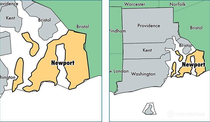
Newport County is a county equivalent area found in Rhode Island, USA.
With a total 812.2 sq. km of land and water area, Newport County, Rhode Island is the 2816th largest county equivalent area in the United States. Home to 82,358 people, Newport County has a total 41707 households earning 71713 on average per year.
Newport County, Rhode Island offers the following attractions to visitors: Rosecliff, Touro Synagogue NHS
Newport County, Rhode Island - Quick Facts
| FIPS Code | 44005 |
| Area Codes | 401 |
| Time Zone | EST |
| Major Cities | Newport (population: 24,472), Portsmouth (population: 16,994), Middletown (population: 15,929), Tiverton (population: 15,617), Jamestown (population: 5,349), Little Compton (population: 3,456) |
| Land Area | 31,799 sq miles |
| Water Area | 102 sq miles |
| Household Income | $71,713 |
| Housing Units | 41,707 |
| Median Home Value | $355,800 |
| High School Grads | 93% of population |
| Holders of Bachelors Degrees | 45% of population |
| Retail Spending | $13,483 per capita |
| Food & Accomodation Sales | $343,003 per capita |
This page was last updated on June 30, 2016.