Where is Woods County, Oklahoma?
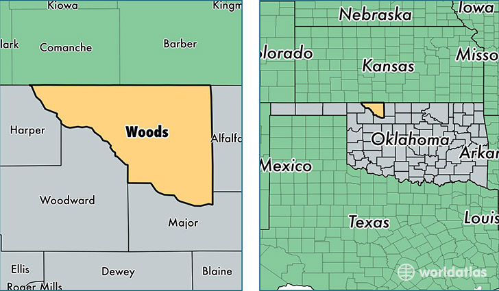
Woods County is a county equivalent area found in Oklahoma, USA. The county government of Woods is found in the county seat of Alva.
With a total 3,340.99 sq. km of land and water area, Woods County, Oklahoma is the 534th largest county equivalent area in the United States. Home to 9,288 people, Woods County has a total 4439 households earning 51619 on average per year.
Woods County, Oklahoma - Quick Facts
| FIPS Code | 40151 |
| Area Codes | 580 |
| Time Zone | CST |
| Major Cities | Alva (population: 6,810), Waynoka (population: 1,332), Freedom (population: 492), Dacoma (population: 170), Hopeton (population: 36) |
| Land Area | 3,586 sq miles |
| Water Area | 1,286 sq miles |
| Household Income | $51,619 |
| Housing Units | 4,439 |
| Median Home Value | $80,700 |
| High School Grads | 89% of population |
| Holders of Bachelors Degrees | 27% of population |
| Retail Spending | $11,779 per capita |
| Food & Accomodation Sales | $10,403 per capita |
This page was last updated on June 30, 2016.