Where is Hardin County, Ohio?
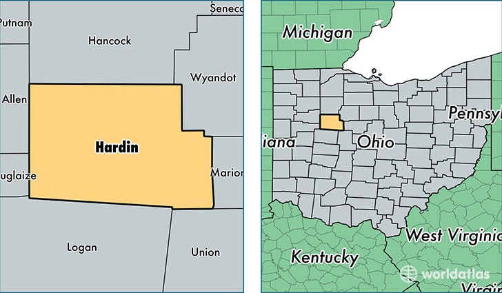
Hardin County is a county equivalent area found in Ohio, USA. The county government of Hardin is found in the county seat of Kenton.
With a total 1,218.97 sq. km of land and water area, Hardin County, Ohio is the 2278th largest county equivalent area in the United States. Home to 31,796 people, Hardin County has a total 13076 households earning 40415 on average per year.
Hardin County, Ohio - Quick Facts
| FIPS Code | 39065 |
| Area Codes | 419,937 |
| Time Zone | EST |
| Major Cities | Kenton (population: 13,428), Ada (population: 8,352), Forest (population: 3,676), Alger (population: 1,916), Mount Victory (population: 1,701), Dunkirk (population: 1,459), Ridgeway (population: 909), McGuffey (population: 488), Dola (population: 483) |
| Land Area | 12,276 sq miles |
| Water Area | 470 sq miles |
| Household Income | $40,415 |
| Housing Units | 13,076 |
| Median Home Value | $95,600 |
| High School Grads | 87% of population |
| Holders of Bachelors Degrees | 13% of population |
| Retail Spending | $6,075 per capita |
| Food & Accomodation Sales | $29,488 per capita |
This page was last updated on June 30, 2016.