Where is Yellowstone County, Montana?
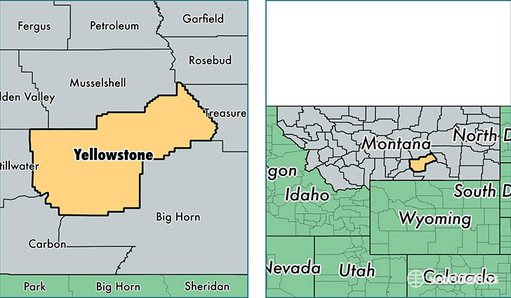
Yellowstone County is a county equivalent area found in Montana, USA. The county government of Yellowstone is found in the county seat of Billings.
With a total 6,860.94 sq. km of land and water area, Yellowstone County, Montana is the 212th largest county equivalent area in the United States. Home to 155,634 people, Yellowstone County has a total 64883 households earning 51342 on average per year.
Yellowstone County, Montana offers the following attractions to visitors: Lewis and Clark NHT, Pompeys Pillar NM
Yellowstone County, Montana - Quick Facts
| FIPS Code | 30111 |
| Area Codes | 406 |
| Time Zone | MST |
| Major Cities | Billings (population: 131,508), Laurel (population: 11,253), Shepherd (population: 3,572), Huntley (population: 1,716), Worden (population: 1,409), Ballantine (population: 950), Molt (population: 707), Broadview (population: 590), Custer (population: 399), Pompeys Pillar (population: 291) |
| Land Area | 60,091 sq miles |
| Water Area | 2,633 sq miles |
| Household Income | $51,342 |
| Housing Units | 64,883 |
| Median Home Value | $181,500 |
| High School Grads | 92% of population |
| Holders of Bachelors Degrees | 29% of population |
| Retail Spending | $20,284 per capita |
| Food & Accomodation Sales | $361,729 per capita |
This page was last updated on June 30, 2016.