Where is Mackinac County, Michigan?
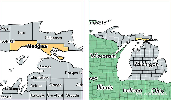
Mackinac County is a county equivalent area found in Michigan, USA. The county government of Mackinac is found in the county seat of Saint Ignace.
With a total 5,440.66 sq. km of land and water area, Mackinac County, Michigan is the 301st largest county equivalent area in the United States. Home to 11,042 people, Mackinac County has a total 10970 households earning 38704 on average per year.
Mackinac County, Michigan offers the following attraction to visitors: Father Marquette NMEM
Mackinac County, Michigan - Quick Facts
| FIPS Code | 26097 |
| Area Codes | 906,231 |
| Time Zone | EST |
| Major Cities | Saint Ignace (population: 4,028), Cedarville (population: 1,364), Hessel (population: 1,091), Engadine (population: 898), Moran (population: 714), Naubinway (population: 640), Gould City (population: 505), Mackinac Island (population: 493), Curtis (population: 382), Pointe Aux Pins (population: 95) |
| Land Area | 4,263 sq miles |
| Water Area | 1,022 sq miles |
| Household Income | $38,704 |
| Housing Units | 10,970 |
| Median Home Value | $119,300 |
| High School Grads | 88% of population |
| Holders of Bachelors Degrees | 19% of population |
| Retail Spending | $14,289 per capita |
| Food & Accomodation Sales | $56,481 per capita |
This page was last updated on June 30, 2016.